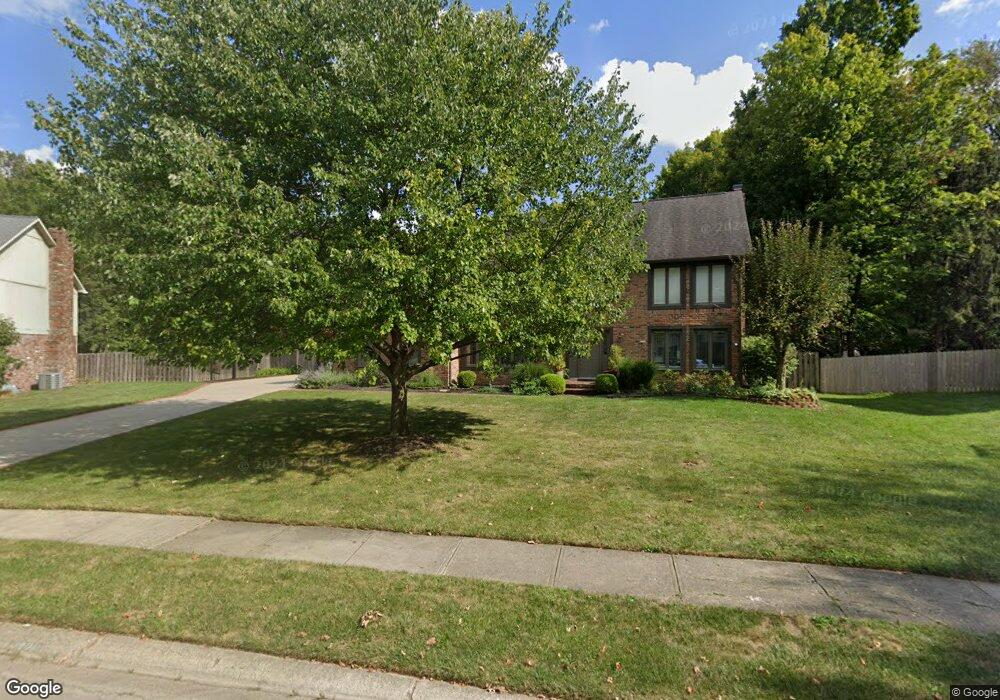
1321 Linden Ln Carmel, IN 46033
East Carmel NeighborhoodEstimated Value: $531,000 - $649,000
4
Beds
3
Baths
2,228
Sq Ft
$262/Sq Ft
Est. Value
About This Home
This home is located at 1321 Linden Ln, Carmel, IN 46033 and is currently estimated at $582,656, approximately $261 per square foot. 1321 Linden Ln is a home located in Hamilton County with nearby schools including Cherry Tree Elementary School, Clay Middle School, and Carmel High School.
Ownership History
Date
Name
Owned For
Owner Type
Purchase Details
Closed on
Jul 2, 2001
Sold by
Kagy Richard M and Kagy Pamela S
Bought by
Misner Mark D and Misner Nickey A
Current Estimated Value
Home Financials for this Owner
Home Financials are based on the most recent Mortgage that was taken out on this home.
Original Mortgage
$210,400
Outstanding Balance
$75,714
Interest Rate
7.2%
Estimated Equity
$506,942
Create a Home Valuation Report for This Property
The Home Valuation Report is an in-depth analysis detailing your home's value as well as a comparison with similar homes in the area
Home Values in the Area
Average Home Value in this Area
Purchase History
| Date | Buyer | Sale Price | Title Company |
|---|---|---|---|
| Misner Mark D | -- | -- |
Source: Public Records
Mortgage History
| Date | Status | Borrower | Loan Amount |
|---|---|---|---|
| Open | Misner Mark D | $210,400 |
Source: Public Records
Tax History
| Year | Tax Paid | Tax Assessment Tax Assessment Total Assessment is a certain percentage of the fair market value that is determined by local assessors to be the total taxable value of land and additions on the property. | Land | Improvement |
|---|---|---|---|---|
| 2025 | $5,961 | $500,100 | $137,100 | $363,000 |
| 2024 | $5,759 | $525,400 | $137,100 | $388,300 |
| 2023 | $5,759 | $515,800 | $127,500 | $388,300 |
| 2022 | $4,835 | $413,100 | $127,500 | $285,600 |
| 2021 | $4,044 | $353,400 | $127,500 | $225,900 |
| 2020 | $3,659 | $317,100 | $127,500 | $189,600 |
| 2019 | $3,598 | $313,300 | $69,200 | $244,100 |
| 2018 | $3,388 | $296,800 | $69,200 | $227,600 |
| 2017 | $3,404 | $299,300 | $69,200 | $230,100 |
| 2016 | $3,290 | $287,700 | $69,200 | $218,500 |
| 2014 | $2,991 | $274,100 | $54,800 | $219,300 |
| 2013 | $2,991 | $262,500 | $54,800 | $207,700 |
Source: Public Records
Map
Nearby Homes
- 1260 Driftwood Dr
- 13727 Smokey Ridge Overlook
- 329 4th Ct E
- 727 Johnson Dr
- 2945 Millgate Dr
- 4314 Worchester Ct
- 1490 Warwick Ct
- 233 Brierley Way
- 14340 Sydney Ln
- 14311 Devonport Dr
- 13082 Andover Dr
- 3030 E Village Park Cir
- 2645 Faust Ct
- 712 E Main St
- 992 Bard Ln
- 984 Bard Ln
- 4904 Deer Ridge Dr S
- 874 Rosalind Place
- 3122 E Village Park North Dr
- 12854 Brookshire Pkwy
- 1337 Linden Ln
- 1307 Linden Ln
- 1350 Hemlock St
- 1338 Hemlock St
- 846 Hawthorne Dr
- 824 Hawthorne Dr
- 1310 Linden Ln
- 868 Hawthorne Dr
- 1299 Linden Ln
- 1314 Hemlock St
- 879 Linden Ln
- 876 Linden Ln
- 776 Hawthorne Dr
- 1294 Linden Ln
- 890 Hawthorne Dr
- 1292 Hemlock St
- 1291 Driftwood Dr
- 1283 Linden Ln
- 837 Hawthorne Dr
- 855 Hawthorne Dr
Your Personal Tour Guide
Ask me questions while you tour the home.