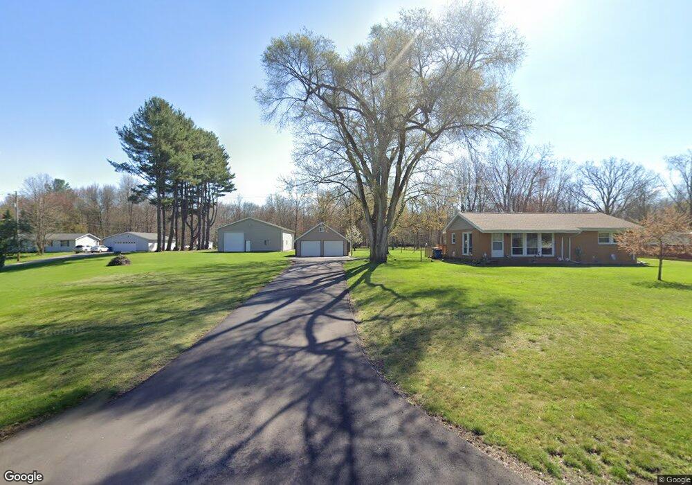
1321 S Homer Rd Midland, MI 48640
Estimated Value: $147,963 - $225,000
--
Bed
--
Bath
1,134
Sq Ft
$175/Sq Ft
Est. Value
About This Home
This home is located at 1321 S Homer Rd, Midland, MI 48640 and is currently estimated at $198,741, approximately $175 per square foot. 1321 S Homer Rd is a home located in Midland County with nearby schools including Bullock Creek High School.
Ownership History
Date
Name
Owned For
Owner Type
Purchase Details
Closed on
Sep 1, 2015
Sold by
Mortgage Electronic Registration Systems and Wilkinson Roy A
Bought by
Bryant Donald F and Bryant Deborah K
Current Estimated Value
Home Financials for this Owner
Home Financials are based on the most recent Mortgage that was taken out on this home.
Original Mortgage
$78,247
Outstanding Balance
$61,437
Interest Rate
3.9%
Estimated Equity
$137,304
Purchase Details
Closed on
May 15, 2008
Sold by
Mapes Tadd P
Bought by
Wilkinson Dr Roy A
Purchase Details
Closed on
Jun 14, 2005
Sold by
Barth Russell W
Bought by
Mapes Tadd P
Create a Home Valuation Report for This Property
The Home Valuation Report is an in-depth analysis detailing your home's value as well as a comparison with similar homes in the area
Home Values in the Area
Average Home Value in this Area
Purchase History
| Date | Buyer | Sale Price | Title Company |
|---|---|---|---|
| Bryant Donald F | -- | None Available | |
| Wilkinson Dr Roy A | $122,075 | -- | |
| Wilkinson Roy A | $122,100 | -- | |
| Mapes Tadd P | $138,000 | -- |
Source: Public Records
Mortgage History
| Date | Status | Borrower | Loan Amount |
|---|---|---|---|
| Open | Bryant Donald F | $78,247 |
Source: Public Records
Tax History Compared to Growth
Tax History
| Year | Tax Paid | Tax Assessment Tax Assessment Total Assessment is a certain percentage of the fair market value that is determined by local assessors to be the total taxable value of land and additions on the property. | Land | Improvement |
|---|---|---|---|---|
| 2025 | $2,040 | $83,900 | $0 | $0 |
| 2024 | $625 | $75,800 | $0 | $0 |
| 2023 | $596 | $65,600 | $0 | $0 |
| 2022 | $1,816 | $55,700 | $0 | $0 |
| 2021 | $1,731 | $50,400 | $0 | $0 |
| 2020 | $1,876 | $55,100 | $0 | $0 |
| 2019 | $1,825 | $53,800 | $53,800 | $0 |
| 2018 | $1,826 | $53,800 | $53,800 | $0 |
| 2017 | $0 | $54,000 | $54,000 | $0 |
| 2016 | $2,800 | $54,500 | $54,500 | $0 |
| 2014 | -- | $55,000 | $55,000 | $0 |
Source: Public Records
Map
Nearby Homes
- 887 E Gordonville Rd
- 859 E Gordonville Rd
- 941 Crooked Tree Ln
- 859 S Crooked Tree Ln
- Lot 56 Kirkwood Cir
- Lot 55 S Kirkwood Cir
- VL E Bradford Rd
- 247 N Five Mile Rd
- 747 S Hidden Ridge
- 1740 E Miller Rd
- 1538 S Ford Ct
- 671 S Woodcock Rd
- 456 E Chippewa River Rd
- 116 S Westlawn Dr
- 296 W Gordonville Rd
- 1534 E Gay Ln
- 4203 E Isabella Rd
- 2310 S Meridian Rd
- 600 Sandow Rd
- 600 S Maplewood Dr
- 1329 S Homer Rd
- 1328 S Homer Rd
- 1335 S Homer Rd
- 1318 S Homer Rd
- 1308 S Homer Rd
- 1309 S Homer Rd
- 1291 S Homer Rd
- 1365 S Homer Rd
- 1272 S Homer Rd
- 1300 E Red Oak Ln
- 1353 S Homer Rd
- 1024 E Stewart Rd
- 1276 E Red Oak Ln
- 1388 S Homer Rd
- 0 E Stewart Unit 140324
- 0 E Stewart Unit 90436
- 0 E Stewart Unit 80222
- 0 E Stewart Unit 110075
- 1060 E Stewart Rd
- 1320 E Red Oak Ln