1321 Shepherd Rd Madison, GA 30650
Estimated payment $12,203/month
Highlights
- 160.4 Acre Lot
- No HOA
- Timber
- Morgan County Primary School Rated A-
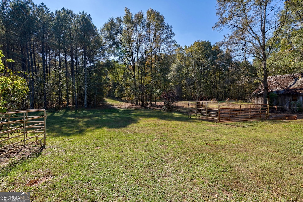
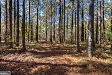
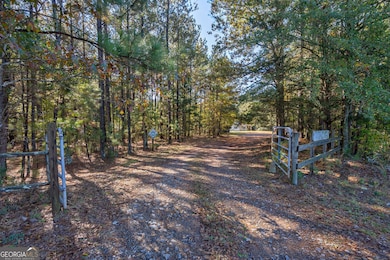
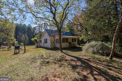
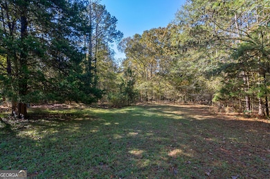
About This Lot
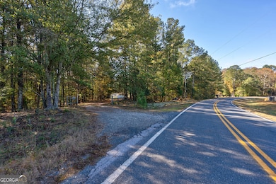
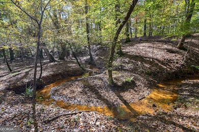
Southern Land Exchange is proud to present 1321 Shepherd Road - 160 acres in Morgan County coming to market for the first time in 45 years. Located in one of Madison's most desirable areas, the property is less than 10 minutes north of historic downtown Madison, 10 minutes from Hard Labor State Park and less than 2 miles from Scarlett Oaks Estate! There's a good internal road & trail network and with the abundance of wildlife, the recreational opportunities are excellent. The property is predominantly hardwoods and with over 9,000 ft of streams, 30+ acres of mature pine stands and sandy creek bottoms, you are surrounded by natural beauty. There is over 600 ft of frontage on Shepherd Road, allowing for the potential for the new owner to divide the property. Additionally, there is a 1920's historic home on the property, currently occupied with tenants. For those looking for a pond or lake, this property does have an existing old pond site and with all the water running through the property there could be potential for a much larger lake to be built. Come be a part of Madison's small-town charm and thriving outdoor culture!
Listing Agent
Southern Land Exchange Brokerage Phone: 706.614.8840 License #379083 Listed on: 11/07/2025
Property Details
Property Type
- Land
Est. Annual Taxes
- $4,824
Lot Details
- 160.4 Acre Lot
- Property fronts a county road
Schools
- Morgan County Primary/Elementa Elementary School
- Morgan County Middle School
- Morgan County High School
Additional Features
- Timber
- Well
Community Details
- No Home Owners Association
Map
Home Values in the Area
Average Home Value in this Area
Tax History
| Year | Tax Paid | Tax Assessment Tax Assessment Total Assessment is a certain percentage of the fair market value that is determined by local assessors to be the total taxable value of land and additions on the property. | Land | Improvement |
|---|---|---|---|---|
| 2024 | $1,615 | $211,732 | $177,472 | $34,260 |
| 2023 | $1,566 | $208,461 | $177,472 | $30,989 |
| 2022 | $1,576 | $207,194 | $177,472 | $29,722 |
| 2021 | $1,560 | $207,194 | $177,471 | $29,723 |
| 2020 | $1,552 | $207,194 | $177,472 | $29,722 |
| 2019 | $1,556 | $207,194 | $177,472 | $29,722 |
| 2018 | $1,553 | $191,060 | $161,338 | $29,722 |
| 2017 | $4,985 | $192,415 | $162,951 | $29,464 |
| 2016 | $1,491 | $187,336 | $161,338 | $25,999 |
| 2015 | $1,455 | $223,280 | $197,600 | $25,680 |
| 2014 | $1,359 | $247,796 | $224,280 | $23,516 |
| 2013 | -- | $183,672 | $165,840 | $17,832 |
Property History
| Date | Event | Price | List to Sale | Price per Sq Ft |
|---|---|---|---|---|
| 11/07/2025 11/07/25 | For Sale | $2,250,000 | -- | -- |
Purchase History
| Date | Type | Sale Price | Title Company |
|---|---|---|---|
| Warranty Deed | -- | -- | |
| Warranty Deed | -- | -- | |
| Deed | $108,000 | -- | |
| Deed | -- | -- |
Source: Georgia MLS
MLS Number: 10639961
APN: 018025000
Disclaimer: Certain information contained herein is derived from information provided by parties other than Homes.com. All information provided is deemed reliable, but is not guaranteed to be accurate and should be independently verified.
![]() The data relating to real estate for sale on this web site comes in part from the Broker Reciprocity Program of Georgia MLS. Real estate listings held by brokerage firms other than Redfin are marked with the Broker Reciprocity logo and detailed information about them includes the name of the listing brokers. Information deemed reliable but not guaranteed. Copyright 2025 Georgia MLS. All rights reserved.
The data relating to real estate for sale on this web site comes in part from the Broker Reciprocity Program of Georgia MLS. Real estate listings held by brokerage firms other than Redfin are marked with the Broker Reciprocity logo and detailed information about them includes the name of the listing brokers. Information deemed reliable but not guaranteed. Copyright 2025 Georgia MLS. All rights reserved.
- 0 Doster Rd Unit 2720 CL335828
- 0 Doster Rd Unit 10565311
- 0 Doster Rd Unit 2720 10581615
- 2720 Doster Rd
- 2950 Doster Rd
- 0 Double Bridges Rd Unit Madison GA 30650
- 1310 Wallace Rd
- 0 Sandy Creek Rd Unit TRACT 4 10326316
- 28.61 ACRES Sandy Creek Rd
- 2911 A Sandy Creek Rd
- LOT 8 Wallace Rd
- LOT 13 Wallace Rd
- LOT 12 Wallace Rd
- LOT 14 Wallace Rd
- 4000 Bostwick Hwy
- LOT 3 Mallory Rd
- 2911 A Sandy Creek Rd
- 0 Double Bridges Rd Unit 7579574
- 0 Double Bridges Rd Unit 67935
- 1121 Prospect Rd Unit A
- 1451 Prospect Rd
- 1571 Bostwick Rd
- 420 Porter St Unit Historic Madison Cottage
- 205 N Second St
- 315 N Main St Unit 800
- 615 Harris St
- 363 E Jefferson St
- 491 Vine St Unit B
- 491 Vine St Unit A
- 483 Vine St Unit A
- 483 Vine St Unit B
- 475 Vine St Unit A
- 475 Vine St Unit B
- 1000 Bell Cir
- 1020 Bell Cir
- 175 E Main St Unit A
- 175 E Main St Unit B
- 1181 Commerce St
- 1015 Highland Ave
