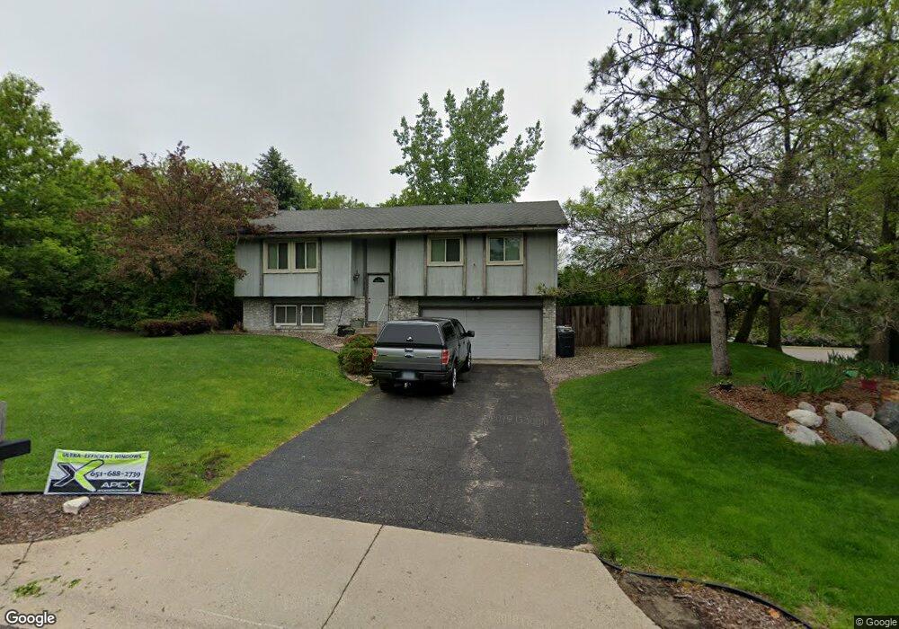
13217 E Manor Blvd Burnsville, MN 55337
Estimated Value: $370,000 - $389,000
3
Beds
2
Baths
1,220
Sq Ft
$310/Sq Ft
Est. Value
About This Home
This home is located at 13217 E Manor Blvd, Burnsville, MN 55337 and is currently estimated at $378,103, approximately $309 per square foot. 13217 E Manor Blvd is a home located in Dakota County with nearby schools including Vista View Elementary School, Joseph Nicollet Middle School, and Burnsville High School.
Ownership History
Date
Name
Owned For
Owner Type
Purchase Details
Closed on
Oct 13, 2005
Sold by
Hill John C
Bought by
Walker Chris
Current Estimated Value
Purchase Details
Closed on
May 28, 2004
Sold by
Hill John C
Bought by
Walker Christopher J
Home Financials for this Owner
Home Financials are based on the most recent Mortgage that was taken out on this home.
Original Mortgage
$191,879
Interest Rate
8%
Mortgage Type
Land Contract Argmt. Of Sale
Create a Home Valuation Report for This Property
The Home Valuation Report is an in-depth analysis detailing your home's value as well as a comparison with similar homes in the area
Home Values in the Area
Average Home Value in this Area
Purchase History
| Date | Buyer | Sale Price | Title Company |
|---|---|---|---|
| Walker Chris | $200,000 | -- | |
| Kemp Patrick | $250,000 | -- | |
| Walker Christopher J | $200,000 | -- |
Source: Public Records
Mortgage History
| Date | Status | Borrower | Loan Amount |
|---|---|---|---|
| Previous Owner | Walker Christopher J | $191,879 |
Source: Public Records
Tax History Compared to Growth
Tax History
| Year | Tax Paid | Tax Assessment Tax Assessment Total Assessment is a certain percentage of the fair market value that is determined by local assessors to be the total taxable value of land and additions on the property. | Land | Improvement |
|---|---|---|---|---|
| 2024 | $3,152 | $312,000 | $88,100 | $223,900 |
| 2023 | $3,152 | $306,900 | $88,100 | $218,800 |
| 2022 | $2,714 | $305,600 | $87,900 | $217,700 |
| 2021 | $2,710 | $263,100 | $76,500 | $186,600 |
| 2020 | $2,570 | $250,300 | $72,800 | $177,500 |
| 2019 | $2,630 | $230,900 | $63,800 | $167,100 |
| 2018 | $2,463 | $225,200 | $60,800 | $164,400 |
| 2017 | $2,310 | $206,800 | $57,900 | $148,900 |
| 2016 | $2,323 | $193,000 | $55,200 | $137,800 |
| 2015 | $2,224 | $163,538 | $47,499 | $116,039 |
| 2014 | -- | $162,884 | $46,576 | $116,308 |
| 2013 | -- | $149,477 | $41,972 | $107,505 |
Source: Public Records
Map
Nearby Homes
- 13303 Morgan Ave S
- 13006 County Road 5
- 13147 Thomas Ave S
- 13100 Thomas Ave S
- 13208 Upton Ave S
- 13212 Fremont Ave S
- 1009 Knob Hill Rd
- 1200 W 136th St
- 13236 Fremont Ave S
- 2704 W 135th St
- 1701 W 138th St
- 2729 Terrace Dr
- 2708 Williams Dr
- 1724 W 140th St
- 2104 W 140th St
- XXXX Woodhill Rd
- 13817 Thomas Ave S
- 1905 W 140th St
- 521 Timberland Dr
- 1725 W 140th St
- 13213 E Manor Blvd
- 13216 E Manor Blvd
- 13209 E Manor Blvd
- 13323 Morgan Ave S
- 13325 Morgan Ave S
- 13327 Morgan Ave S
- 13321 Morgan Ave S
- 1866 W Burnsville Pkwy
- 1866 Burnsville Pkwy W
- 1864 W Burnsville Pkwy
- 13319 Morgan Ave S
- 1868 W Burnsville Pkwy
- 1862 W Burnsville Pkwy
- 13317 Morgan Ave S
- 13315 Morgan Ave S
- 1852 W Burnsville Pkwy
- 1908 Highland Dr
- 13208 E Manor Blvd
- 13313 Morgan Ave S
- 13205 E Manor Blvd