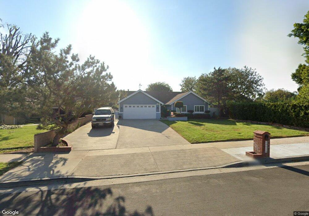
13219 Norris Ave Sylmar, CA 91342
Estimated Value: $855,000 - $942,790
4
Beds
2
Baths
1,854
Sq Ft
$487/Sq Ft
Est. Value
About This Home
This home is located at 13219 Norris Ave, Sylmar, CA 91342 and is currently estimated at $902,198, approximately $486 per square foot. 13219 Norris Ave is a home located in Los Angeles County with nearby schools including Herrick Avenue Elementary School, Olive Vista Middle School, and San Fernando Senior High School.
Ownership History
Date
Name
Owned For
Owner Type
Purchase Details
Closed on
May 12, 2023
Sold by
Mackey Family Trust
Bought by
Mackey Family Trust and Mackey
Current Estimated Value
Purchase Details
Closed on
Jul 2, 2012
Sold by
Mackey Larry J and Mackey Janet L
Bought by
Mackey Larry J and Mackey Janet L
Create a Home Valuation Report for This Property
The Home Valuation Report is an in-depth analysis detailing your home's value as well as a comparison with similar homes in the area
Home Values in the Area
Average Home Value in this Area
Purchase History
| Date | Buyer | Sale Price | Title Company |
|---|---|---|---|
| Mackey Family Trust | -- | None Listed On Document | |
| Mackey Larry J | -- | None Available |
Source: Public Records
Tax History Compared to Growth
Tax History
| Year | Tax Paid | Tax Assessment Tax Assessment Total Assessment is a certain percentage of the fair market value that is determined by local assessors to be the total taxable value of land and additions on the property. | Land | Improvement |
|---|---|---|---|---|
| 2025 | $4,536 | $348,518 | $136,643 | $211,875 |
| 2024 | $4,536 | $341,685 | $133,964 | $207,721 |
| 2023 | $4,455 | $334,987 | $131,338 | $203,649 |
| 2022 | $4,261 | $328,419 | $128,763 | $199,656 |
| 2021 | $4,203 | $321,981 | $126,239 | $195,742 |
| 2019 | $4,084 | $312,433 | $122,496 | $189,937 |
| 2018 | $3,925 | $306,308 | $120,095 | $186,213 |
| 2016 | $3,739 | $294,416 | $115,433 | $178,983 |
| 2015 | $3,687 | $289,995 | $113,700 | $176,295 |
| 2014 | $3,712 | $284,315 | $111,473 | $172,842 |
Source: Public Records
Map
Nearby Homes
- 13120 Bradley Ave Unit 43
- 13120 Bradley Ave Unit 44
- 15185 Cobalt St
- 14923 La Valle St
- 13346 Los Olivos Rd
- 15320 Bledsoe St
- 13522 Glenoaks Blvd Unit 4
- 12917 El Dorado Ave
- 12925 El Dorado Ave
- 15122 Roxford St Unit 7
- 13531 Fusano Ave
- 15258 La Valle St
- 13009 Herrick Ave
- 12744 El Dorado Ave
- 14758 Lakeside St
- 15766 Roxford St
- 15245 Monte St
- 12867 Norris Ave
- 14785 Polk St
- 15721 Cobalt St Unit 118
- 13215 Norris Ave
- 13211 Norris Ave
- 13220 Norris Ave
- 13216 Norris Ave
- 15276 Cobalt St
- 13224 Norris Ave
- 13207 Norris Ave
- 13212 Norris Ave
- 13228 Norris Ave
- 13208 Norris Ave
- 13201 Norris Ave
- 13232 Norris Ave
- 15266 Cobalt St
- 13204 Norris Ave
- 13236 Norris Ave
- 13247 Woodcock Ave
- 13243 Woodcock Ave
- 13197 Norris Ave
- 13251 Woodcock Ave
- 13239 Woodcock Ave