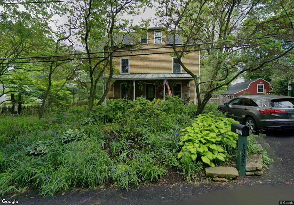
1322 Kirks Ln Dresher, PA 19025
Estimated Value: $576,294 - $742,000
3
Beds
2
Baths
2,024
Sq Ft
$321/Sq Ft
Est. Value
About This Home
This home is located at 1322 Kirks Ln, Dresher, PA 19025 and is currently estimated at $650,074, approximately $321 per square foot. 1322 Kirks Ln is a home located in Montgomery County with nearby schools including Jarrettown Elementary School, Sandy Run Middle School, and Upper Dublin High School.
Ownership History
Date
Name
Owned For
Owner Type
Purchase Details
Closed on
Apr 23, 2012
Sold by
Ford Mary Patricia
Bought by
Ford Mary Patricia and Weldon Hugh Andrew
Current Estimated Value
Purchase Details
Closed on
Jun 20, 2002
Sold by
Mario Samuel Michael and Ford Mary Pat
Bought by
Ford Mary Pat and Ford Mary Patricia
Purchase Details
Closed on
Jun 29, 1995
Sold by
Smith Andrew
Bought by
Mario Samuel Michael and Patford Mary
Purchase Details
Closed on
Jan 31, 1995
Sold by
Daly Marshall and Daly Mildred H
Bought by
Smith Andrew
Create a Home Valuation Report for This Property
The Home Valuation Report is an in-depth analysis detailing your home's value as well as a comparison with similar homes in the area
Home Values in the Area
Average Home Value in this Area
Purchase History
| Date | Buyer | Sale Price | Title Company |
|---|---|---|---|
| Ford Mary Patricia | -- | None Available | |
| Ford Mary Pat | -- | -- | |
| Mario Samuel Michael | $174,550 | -- | |
| Smith Andrew | $110,000 | -- |
Source: Public Records
Tax History Compared to Growth
Tax History
| Year | Tax Paid | Tax Assessment Tax Assessment Total Assessment is a certain percentage of the fair market value that is determined by local assessors to be the total taxable value of land and additions on the property. | Land | Improvement |
|---|---|---|---|---|
| 2025 | $9,192 | $188,480 | -- | -- |
| 2024 | $9,192 | $188,480 | -- | -- |
| 2023 | $8,978 | $188,480 | $0 | $0 |
| 2022 | $8,978 | $188,480 | $0 | $0 |
| 2021 | $8,562 | $188,480 | $0 | $0 |
| 2020 | $8,315 | $188,480 | $0 | $0 |
| 2019 | $8,176 | $188,480 | $0 | $0 |
| 2018 | $8,176 | $188,480 | $0 | $0 |
| 2017 | $7,878 | $188,480 | $0 | $0 |
| 2016 | $7,804 | $188,480 | $0 | $0 |
| 2015 | $7,372 | $188,480 | $0 | $0 |
| 2014 | $7,372 | $188,480 | $0 | $0 |
Source: Public Records
Map
Nearby Homes
- 1300 Kirks Ln
- 1525 Limekiln Pike
- 1423 Southwind Way
- 1485 Mundock Rd
- 1404 Cinnamon Cir
- 1425 Crosby Dr
- 3225 Burn Brae Dr
- 516 Galleria St
- 1354 Wentz Dr
- 1478 Dillon Rd
- 505 Galleria St
- 536 Cardinal Dr
- 541 Cardinal Dr
- 105 Magnolia St
- 1212 Duncan Dr
- 1710 Twining Rd
- 237 Magnolia St
- 309 Woodside Cir
- 1733 Waterford Way
- 501 Martin Ln