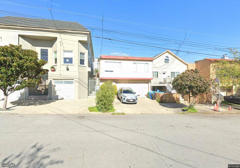
1322 Quesada Ave San Francisco, CA 94124
Bayview NeighborhoodEstimated Value: $954,000 - $1,201,000
4
Beds
3
Baths
1,875
Sq Ft
$559/Sq Ft
Est. Value
About This Home
This home is located at 1322 Quesada Ave, San Francisco, CA 94124 and is currently estimated at $1,048,267, approximately $559 per square foot. 1322 Quesada Ave is a home located in San Francisco County with nearby schools including Carver (George Washington) Elementary School, Willie L. Brown Jr. Middle School, and KIPP Bayview Elementary.
Ownership History
Date
Name
Owned For
Owner Type
Purchase Details
Closed on
Feb 16, 2021
Sold by
Li Lili and Chen Zhekun
Bought by
Li Lili and Chen Zhekun
Current Estimated Value
Purchase Details
Closed on
Jul 11, 2016
Sold by
Goodwin Joann S and Goodwin Ruth
Bought by
Li Lili and Chen Zhekun
Home Financials for this Owner
Home Financials are based on the most recent Mortgage that was taken out on this home.
Original Mortgage
$592,500
Outstanding Balance
$473,299
Interest Rate
3.6%
Mortgage Type
New Conventional
Estimated Equity
$574,968
Create a Home Valuation Report for This Property
The Home Valuation Report is an in-depth analysis detailing your home's value as well as a comparison with similar homes in the area
Home Values in the Area
Average Home Value in this Area
Purchase History
| Date | Buyer | Sale Price | Title Company |
|---|---|---|---|
| Li Lili | -- | First American Title Company | |
| Li Lili | $790,000 | Old Republic Title Company |
Source: Public Records
Mortgage History
| Date | Status | Borrower | Loan Amount |
|---|---|---|---|
| Open | Li Lili | $592,500 |
Source: Public Records
Tax History Compared to Growth
Tax History
| Year | Tax Paid | Tax Assessment Tax Assessment Total Assessment is a certain percentage of the fair market value that is determined by local assessors to be the total taxable value of land and additions on the property. | Land | Improvement |
|---|---|---|---|---|
| 2025 | $11,237 | $916,855 | $641,800 | $275,055 |
| 2024 | $11,237 | $898,878 | $629,216 | $269,662 |
| 2023 | $11,062 | $881,254 | $616,879 | $264,375 |
| 2022 | $10,843 | $863,976 | $604,784 | $259,192 |
| 2021 | $10,647 | $847,032 | $592,924 | $254,108 |
| 2020 | $10,704 | $838,350 | $586,846 | $251,504 |
| 2019 | $10,337 | $821,914 | $575,340 | $246,574 |
| 2018 | $9,989 | $805,800 | $564,060 | $241,740 |
| 2017 | $9,571 | $790,000 | $553,000 | $237,000 |
| 2016 | $2,617 | $192,118 | $34,288 | $157,830 |
| 2015 | $3,580 | $189,234 | $33,774 | $155,460 |
| 2014 | $3,144 | $185,530 | $33,114 | $152,416 |
Source: Public Records
Map
Nearby Homes
- 0 Ship St Unit HD24144152
- 0 Ship St Unit HD24144130
- 0 Ship St Unit HD24144117
- 0 Ship St Unit HD24144142
- 1143 Palou Ave
- 1414 Shafter Ave
- 1379-1381 Palou Ave
- 1278 Thomas Ave
- 19 Progress St
- 1411 Oakdale Ave
- 1411 Newcomb Ave
- 59 Kiska Rd
- 1942 Jennings St
- 1463 Thomas Ave
- 1537 Revere Ave
- 1484 Newcomb Ave
- 983 Innes Ave
- 1590 Underwood Ave
- 1688 Wallace Ave Unit 304
- 5264 3rd St Unit 303
- 1318 Quesada Ave
- 1326 Quesada Ave
- 1314 Quesada Ave
- 1310 Quesada Ave
- 1330 Quesada Ave
- 1219 Palou Ave
- 1338 Quesada Ave
- 1306 Quesada Ave
- 1227 Palou Ave
- 1209 Palou Ave
- 1520 Ingalls St
- 1550 Ingalls St
- 1344 Quesada Ave
- 1235 Palou Ave
- 1207 Palou Ave
- 1239 Palou Ave
- 1352 Quesada Ave
- 1243 Palou Ave
- 1201 Palou Ave
- 1311 Quesada Ave