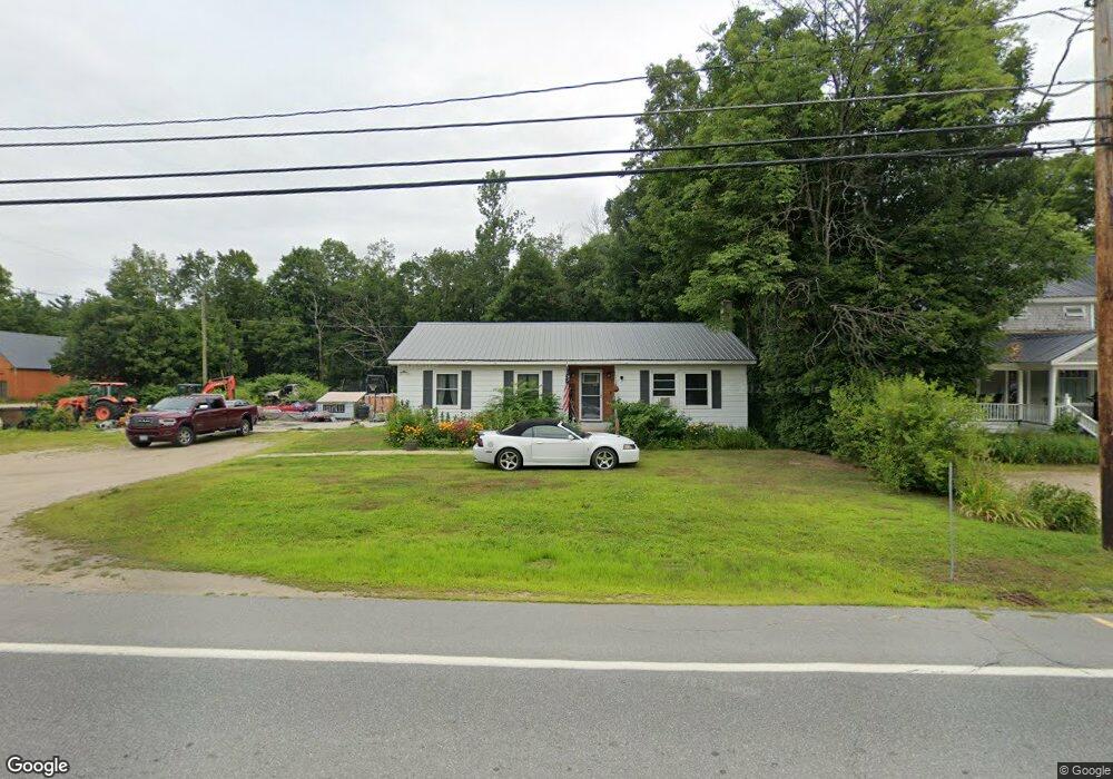
1322 Us Route 302 Bartlett, NH 03812
Estimated Value: $378,285 - $525,000
3
Beds
2
Baths
1,419
Sq Ft
$319/Sq Ft
Est. Value
About This Home
This home is located at 1322 Us Route 302, Bartlett, NH 03812 and is currently estimated at $453,071, approximately $319 per square foot. 1322 Us Route 302 is a home with nearby schools including Josiah Bartlett Elementary School.
Ownership History
Date
Name
Owned For
Owner Type
Purchase Details
Closed on
Apr 11, 2016
Sold by
Waters Rhonda M
Bought by
Greenwood Vernon W
Current Estimated Value
Home Financials for this Owner
Home Financials are based on the most recent Mortgage that was taken out on this home.
Original Mortgage
$164,524
Outstanding Balance
$130,446
Interest Rate
3.62%
Mortgage Type
New Conventional
Estimated Equity
$322,625
Purchase Details
Closed on
Sep 5, 2001
Sold by
Clemons Richard E and Clemons Mary E
Bought by
Waters Rhonda Michelle
Home Financials for this Owner
Home Financials are based on the most recent Mortgage that was taken out on this home.
Original Mortgage
$103,500
Interest Rate
7.05%
Mortgage Type
Purchase Money Mortgage
Create a Home Valuation Report for This Property
The Home Valuation Report is an in-depth analysis detailing your home's value as well as a comparison with similar homes in the area
Home Values in the Area
Average Home Value in this Area
Purchase History
| Date | Buyer | Sale Price | Title Company |
|---|---|---|---|
| Greenwood Vernon W | $160,000 | -- | |
| Waters Rhonda Michelle | $115,000 | -- |
Source: Public Records
Mortgage History
| Date | Status | Borrower | Loan Amount |
|---|---|---|---|
| Open | Greenwood Vernon W | $164,524 | |
| Previous Owner | Waters Rhonda Michelle | $103,500 |
Source: Public Records
Tax History Compared to Growth
Tax History
| Year | Tax Paid | Tax Assessment Tax Assessment Total Assessment is a certain percentage of the fair market value that is determined by local assessors to be the total taxable value of land and additions on the property. | Land | Improvement |
|---|---|---|---|---|
| 2024 | $1,964 | $351,900 | $97,400 | $254,500 |
| 2023 | $1,816 | $351,900 | $97,400 | $254,500 |
| 2022 | $1,749 | $351,900 | $97,400 | $254,500 |
| 2021 | $1,985 | $208,300 | $72,300 | $136,000 |
| 2020 | $2,012 | $208,300 | $72,300 | $136,000 |
| 2019 | $1,845 | $197,500 | $72,300 | $125,200 |
| 2018 | $1,803 | $197,500 | $72,300 | $125,200 |
| 2016 | $1,662 | $174,900 | $50,700 | $124,200 |
| 2015 | $1,669 | $174,900 | $50,700 | $124,200 |
| 2014 | $1,712 | $174,900 | $50,700 | $124,200 |
| 2010 | $2,033 | $222,200 | $109,700 | $112,500 |
Source: Public Records
Map
Nearby Homes
- 1331 Us Rte 302
- 53 Saco Ridge Rd
- 70 River St
- 12 Forest Ave
- 0 U S 302 Unit 1 and 2 5003976
- 114 Cobb Farm Rd
- 83 Parker Ridge Rd
- 30 Parker Ridge Rd
- 0 Parker Ridge Rd Unit 47 5058947
- F4 Cave Mountain Rd
- 00 Tall Woods Loop Unit 9
- 4 Mountainside at Attitash Rd
- 8 River Run Dr Unit G
- 6S River Run Dr
- 2E/F River Run Dr Unit E/F
- 46 Ammonoosuc Dr
- 53 Ammonoosuc Dr
- 30 Top Notch Rd Unit 30
- 461 Jericho Rd
- 31 Cave Mountain Rd
- 1316 US Route 302
- 1316 U S 302
- 1329 Us Route 302
- 6 School St
- 1331 Us Route 302
- 12 River St
- 16 River St
- 12 School St
- 18 River St
- 7 River St
- 7 River St Unit 7G
- 7 River St Unit 7N
- 7 River St Unit 7N
- 7 River St Unit 7
- 7 River St Unit 7S & 7S2
- 7 River St
- 5L River Run Unit 5L
- 5H River Run Dr Unit 5H
- 5G River Run Dr Unit 5G
- 5C River Run Dr Unit 5C