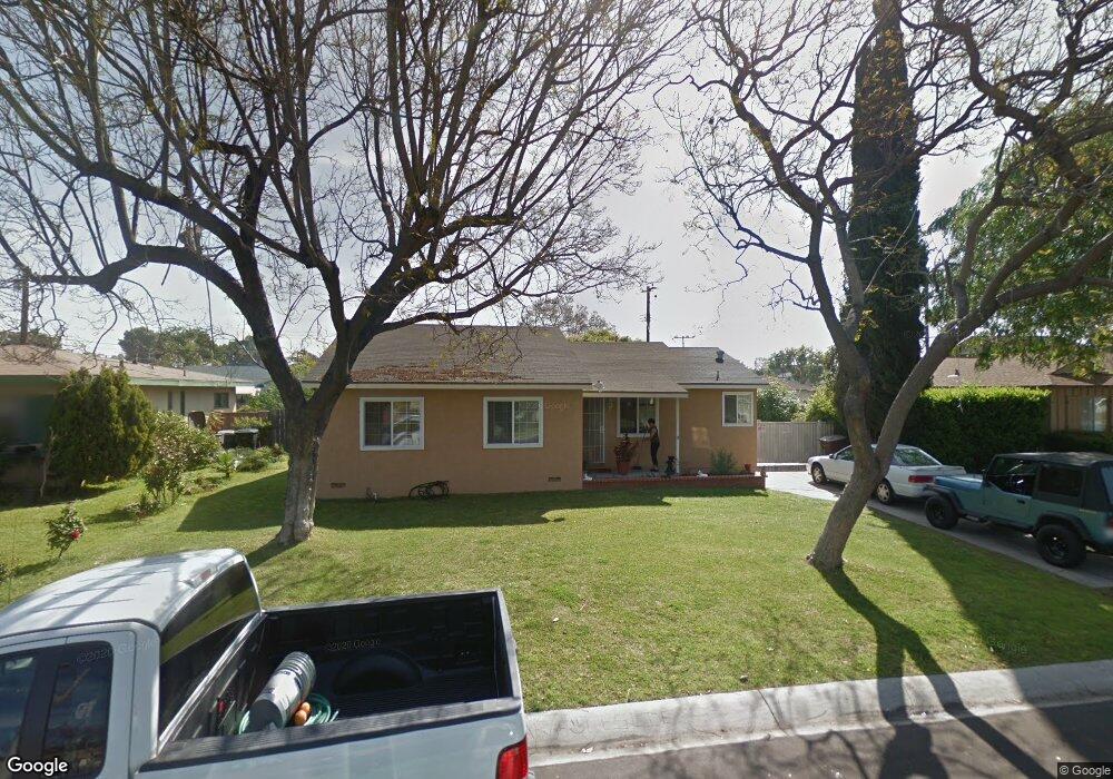
13222 Safford St Garden Grove, CA 92843
Estimated Value: $902,354 - $951,000
2
Beds
2
Baths
1,308
Sq Ft
$712/Sq Ft
Est. Value
About This Home
This home is located at 13222 Safford St, Garden Grove, CA 92843 and is currently estimated at $931,589, approximately $712 per square foot. 13222 Safford St is a home located in Orange County with nearby schools including Peters K-3 Elementary School, Garden Grove High School, and King Of Kings Lutheran School.
Ownership History
Date
Name
Owned For
Owner Type
Purchase Details
Closed on
Sep 1, 1995
Sold by
Ward James L and Ward Margaret Eileen
Bought by
Arellano Fernando and Arellano Isabel
Current Estimated Value
Home Financials for this Owner
Home Financials are based on the most recent Mortgage that was taken out on this home.
Original Mortgage
$139,345
Interest Rate
7.92%
Create a Home Valuation Report for This Property
The Home Valuation Report is an in-depth analysis detailing your home's value as well as a comparison with similar homes in the area
Home Values in the Area
Average Home Value in this Area
Purchase History
| Date | Buyer | Sale Price | Title Company |
|---|---|---|---|
| Arellano Fernando | $155,000 | Continental Lawyers Title Co |
Source: Public Records
Mortgage History
| Date | Status | Borrower | Loan Amount |
|---|---|---|---|
| Closed | Arellano Fernando | $139,345 |
Source: Public Records
Tax History Compared to Growth
Tax History
| Year | Tax Paid | Tax Assessment Tax Assessment Total Assessment is a certain percentage of the fair market value that is determined by local assessors to be the total taxable value of land and additions on the property. | Land | Improvement |
|---|---|---|---|---|
| 2025 | $3,447 | $257,485 | $176,889 | $80,596 |
| 2024 | $3,447 | $252,437 | $173,421 | $79,016 |
| 2023 | $3,382 | $247,488 | $170,021 | $77,467 |
| 2022 | $3,306 | $242,636 | $166,687 | $75,949 |
| 2021 | $3,261 | $237,879 | $163,419 | $74,460 |
| 2020 | $3,222 | $235,440 | $161,743 | $73,697 |
| 2019 | $3,181 | $230,824 | $158,572 | $72,252 |
| 2018 | $3,107 | $226,299 | $155,463 | $70,836 |
| 2017 | $3,074 | $221,862 | $152,414 | $69,448 |
| 2016 | $2,928 | $217,512 | $149,425 | $68,087 |
| 2015 | $2,890 | $214,245 | $147,180 | $67,065 |
| 2014 | $2,824 | $210,049 | $144,297 | $65,752 |
Source: Public Records
Map
Nearby Homes
- 13052 Rockinghorse Rd
- 13621 Malibu St
- 12851 Newhope St
- 12861 West St Unit 157
- 12861 West St Unit 100
- 12662 Woodland Ln
- 13312 Michael Rainford Cir
- 13801 Shirley St Unit 25
- 12727 West St
- 11321 Parkgreen Ln Unit 102
- 12152 Trask Ave Unit 29
- 1609 N Parsons Place
- 12600 Euclid St Unit 19
- 13372 Jessica Dr
- 11052 Peppertree Ln
- 12222 Emrys Ave
- 12555 Euclid St Unit 61
- 12555 Euclid St Unit 2
- 12555 Euclid St Unit 79
- 12555 S Euclid St Unit 32
- 13232 Safford St
- 13202 Safford St
- 13221 Newell St
- 13231 Newell St
- 13201 Newell St
- 13192 Safford St
- 13221 Safford St
- 13231 Safford St
- 13201 Safford St
- 13191 Newell St
- 13182 Safford St
- 11382 Paloma Ave
- 11402 Paloma Ave
- 13181 Newell St
- 13241 Safford St
- 13181 Safford St
- 11422 Paloma Ave
- 13202 Newell St
- 13232 Newell St