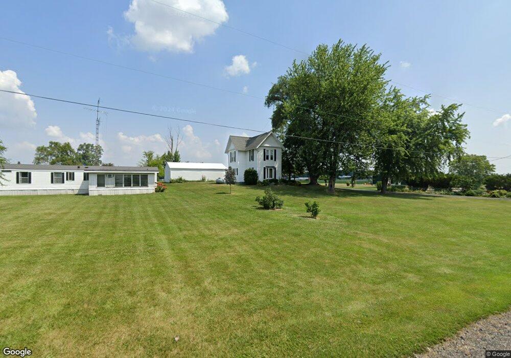
13224 County Road H Wauseon, OH 43567
Estimated Value: $246,000 - $274,000
3
Beds
1
Bath
1,813
Sq Ft
$142/Sq Ft
Est. Value
About This Home
This home is located at 13224 County Road H, Wauseon, OH 43567 and is currently estimated at $257,906, approximately $142 per square foot. 13224 County Road H is a home located in Fulton County with nearby schools including Wauseon Primary School, Wauseon Elementary School, and Wauseon Middle School.
Ownership History
Date
Name
Owned For
Owner Type
Purchase Details
Closed on
Sep 17, 1997
Sold by
Miller Shirely
Bought by
Shadle Karen
Current Estimated Value
Home Financials for this Owner
Home Financials are based on the most recent Mortgage that was taken out on this home.
Original Mortgage
$72,000
Outstanding Balance
$11,237
Interest Rate
7.55%
Mortgage Type
New Conventional
Estimated Equity
$246,669
Purchase Details
Closed on
Jan 23, 1995
Sold by
Miller Shirley A
Bought by
Hite Bruce and Hite Ruth
Home Financials for this Owner
Home Financials are based on the most recent Mortgage that was taken out on this home.
Original Mortgage
$180,894
Interest Rate
9.2%
Mortgage Type
New Conventional
Create a Home Valuation Report for This Property
The Home Valuation Report is an in-depth analysis detailing your home's value as well as a comparison with similar homes in the area
Home Values in the Area
Average Home Value in this Area
Purchase History
| Date | Buyer | Sale Price | Title Company |
|---|---|---|---|
| Shadle Karen | $72,000 | -- | |
| Hite Bruce | $210,894 | -- |
Source: Public Records
Mortgage History
| Date | Status | Borrower | Loan Amount |
|---|---|---|---|
| Open | Shadle Karen | $72,000 | |
| Previous Owner | Hite Bruce | $180,894 |
Source: Public Records
Tax History Compared to Growth
Tax History
| Year | Tax Paid | Tax Assessment Tax Assessment Total Assessment is a certain percentage of the fair market value that is determined by local assessors to be the total taxable value of land and additions on the property. | Land | Improvement |
|---|---|---|---|---|
| 2024 | $3,131 | $67,770 | $22,440 | $45,330 |
| 2023 | $3,131 | $67,770 | $22,440 | $45,330 |
| 2022 | $2,866 | $53,550 | $18,690 | $34,860 |
| 2021 | $3,009 | $53,550 | $18,690 | $34,860 |
| 2020 | $2,817 | $53,550 | $18,690 | $34,860 |
| 2019 | $2,697 | $51,100 | $16,520 | $34,580 |
| 2018 | $2,475 | $51,100 | $16,520 | $34,580 |
| 2017 | $2,437 | $51,100 | $16,520 | $34,580 |
| 2016 | $2,475 | $47,950 | $16,520 | $31,430 |
| 2015 | $2,311 | $47,950 | $16,520 | $31,430 |
| 2014 | $2,315 | $47,950 | $16,520 | $31,430 |
| 2013 | $2,387 | $45,500 | $13,860 | $31,640 |
Source: Public Records
Map
Nearby Homes
- 0 County Road H
- 8453 County Road 13
- 13354 U S 20a
- 13242 Us Highway 20a
- 7620 County Road 12
- 7373 County Road 12
- 460 Airport Hwy
- 1209 Apache Dr
- 14900 County Road H
- 14900 W Co Rd H
- 14578 Us Highway 20a
- Integrity 1830 Plan at Arrowhead Trails
- integrity 2280 Plan at Arrowhead Trails
- Integrity 2080 Plan at Arrowhead Trails
- 1062 Seneca Dr
- 1090 Seneca Dr
- 1058 Seneca Dr
- 1066 Seneca Dr
- 1338 N Park Ln
- 1270 S Park Ln
- 13225 County Road H
- 13195 County Road H
- 13131 County Road H
- 00 County Road H
- 13065 County Road H
- 7951 County Road 13
- 13508 County Road H
- 12921 County Road H
- 0 Co Rd H Unit 4656118
- 0 Co Rd H Unit 4656117
- 0 Co Rd H Unit 4666037
- 0 Co Rd H Unit 4666036
- 0 Co Rd H Unit 5009079
- 0 Co Rd H Unit 5009078
- 0 Co Rd H Unit 2019738
- 0 Co Rd H Unit 9009471
- 0 Co Rd H Unit 4590414
- 0 Co Rd H Unit 9009468
- 0 Co Rd H Unit 9009465
- 0 Co Rd H Unit 4579261