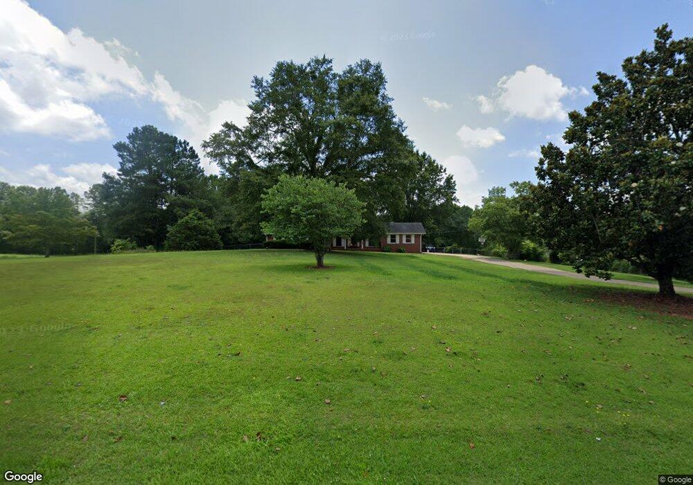
1323 Highway 211 NE Winder, GA 30680
Estimated Value: $289,000 - $339,000
3
Beds
2
Baths
1,740
Sq Ft
$185/Sq Ft
Est. Value
About This Home
This home is located at 1323 Highway 211 NE, Winder, GA 30680 and is currently estimated at $322,027, approximately $185 per square foot. 1323 Highway 211 NE is a home located in Barrow County with nearby schools including Statham Elementary School, Bear Creek Middle School, and Winder-Barrow High School.
Ownership History
Date
Name
Owned For
Owner Type
Purchase Details
Closed on
May 19, 2021
Sold by
New Pentecost United Methodist Church Of
Bought by
Patterson April R and Patterson Jeremy D
Current Estimated Value
Home Financials for this Owner
Home Financials are based on the most recent Mortgage that was taken out on this home.
Original Mortgage
$180,303
Outstanding Balance
$163,400
Interest Rate
3.1%
Mortgage Type
New Conventional
Estimated Equity
$158,627
Purchase Details
Closed on
Dec 30, 1994
Bought by
New Pentecost Method
Create a Home Valuation Report for This Property
The Home Valuation Report is an in-depth analysis detailing your home's value as well as a comparison with similar homes in the area
Home Values in the Area
Average Home Value in this Area
Purchase History
| Date | Buyer | Sale Price | Title Company |
|---|---|---|---|
| Patterson April R | -- | -- | |
| Patterson April R | $178,500 | -- | |
| New Pentecost Method | -- | -- |
Source: Public Records
Mortgage History
| Date | Status | Borrower | Loan Amount |
|---|---|---|---|
| Open | Patterson April R | $180,303 |
Source: Public Records
Tax History Compared to Growth
Tax History
| Year | Tax Paid | Tax Assessment Tax Assessment Total Assessment is a certain percentage of the fair market value that is determined by local assessors to be the total taxable value of land and additions on the property. | Land | Improvement |
|---|---|---|---|---|
| 2024 | $2,439 | $101,927 | $16,000 | $85,927 |
| 2023 | $2,797 | $101,927 | $16,000 | $85,927 |
| 2022 | $1,807 | $66,114 | $16,000 | $50,114 |
| 2021 | $36 | $54,952 | $20,272 | $34,680 |
| 2020 | $36 | $54,952 | $20,272 | $34,680 |
| 2019 | $0 | $54,952 | $20,272 | $34,680 |
| 2018 | $24 | $54,952 | $20,272 | $34,680 |
| 2017 | $1,437 | $49,342 | $20,272 | $29,070 |
| 2016 | -- | $49,342 | $20,272 | $29,070 |
| 2015 | $18 | $49,342 | $20,272 | $29,070 |
| 2014 | $18 | $43,666 | $14,596 | $29,070 |
| 2013 | -- | $39,806 | $12,771 | $27,035 |
Source: Public Records
Map
Nearby Homes
- 1212 Highway 211 NE
- 1226 Highway 211 NE
- 212 Rainbow Ln
- 385 Finch Landing Rd
- 330 Anchors Way
- 1431 Solomon Dr
- 1206 Corkybrooke Ln
- 1023 Solomon Ct
- 1453 Solomon Dr
- 917 Justin Dr Unit 3
- 1553 Shoal Creek Dr
- 1556 Shoal Creek Dr
- 388 Kay Dr Unit 1
- 508 Pleasant Hill Church Rd NE
- 130 (Tract 1) Bowman Mill Rd NE
- 315 Paige Way
- 130 Bowman Mill Rd NE Unit 1
- 1415 Red Oak Way
- 0 Hancock Bridge Rd Unit 10535063
- 63 Delightful Way Unit 1
- 106 Clearwater Ct
- 104 Clearwater Ct Unit LOT52
- 104 Clearwater Ct
- 0 Clearwater Ct Unit 8243447
- 100 Clearwater Ct
- 100 Clearwater Ct Unit 53
- 109 Clearwater Ct Unit lot 50
- 109 Clearwater Ct
- 107 Clearwater Ct Unit lot 49
- 107 Clearwater Ct
- 1349 Highway 211 NE
- 1201 Clearwater Dr Unit Lot 1
- 1201 Clearwater Dr
- 1328 Highway 211 NE
- 1204 Clearwater Dr Unit Lot 48
- 1204 Clearwater Dr
- 1205 Clearwater Dr Unit Lot 2
- 1205 Clearwater Dr
- 1208 Clearwater Dr Unit Lot 47
- 1208 Clearwater Dr