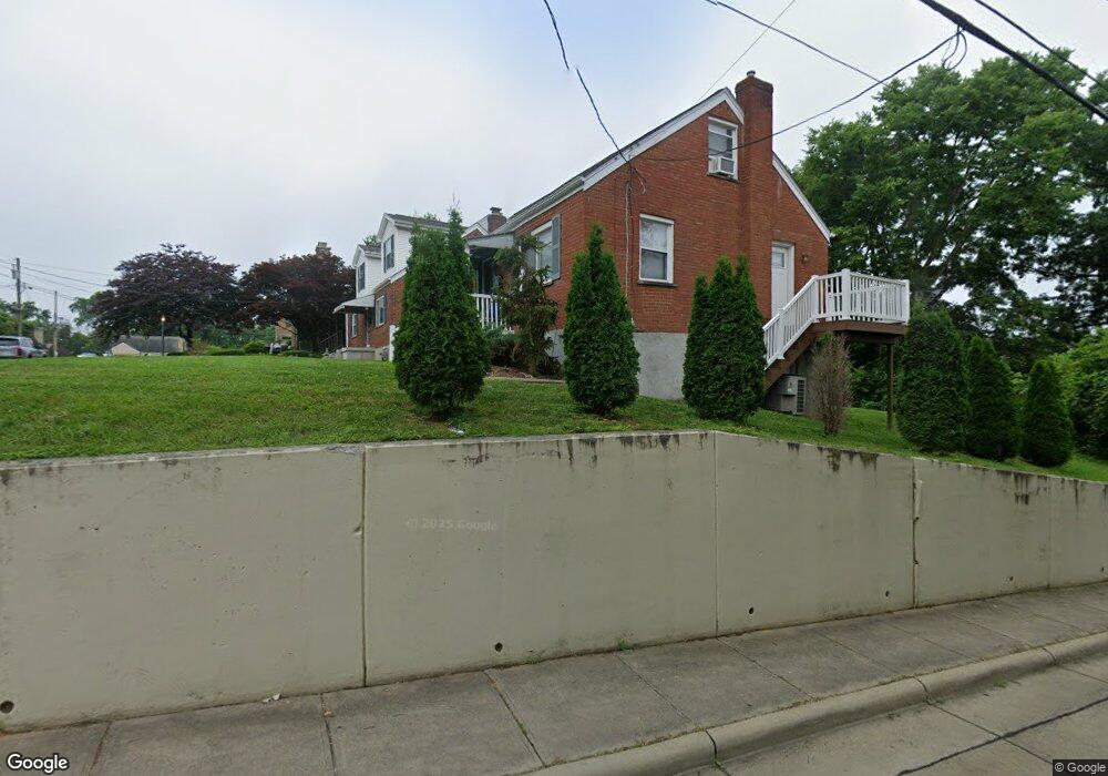
1323 Observatory Ave Cincinnati, OH 45215
Estimated Value: $170,000 - $254,000
4
Beds
1
Bath
1,208
Sq Ft
$173/Sq Ft
Est. Value
About This Home
This home is located at 1323 Observatory Ave, Cincinnati, OH 45215 and is currently estimated at $208,819, approximately $172 per square foot. 1323 Observatory Ave is a home located in Hamilton County with nearby schools including Reading Community High School, Saints Peter and Paul Academy, and Mount Notre Dame High School.
Ownership History
Date
Name
Owned For
Owner Type
Purchase Details
Closed on
Jan 11, 2024
Sold by
Aildasani John V
Bought by
Jjje Llc
Current Estimated Value
Purchase Details
Closed on
Jun 7, 2019
Sold by
Rourke Robert F
Bought by
Aildasani John
Purchase Details
Closed on
Jan 30, 1995
Sold by
Wisbey Joey A
Bought by
Rourke Robert F
Home Financials for this Owner
Home Financials are based on the most recent Mortgage that was taken out on this home.
Original Mortgage
$77,800
Interest Rate
9.24%
Create a Home Valuation Report for This Property
The Home Valuation Report is an in-depth analysis detailing your home's value as well as a comparison with similar homes in the area
Home Values in the Area
Average Home Value in this Area
Purchase History
| Date | Buyer | Sale Price | Title Company |
|---|---|---|---|
| Jjje Llc | -- | None Listed On Document | |
| Jjje Llc | -- | None Listed On Document | |
| Aildasani John | $60,000 | None Available | |
| Rourke Robert F | -- | -- |
Source: Public Records
Mortgage History
| Date | Status | Borrower | Loan Amount |
|---|---|---|---|
| Previous Owner | Rourke Robert F | $77,800 |
Source: Public Records
Tax History
| Year | Tax Paid | Tax Assessment Tax Assessment Total Assessment is a certain percentage of the fair market value that is determined by local assessors to be the total taxable value of land and additions on the property. | Land | Improvement |
|---|---|---|---|---|
| 2025 | $2,747 | $50,593 | $11,865 | $38,728 |
| 2024 | $2,748 | $50,593 | $11,865 | $38,728 |
| 2023 | $2,743 | $50,593 | $11,865 | $38,728 |
| 2022 | $1,424 | $21,000 | $10,283 | $10,717 |
| 2021 | $1,188 | $21,000 | $10,283 | $10,717 |
| 2020 | $1,201 | $21,000 | $10,283 | $10,717 |
| 2019 | $1,970 | $31,444 | $9,100 | $22,344 |
| 2018 | $1,972 | $31,444 | $9,100 | $22,344 |
| 2017 | $1,858 | $31,444 | $9,100 | $22,344 |
| 2016 | $1,891 | $32,092 | $8,918 | $23,174 |
| 2015 | $1,908 | $32,092 | $8,918 | $23,174 |
| 2014 | $1,669 | $32,092 | $8,918 | $23,174 |
| 2013 | $1,692 | $32,746 | $9,100 | $23,646 |
Source: Public Records
Map
Nearby Homes
- 310 E Vine St
- 1521 Hunt Rd
- 2148 Julie Terrace
- 234 Mcguire Ln
- 2113 Bolser Dr
- 109 Calico Ct
- 54 Gorman Ln
- 103 W Crest Dr
- 26 Gahl Terrace
- 9350 Reading Rd
- 18 Gahl Terrace
- 1357 Thurnridge Dr
- 1320 Thurnridge Dr
- 636 Maple Dr
- 0 Hill St Unit 1616370
- 654 3rd St
- 129 Pike St
- 1421 Jefferson Ave
- 1401 Jefferson Ave
- 2258 Hunt Rd
- 1321 Observatory Ave
- 1315 Observatory Ave
- 401 E Columbia Ave
- 1313 Observatory Ave
- 426 E Columbia Ave
- 420 E Columbia Ave
- 420 E Columbia Ave
- 1322 Observatory Ave
- 1311 Observatory Ave
- 1318 Observatory Ave
- 414 E Columbia Ave
- 442 E Columbia Ave
- 1309 Observatory Ave
- 1314 Observatory Ave
- 412 E Columbia Ave
- 1312 Observatory Ave
- 444 E Columbia Ave
- 404 E Columbia Ave
- 251 E Columbia Ave
- 1307 Observatory Ave
Your Personal Tour Guide
Ask me questions while you tour the home.