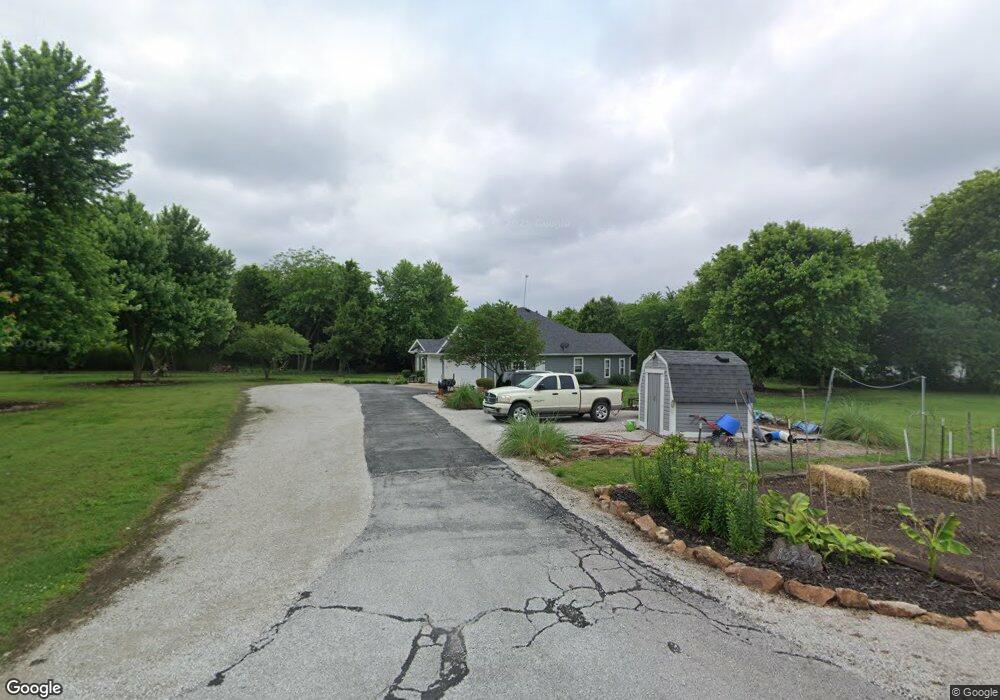
13230 Loss Ln Carthage, MO 64836
Estimated Value: $271,429 - $453,000
3
Beds
2
Baths
1,948
Sq Ft
$186/Sq Ft
Est. Value
About This Home
This home is located at 13230 Loss Ln, Carthage, MO 64836 and is currently estimated at $361,357, approximately $185 per square foot. 13230 Loss Ln is a home located in Jasper County with nearby schools including Carthage High School and Victory Academy.
Ownership History
Date
Name
Owned For
Owner Type
Purchase Details
Closed on
Jun 24, 2024
Sold by
Clay Anthony W and Clay Marvena B
Bought by
Standhardt Evelyn M
Current Estimated Value
Purchase Details
Closed on
Mar 6, 2008
Sold by
Ls General Partnership
Bought by
Anderson Aaron S and Debey Shelley
Home Financials for this Owner
Home Financials are based on the most recent Mortgage that was taken out on this home.
Original Mortgage
$146,300
Interest Rate
5.47%
Mortgage Type
Unknown
Create a Home Valuation Report for This Property
The Home Valuation Report is an in-depth analysis detailing your home's value as well as a comparison with similar homes in the area
Home Values in the Area
Average Home Value in this Area
Purchase History
| Date | Buyer | Sale Price | Title Company |
|---|---|---|---|
| Standhardt Evelyn M | -- | None Listed On Document | |
| Anderson Aaron S | -- | Abbey |
Source: Public Records
Mortgage History
| Date | Status | Borrower | Loan Amount |
|---|---|---|---|
| Previous Owner | Anderson Aaron S | $146,300 |
Source: Public Records
Tax History Compared to Growth
Tax History
| Year | Tax Paid | Tax Assessment Tax Assessment Total Assessment is a certain percentage of the fair market value that is determined by local assessors to be the total taxable value of land and additions on the property. | Land | Improvement |
|---|---|---|---|---|
| 2024 | $1,411 | $30,160 | $2,760 | $27,400 |
| 2023 | $1,411 | $30,160 | $2,760 | $27,400 |
| 2022 | $1,405 | $30,150 | $2,760 | $27,390 |
| 2021 | $1,389 | $30,150 | $2,760 | $27,390 |
| 2020 | $1,333 | $27,820 | $2,760 | $25,060 |
| 2019 | $1,336 | $27,820 | $2,760 | $25,060 |
| 2018 | $1,281 | $26,710 | $0 | $0 |
| 2017 | $1,285 | $26,710 | $0 | $0 |
| 2016 | $1,333 | $27,800 | $0 | $0 |
| 2015 | $1,214 | $27,800 | $0 | $0 |
| 2014 | $1,214 | $27,630 | $0 | $0 |
Source: Public Records
Map
Nearby Homes
- 11279 County Road 130
- 13341 Knoll Rd
- 13825 Jasmine Loop
- 9671 County Road 118
- 9404 County Lane 121
- 9599 County Road 118
- 9670 County Lane 116
- Tbd Highway Hh S 25
- 707 Limestone St
- xxxx County Road 160
- 000 County Road 160
- 2061 Lakeview St
- TBD County Road 160
- 703 W Central Tract 2
- 527 Olive St
- 10191 County Road 100
- 417 S Mcgregor St
- 624 S Orner St
- 1604 E Chestnut St
- 1977 Hammer Ln
- 13260 Loss Ln
- 13150 Loss Ln
- 0 Loss Ln
- 13161 Loss Ln
- 13130 Loss Ln
- 11715 County Road 130
- 11657 County Road 130
- 11415 Co Rd Unit 76-213
- 11383 County Road 130
- 13041 Locust Rd
- 12101 County Road 130
- 11682 County Road 137
- 11734 County Road 137
- 13459 Locust Rd
- 13483 Little Ln
- 12175 County Road 130
- 11436 County Road 137
- 13081 Kafir Rd
- 13243 Kafir Rd
- 12905 Kafir Rd