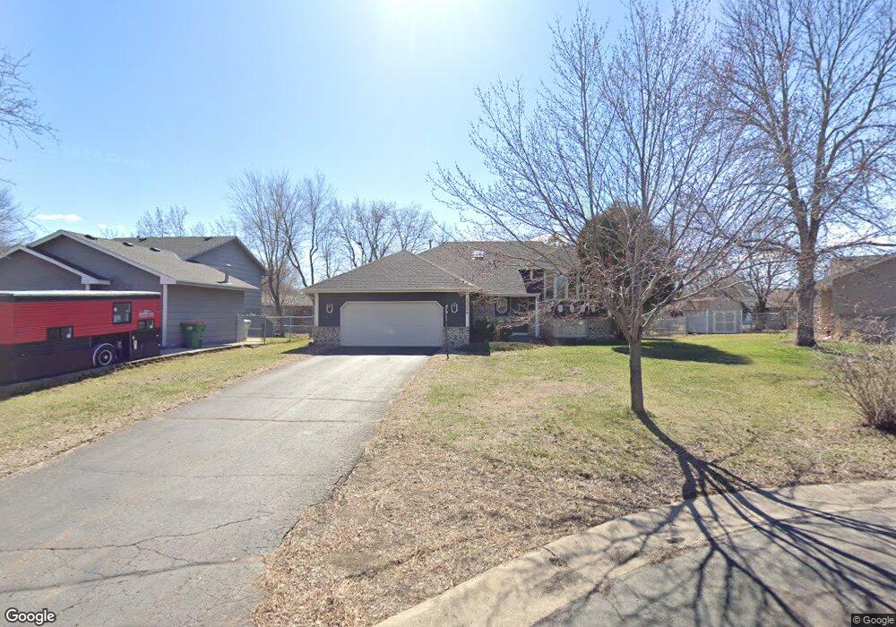
13230 Quinn St NW Coon Rapids, MN 55448
Estimated Value: $396,972 - $408,000
3
Beds
2
Baths
2,440
Sq Ft
$165/Sq Ft
Est. Value
About This Home
This home is located at 13230 Quinn St NW, Coon Rapids, MN 55448 and is currently estimated at $403,243, approximately $165 per square foot. 13230 Quinn St NW is a home located in Anoka County with nearby schools including Lucile Bruner Elementary School, Morris Bye Elementary School, and Laughlin Junior/Senior High School.
Ownership History
Date
Name
Owned For
Owner Type
Purchase Details
Closed on
Apr 16, 2021
Sold by
Debiaso Timothy and Debiaso Danielle
Bought by
Kramer Patty and Anderson Eric
Current Estimated Value
Home Financials for this Owner
Home Financials are based on the most recent Mortgage that was taken out on this home.
Original Mortgage
$314,450
Outstanding Balance
$283,910
Interest Rate
3%
Mortgage Type
New Conventional
Estimated Equity
$119,333
Purchase Details
Closed on
May 30, 2018
Sold by
Long Karen E and The James R Long Trust
Bought by
Debiaso Donald and Debiaso Kelly
Home Financials for this Owner
Home Financials are based on the most recent Mortgage that was taken out on this home.
Original Mortgage
$216,000
Interest Rate
4.5%
Mortgage Type
New Conventional
Create a Home Valuation Report for This Property
The Home Valuation Report is an in-depth analysis detailing your home's value as well as a comparison with similar homes in the area
Home Values in the Area
Average Home Value in this Area
Purchase History
| Date | Buyer | Sale Price | Title Company |
|---|---|---|---|
| Kramer Patty | $331,000 | Trademark Title Services Inc | |
| Debiaso Donald | $270,000 | Trademark Title Services Inc | |
| Anderson Eric Eric | $331,000 | -- |
Source: Public Records
Mortgage History
| Date | Status | Borrower | Loan Amount |
|---|---|---|---|
| Open | Kramer Patty | $314,450 | |
| Previous Owner | Debiaso Donald | $216,000 | |
| Closed | Anderson Eric Eric | $315,402 |
Source: Public Records
Tax History Compared to Growth
Tax History
| Year | Tax Paid | Tax Assessment Tax Assessment Total Assessment is a certain percentage of the fair market value that is determined by local assessors to be the total taxable value of land and additions on the property. | Land | Improvement |
|---|---|---|---|---|
| 2025 | $3,881 | $372,400 | $94,500 | $277,900 |
| 2024 | $3,881 | $357,500 | $91,400 | $266,100 |
| 2023 | $3,569 | $349,800 | $75,600 | $274,200 |
| 2022 | $3,190 | $359,400 | $75,600 | $283,800 |
| 2021 | $3,088 | $291,500 | $58,800 | $232,700 |
| 2020 | $3,064 | $276,600 | $58,800 | $217,800 |
| 2019 | $2,984 | $263,900 | $58,800 | $205,100 |
| 2018 | $2,815 | $250,400 | $0 | $0 |
| 2017 | $2,547 | $230,600 | $0 | $0 |
| 2016 | $2,565 | $204,600 | $0 | $0 |
| 2015 | -- | $204,600 | $52,500 | $152,100 |
| 2014 | -- | $172,200 | $37,200 | $135,000 |
Source: Public Records
Map
Nearby Homes
- 13416 Swallow St NW
- 13519 Partridge Cir NW
- 13182 Zion St NW
- 1776 133rd Ave NW
- 2270 137th Ln NW
- 12760 Raven St NW
- 1687 131st Ln NW
- 2740 132nd Ln NW
- 1930 127th Cir NW
- 2201 139th Ave NW
- 2147 125th Ln NW
- 2675 128th Ave NW
- 1520 129th Ave NW
- 12554 Grouse St NW
- 13624 Gladiola St NW
- 2068 124th Ln NW
- 13680 Gladiola St NW
- 13664 Gladiola St NW
- 1593 126th Ln NW
- 2538 140th Ln NW
- 13228 Quinn St NW
- 13234 Quinn St NW
- 13223 Raven St NW
- 2169 132nd Ave NW
- 2181 132nd Ave NW
- 13244 Quinn St NW
- 13245 Raven St NW
- 13217 Raven St NW
- 13231 Quinn St NW
- 13235 Quinn St NW
- 2157 132nd Ave NW
- 13239 Quinn St NW
- 13201 Raven St NW
- 13265 Raven St NW
- 13227 Quinn St NW
- 2211 132nd Ln NW
- 13223 Quinn St NW
- 13232 Raven St NW
- 2186 132nd Ave NW
- 13248 Raven St NW