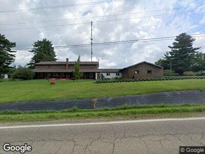
13233 State Route 39 Big Prairie, OH 44611
Estimated Value: $420,135 - $461,000
--
Bed
1
Bath
3,808
Sq Ft
$115/Sq Ft
Est. Value
About This Home
This home is located at 13233 State Route 39, Big Prairie, OH 44611 and is currently estimated at $437,712, approximately $114 per square foot. 13233 State Route 39 is a home located in Holmes County with nearby schools including West Holmes High School, DEER RUN, and HICKORY RIDGE.
Ownership History
Date
Name
Owned For
Owner Type
Purchase Details
Closed on
Jan 19, 2018
Sold by
Leppla Larry B and Leppla Patricia M
Bought by
Troyer Nelson A and Troyer Sara E
Current Estimated Value
Purchase Details
Closed on
Jan 1, 1990
Bought by
Leppla Larry B and Leppla Patricia
Create a Home Valuation Report for This Property
The Home Valuation Report is an in-depth analysis detailing your home's value as well as a comparison with similar homes in the area
Home Values in the Area
Average Home Value in this Area
Purchase History
| Date | Buyer | Sale Price | Title Company |
|---|---|---|---|
| Troyer Nelson A | $164,875 | None Available | |
| Leppla Patricia M | -- | None Available | |
| Leppla Larry B | -- | -- |
Source: Public Records
Tax History Compared to Growth
Tax History
| Year | Tax Paid | Tax Assessment Tax Assessment Total Assessment is a certain percentage of the fair market value that is determined by local assessors to be the total taxable value of land and additions on the property. | Land | Improvement |
|---|---|---|---|---|
| 2024 | $4,356 | $123,810 | $32,420 | $91,390 |
| 2023 | $4,356 | $123,810 | $32,420 | $91,390 |
| 2022 | $4,209 | $102,560 | $32,420 | $70,140 |
| 2021 | $3,680 | $83,410 | $20,060 | $63,350 |
| 2020 | $3,351 | $83,410 | $20,060 | $63,350 |
| 2019 | $3,308 | $83,410 | $20,060 | $63,350 |
| 2018 | $3,243 | $63,840 | $17,150 | $46,690 |
| 2017 | $2,944 | $57,750 | $17,460 | $40,290 |
| 2016 | $2,906 | $57,750 | $17,460 | $40,290 |
| 2015 | $2,352 | $55,890 | $15,530 | $40,360 |
| 2014 | $2,364 | $55,890 | $15,530 | $40,360 |
| 2013 | $1,224 | $55,890 | $15,530 | $40,360 |
Source: Public Records
Map
Nearby Homes
- 139 W Millersburg St
- 6833 State Route 754
- 8538 Township Road 1060
- 0 Township Road 276
- 13575 County Road 100
- 5756 Township Road 276
- 13100 State Route 226
- 319 Galation St
- 10296 Newkirk Rd
- 9139 County Road 51
- 16135 Township Road 211 Unit 81
- 3535 Township Road 29
- 4042 Township Road 55
- 0 Vess Rd
- 13975 Township Road 14
- 8978 S Funk Rd
- 16531 Ohio 3
- 433 Liberty St
- 4015 Township Road 271
- 533 N Park Place
- 13233 State Route 39
- 13233 State Route 39
- 13231 State Route 39
- 13236 State Route 39
- 13217 State Route 39
- 13225 State Route 39
- 13282 State Route 39
- 13282 Ohio 39
- 13291 State Route 39
- 13170 State Route 39
- 13155 State Route 39
- 13293 State Route 39
- 13133 State Route 39
- 6372 Township Road 219
- 6358 Township Road 219
- 6342 Township Road 219
- 13371 State Route 39
- 13371 State Route 39
- 13180 State Route 39
- 6294 Tr 219