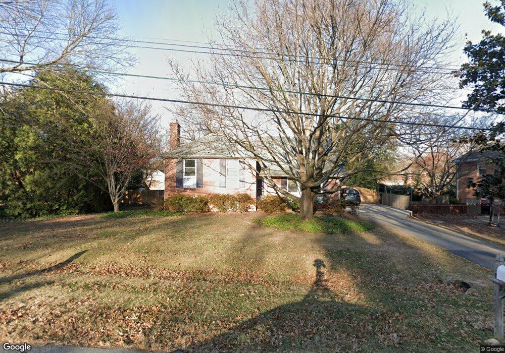
13236 Glenhill Rd Silver Spring, MD 20904
Estimated Value: $510,000 - $585,000
Studio
3
Baths
1,601
Sq Ft
$334/Sq Ft
Est. Value
About This Home
This home is located at 13236 Glenhill Rd, Silver Spring, MD 20904 and is currently estimated at $534,319, approximately $333 per square foot. 13236 Glenhill Rd is a home located in Montgomery County with nearby schools including Cannon Road Elementary School, Francis Scott Key Middle School, and Springbrook High School.
Ownership History
Date
Name
Owned For
Owner Type
Purchase Details
Closed on
Jun 15, 2018
Sold by
George W Rutherford Jr Revocable Trust and Rutherford George W
Bought by
Rutherford George W and Rutherford Deborah M
Current Estimated Value
Purchase Details
Closed on
Feb 2, 2005
Sold by
Rutherford George W
Bought by
Rutherford George W Jr Et Al Tr
Purchase Details
Closed on
Nov 8, 2002
Sold by
Rutherford George W Tr
Bought by
Rutherford George W and Rutherford Deborah M
Purchase Details
Closed on
Mar 19, 1996
Sold by
Rutherford George W and Rutherford M Rutherford D
Bought by
George W Rutherford Et Al Tr
Create a Home Valuation Report for This Property
The Home Valuation Report is an in-depth analysis detailing your home's value as well as a comparison with similar homes in the area
Home Values in the Area
Average Home Value in this Area
Purchase History
We collect this data history from publicly available records. To have your information removed, we recommend requesting removal directly through your county’s website.
| Date | Buyer | Sale Price | Title Company |
|---|---|---|---|
| Rutherford George W | -- | None Available | |
| Rutherford George W Jr Et Al Tr | -- | -- | |
| Rutherford George W | -- | -- | |
| George W Rutherford Et Al Tr | -- | -- |
Source: Public Records
Tax History
| Year | Tax Paid | Tax Assessment Tax Assessment Total Assessment is a certain percentage of the fair market value that is determined by local assessors to be the total taxable value of land and additions on the property. | Land | Improvement |
|---|---|---|---|---|
| 2025 | $5,432 | $466,400 | -- | -- |
| 2024 | $5,432 | $419,100 | $0 | $0 |
| 2023 | $4,171 | $371,800 | $196,500 | $175,300 |
| 2022 | $2,902 | $360,000 | $0 | $0 |
| 2021 | $3,622 | $348,200 | $0 | $0 |
| 2020 | $3,457 | $336,400 | $196,500 | $139,900 |
| 2019 | $3,787 | $331,467 | $0 | $0 |
| 2018 | $3,302 | $326,533 | $0 | $0 |
| 2017 | $3,251 | $321,600 | $0 | $0 |
| 2016 | -- | $310,667 | $0 | $0 |
| 2015 | $3,374 | $299,733 | $0 | $0 |
| 2014 | $3,374 | $288,800 | $0 | $0 |
Source: Public Records
Map
Nearby Homes
- 616 Chichester Ln
- 13307 Bregman Rd
- 523 Copley Ln
- 501 Copley Ln
- 7 Shaw Ave
- 702 Buccaneer Ct
- 12829 Baker Dr
- 13017 Broadmore Rd
- 0 Copley Ln
- 803 Johnson Ave
- 12913 Two Farm Dr
- 816 Rosemere Ave
- 13707 Notley Rd
- 13704 New Hampshire Ave
- 13711 Notley Rd
- 13715 Notley Rd
- 13719 Notley Rd
- 13408 Brackley Terrace
- 13621 Montvale Dr
- 1211 Morningside Dr
- 13232 Glenhill Rd
- 13240 Glenhill Rd
- 13227 Betty Ln
- 13223 Betty Ln
- 13231 Betty Ln
- 13237 Glenhill Rd
- 13241 Glenhill Rd
- 13228 Glenhill Rd
- 13233 Glenhill Rd
- 13244 Glenhill Rd
- 13219 Betty Ln
- 13245 Glenhill Rd
- 13235 Betty Ln
- 13229 Glenhill Rd
- 13220 Betty Ln
- 13224 Glenhill Rd
- 512 Derrydown Ln
- 13215 Betty Ln
- 511 Elderwood Rd
- 13232 Clifton Rd
Your Personal Tour Guide
Ask me questions while you tour the home.