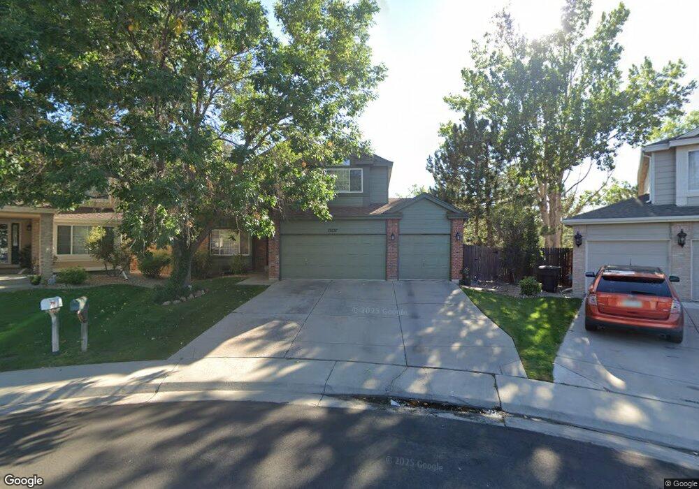
13237 Humboldt Way Thornton, CO 80241
Hunters Glen NeighborhoodEstimated Value: $617,020 - $712,000
3
Beds
3
Baths
2,098
Sq Ft
$316/Sq Ft
Est. Value
About This Home
This home is located at 13237 Humboldt Way, Thornton, CO 80241 and is currently estimated at $664,005, approximately $316 per square foot. 13237 Humboldt Way is a home located in Adams County with nearby schools including Hunters Glen Elementary School, Century Middle School, and Mountain Range High School.
Ownership History
Date
Name
Owned For
Owner Type
Purchase Details
Closed on
Jul 30, 2001
Sold by
Rusovick Michael J and Rusovich Kathleen M
Bought by
Bates Ramon I and Bates Lisa A
Current Estimated Value
Home Financials for this Owner
Home Financials are based on the most recent Mortgage that was taken out on this home.
Original Mortgage
$255,900
Outstanding Balance
$99,245
Interest Rate
7.07%
Estimated Equity
$564,760
Purchase Details
Closed on
Jan 29, 1996
Sold by
Richmond Homes Inc Ii
Bought by
Rusovick Michael J and Rusovick Kathleen M
Home Financials for this Owner
Home Financials are based on the most recent Mortgage that was taken out on this home.
Original Mortgage
$166,100
Interest Rate
7.14%
Create a Home Valuation Report for This Property
The Home Valuation Report is an in-depth analysis detailing your home's value as well as a comparison with similar homes in the area
Home Values in the Area
Average Home Value in this Area
Purchase History
| Date | Buyer | Sale Price | Title Company |
|---|---|---|---|
| Bates Ramon I | $319,900 | -- | |
| Rusovick Michael J | $207,680 | Land Title |
Source: Public Records
Mortgage History
| Date | Status | Borrower | Loan Amount |
|---|---|---|---|
| Open | Bates Ramon I | $255,900 | |
| Previous Owner | Rusovick Michael J | $166,100 |
Source: Public Records
Tax History Compared to Growth
Tax History
| Year | Tax Paid | Tax Assessment Tax Assessment Total Assessment is a certain percentage of the fair market value that is determined by local assessors to be the total taxable value of land and additions on the property. | Land | Improvement |
|---|---|---|---|---|
| 2024 | $4,202 | $39,320 | $11,380 | $27,940 |
| 2023 | $4,159 | $44,310 | $10,550 | $33,760 |
| 2022 | $3,755 | $34,090 | $10,300 | $23,790 |
| 2021 | $3,881 | $34,090 | $10,300 | $23,790 |
| 2020 | $3,851 | $34,520 | $10,600 | $23,920 |
| 2019 | $3,859 | $34,520 | $10,600 | $23,920 |
| 2018 | $3,528 | $30,660 | $9,730 | $20,930 |
| 2017 | $3,208 | $30,660 | $9,730 | $20,930 |
| 2016 | $2,799 | $26,050 | $7,040 | $19,010 |
| 2015 | $2,796 | $26,050 | $7,040 | $19,010 |
| 2014 | $2,557 | $22,160 | $6,000 | $16,160 |
Source: Public Records
Map
Nearby Homes
- 1089 E 131st Dr
- 978 E 132nd Dr
- 13398 Race St
- 12931 Lafayette St Unit G
- 12905 Lafayette St Unit H
- 1282 E 135th Place
- 13242 Pearl Cir
- 12829 Claude Place
- 2275 E 129th Ave
- 13748 Downing St
- 0 128th & Washington St
- 12811 Josephine Ct
- 12962 Grant Cir E Unit A
- 12962 Grant Cir E Unit C
- 12982 Grant Cir E Unit B
- 2746 E 132nd Place
- 12992 Grant Cir E Unit A
- 12913 Grant Cir E Unit A
- 12901 Grant Cir W Unit C
- 2788 E 132nd Cir
- 13247 Humboldt Way
- 13236 Humboldt Way
- 13257 Humboldt Way
- 13246 Humboldt Way
- 13256 Humboldt Way
- 1501 E 133rd Ave
- 13266 Humboldt Way
- 1507 E 133rd Ave
- 13326 Humboldt Dr
- 13276 Humboldt Dr
- 1513 E 133rd Ave
- 13286 Humboldt Dr
- 13277 Humboldt Dr
- 13287 Humboldt Dr
- 1519 E 133rd Ave
- 1507 E 131st Place
- 1517 E 131st Place
- 1523 E 131st Place
- 13296 Humboldt Dr
- 1527 E 131st Place