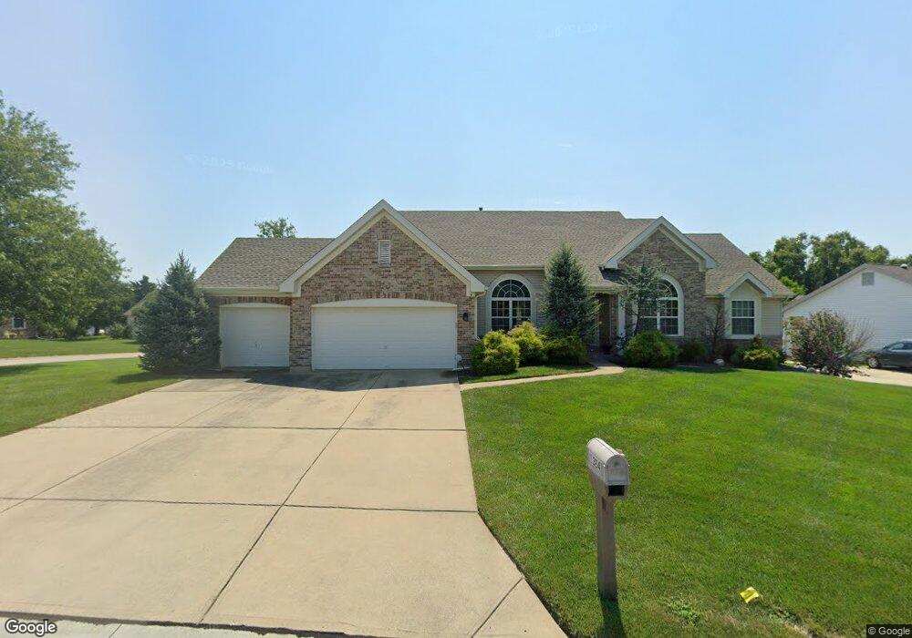
1324 Westbend Dr O Fallon, MO 63368
Estimated Value: $527,863 - $607,000
4
Beds
3
Baths
2,884
Sq Ft
$198/Sq Ft
Est. Value
About This Home
This home is located at 1324 Westbend Dr, O Fallon, MO 63368 and is currently estimated at $571,216, approximately $198 per square foot. 1324 Westbend Dr is a home located in St. Charles County with nearby schools including John Weldon Elementary School, Francis Howell Middle School, and Francis Howell Union High School.
Ownership History
Date
Name
Owned For
Owner Type
Purchase Details
Closed on
Oct 28, 2011
Sold by
Briner William J and Briner Donna F
Bought by
Levins Sean
Current Estimated Value
Home Financials for this Owner
Home Financials are based on the most recent Mortgage that was taken out on this home.
Original Mortgage
$199,750
Outstanding Balance
$136,997
Interest Rate
4.14%
Mortgage Type
New Conventional
Estimated Equity
$434,219
Purchase Details
Closed on
Dec 16, 1999
Sold by
Hayden Homes Inc
Bought by
Briner William J and Briner Donna F
Create a Home Valuation Report for This Property
The Home Valuation Report is an in-depth analysis detailing your home's value as well as a comparison with similar homes in the area
Home Values in the Area
Average Home Value in this Area
Purchase History
| Date | Buyer | Sale Price | Title Company |
|---|---|---|---|
| Levins Sean | $236,000 | Ort | |
| Briner William J | -- | -- |
Source: Public Records
Mortgage History
| Date | Status | Borrower | Loan Amount |
|---|---|---|---|
| Open | Levins Sean | $199,750 |
Source: Public Records
Tax History Compared to Growth
Tax History
| Year | Tax Paid | Tax Assessment Tax Assessment Total Assessment is a certain percentage of the fair market value that is determined by local assessors to be the total taxable value of land and additions on the property. | Land | Improvement |
|---|---|---|---|---|
| 2025 | $4,901 | $88,136 | -- | -- |
| 2023 | $4,899 | $81,042 | $0 | $0 |
| 2022 | $4,370 | $67,067 | $0 | $0 |
| 2021 | $4,374 | $67,067 | $0 | $0 |
| 2020 | $4,122 | $61,132 | $0 | $0 |
| 2019 | $4,103 | $61,132 | $0 | $0 |
| 2018 | $3,962 | $56,441 | $0 | $0 |
| 2017 | $3,930 | $56,441 | $0 | $0 |
| 2016 | $3,615 | $49,956 | $0 | $0 |
| 2015 | $3,580 | $49,956 | $0 | $0 |
| 2014 | $3,363 | $45,531 | $0 | $0 |
Source: Public Records
Map
Nearby Homes
- 1333 Hamden Ct
- 1348 Westbend Dr
- 1532 Woodbury Dr
- 7053 Black Horse Dr
- 47 Landyn Ct
- 223 Toussaint Landing Dr
- 201 Keaton Woods Dr
- 229 Toussaint Landing Dr
- 202 Keaton Woods Dr
- Warson Plan at The Villas at Keaton Woods
- 20 White Chapel Ct
- 21 White Chapel Ct
- 3 Palladio Park
- 763 River Glen Dr
- 149 Haven Ridge Ct
- 146 Haven Ridge Ct
- 627 W Falls Ct
- 552 Boulder River Dr
- 427 Covered Bridge Ln
- 3007 Bromley Dr
- 1320 Westbend Dr
- 1385 Stockbridge Dr
- 1325 Westbend Dr
- 1388 Stockbridge Dr
- 1386 Stockbridge Dr
- 1316 Westbend Dr
- 1321 Westbend Dr
- 1328 Westbend Dr
- 1383 Stockbridge Dr
- 1329 Hamden Ct
- 1384 Stockbridge Dr
- 1312 Westbend Dr
- 1400 Wilkesboro Dr
- 1332 Westbend Dr
- 1331 Hamden Ct
- 1401 Wilkesboro Dr
- 1112 Keighly Crossing
- 1381 Stockbridge Dr
- 1116 Keighly Crossing
- 1382 Stockbridge Dr