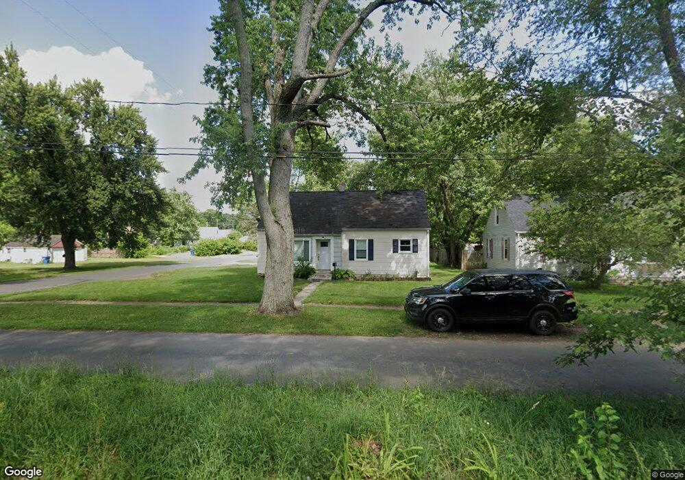
1324 Woodrow Dr Kalamazoo, MI 49048
Estimated Value: $164,000 - $181,000
3
Beds
2
Baths
1,179
Sq Ft
$146/Sq Ft
Est. Value
About This Home
This home is located at 1324 Woodrow Dr, Kalamazoo, MI 49048 and is currently estimated at $172,453, approximately $146 per square foot. 1324 Woodrow Dr is a home located in Kalamazoo County with nearby schools including Northeastern Elementary School, Linden Grove Middle School, and Kalamazoo Central High School.
Ownership History
Date
Name
Owned For
Owner Type
Purchase Details
Closed on
May 24, 2007
Sold by
Hixon Rodney
Bought by
Wells Fargo Bank Na
Current Estimated Value
Purchase Details
Closed on
Nov 22, 2004
Sold by
Foster Abner and Foster Ginger Martin
Bought by
Hixon Rodney
Home Financials for this Owner
Home Financials are based on the most recent Mortgage that was taken out on this home.
Original Mortgage
$106,200
Interest Rate
9.45%
Mortgage Type
Purchase Money Mortgage
Create a Home Valuation Report for This Property
The Home Valuation Report is an in-depth analysis detailing your home's value as well as a comparison with similar homes in the area
Home Values in the Area
Average Home Value in this Area
Purchase History
| Date | Buyer | Sale Price | Title Company |
|---|---|---|---|
| Wells Fargo Bank Na | $93,000 | None Available | |
| Hixon Rodney | $118,000 | First American Title |
Source: Public Records
Mortgage History
| Date | Status | Borrower | Loan Amount |
|---|---|---|---|
| Previous Owner | Hixon Rodney | $106,200 | |
| Closed | Hixon Rodney | $5,900 |
Source: Public Records
Tax History Compared to Growth
Tax History
| Year | Tax Paid | Tax Assessment Tax Assessment Total Assessment is a certain percentage of the fair market value that is determined by local assessors to be the total taxable value of land and additions on the property. | Land | Improvement |
|---|---|---|---|---|
| 2025 | $1,732 | $73,500 | $0 | $0 |
| 2024 | $328 | $62,500 | $0 | $0 |
| 2023 | $313 | $55,500 | $0 | $0 |
| 2022 | $1,577 | $51,400 | $0 | $0 |
| 2021 | $1,481 | $44,900 | $0 | $0 |
| 2020 | $1,457 | $41,400 | $0 | $0 |
| 2019 | $1,391 | $37,800 | $0 | $0 |
| 2018 | $1,356 | $31,100 | $0 | $0 |
| 2017 | $0 | $31,100 | $0 | $0 |
| 2016 | -- | $27,500 | $0 | $0 |
| 2015 | -- | $25,100 | $0 | $0 |
| 2014 | -- | $24,200 | $0 | $0 |
Source: Public Records
Map
Nearby Homes
- 1242 Nassau St
- 1312 Sunnyside Dr
- 1415 Upland Dr
- 1219 Upland Dr
- 3011 E Main St
- 1512 Upland Dr
- 1727 Sunnyside Dr
- 1030 Dwillard Dr
- 925 Dayton Ave
- 2820 Asbury Ave
- 3221 Miami Ave
- 1008 Cooper Ave
- 1013 Chrysler St
- 905 Cooper Ave
- 2535 Gull Rd
- 811 Cooper Ave
- 1320 Nazareth Rd
- 2105 Gull Rd
- 2215 Brook Dr
- 713 Chicago Ave
- 1318 Woodrow Dr
- 1408 Woodrow Dr
- 1319 Texel Dr
- 1308 Woodrow Dr
- 1407 Texel Dr
- 1323 Woodrow Dr
- 1414 Woodrow Dr
- 1317 Woodrow Dr
- 1304 Woodrow Dr
- 1307 Texel Dr
- 2707 Ann St
- 1311 Woodrow Dr
- 1413 Texel Dr
- 1411 Woodrow Dr
- 1420 Woodrow Dr
- 1305 Woodrow Dr
- 1425 Texel Dr
- 1236 Woodrow Dr
- 1417 Woodrow Dr
- 1301 Woodrow Dr