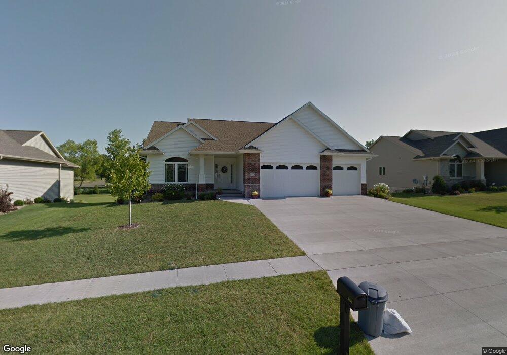
1325 Maple St Robins, IA 52328
Estimated Value: $381,000 - $512,000
4
Beds
3
Baths
2,825
Sq Ft
$162/Sq Ft
Est. Value
About This Home
This home is located at 1325 Maple St, Robins, IA 52328 and is currently estimated at $459,004, approximately $162 per square foot. 1325 Maple St is a home located in Linn County with nearby schools including Nixon Elementary School, Ponderosa Elementary School, and Harding Middle School.
Ownership History
Date
Name
Owned For
Owner Type
Purchase Details
Closed on
Sep 15, 2022
Sold by
Tibbs Loreese M and Tibbs Jack D
Bought by
Even Nicholas and Even Samantha
Current Estimated Value
Purchase Details
Closed on
Jul 9, 2010
Sold by
Sunderman Construction Inc
Bought by
Tibbs Loreese M and Tibbs Jack D
Home Financials for this Owner
Home Financials are based on the most recent Mortgage that was taken out on this home.
Original Mortgage
$200,000
Interest Rate
4.77%
Mortgage Type
New Conventional
Purchase Details
Closed on
Jul 1, 2009
Sold by
Maple Meadows Development Llc
Bought by
Sunderman Construction Inc
Home Financials for this Owner
Home Financials are based on the most recent Mortgage that was taken out on this home.
Original Mortgage
$500,000
Interest Rate
5.32%
Mortgage Type
Commercial
Create a Home Valuation Report for This Property
The Home Valuation Report is an in-depth analysis detailing your home's value as well as a comparison with similar homes in the area
Home Values in the Area
Average Home Value in this Area
Purchase History
| Date | Buyer | Sale Price | Title Company |
|---|---|---|---|
| Even Nicholas | $450,000 | -- | |
| Tibbs Loreese M | $333,500 | None Available | |
| Sunderman Construction Inc | $50,500 | None Available |
Source: Public Records
Mortgage History
| Date | Status | Borrower | Loan Amount |
|---|---|---|---|
| Previous Owner | Tibbs Loreese M | $200,000 | |
| Previous Owner | Sunderman Construction Inc | $500,000 |
Source: Public Records
Tax History Compared to Growth
Tax History
| Year | Tax Paid | Tax Assessment Tax Assessment Total Assessment is a certain percentage of the fair market value that is determined by local assessors to be the total taxable value of land and additions on the property. | Land | Improvement |
|---|---|---|---|---|
| 2025 | $5,004 | $385,100 | $57,800 | $327,300 |
| 2024 | $5,150 | $381,300 | $57,800 | $323,500 |
| 2023 | $5,150 | $381,300 | $57,800 | $323,500 |
| 2022 | $5,482 | $346,800 | $57,800 | $289,000 |
| 2021 | $5,486 | $346,800 | $57,800 | $289,000 |
| 2020 | $5,486 | $322,200 | $57,800 | $264,400 |
| 2019 | $5,132 | $307,300 | $57,800 | $249,500 |
| 2018 | $5,046 | $307,300 | $57,800 | $249,500 |
| 2017 | $5,450 | $316,700 | $57,800 | $258,900 |
| 2016 | $5,450 | $316,700 | $57,800 | $258,900 |
| 2015 | $5,466 | $316,700 | $57,800 | $258,900 |
| 2014 | $5,316 | $316,700 | $57,800 | $258,900 |
| 2013 | $5,196 | $316,700 | $57,800 | $258,900 |
Source: Public Records
Map
Nearby Homes
- 0 Maple St
- 545 Evergreen Ln
- 70.78 Acres M L Quass Rd
- 165 Timber Ln
- 9014 Grand Oaks Dr NE
- 9124 Grand Oaks Dr NE
- 8926 Norway Dr NE
- 8908 Norway Dr NE
- 1332 Stratton Dr NE
- 8809 Middlebury Ct NE
- Lot 9 Kervin Ct
- Lot 10 Kervin Ct
- 3230 N Center Point Rd Unit Lot 3
- 8201 Council St NE
- 923 Messina Dr NE
- 620 Hampton St
- 570 Hampton St
- 540 Hampton St
- 560 Hampton St
- 590 Hampton St