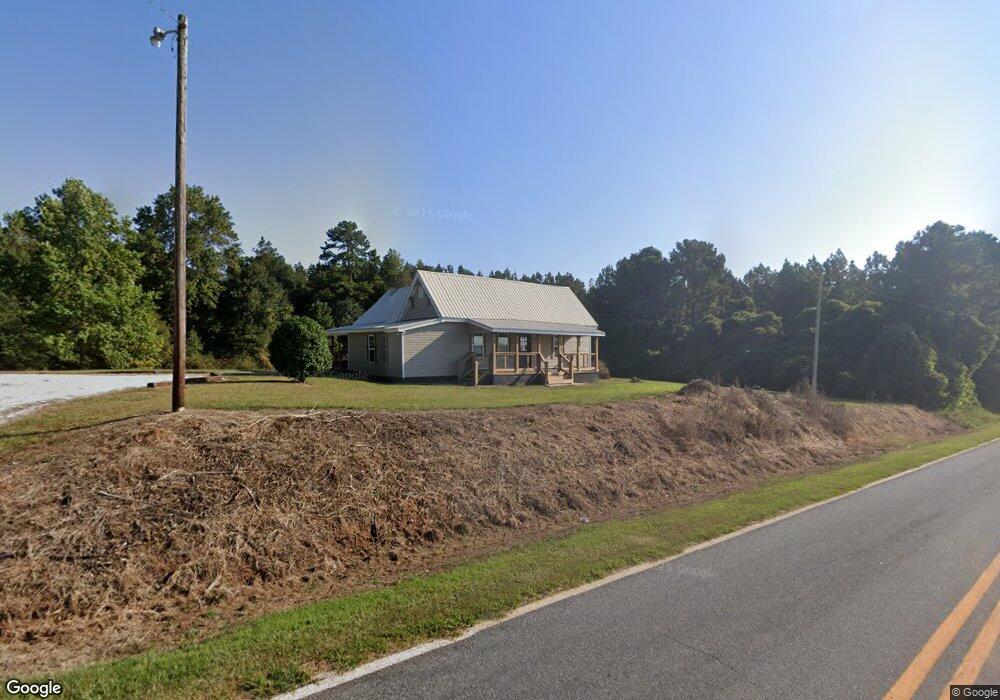
1325 Simpson Rd Franklin, GA 30217
Estimated Value: $148,615 - $283,000
3
Beds
1
Bath
1,488
Sq Ft
$137/Sq Ft
Est. Value
About This Home
This home is located at 1325 Simpson Rd, Franklin, GA 30217 and is currently estimated at $203,654, approximately $136 per square foot. 1325 Simpson Rd is a home located in Heard County with nearby schools including Heard County High School.
Ownership History
Date
Name
Owned For
Owner Type
Purchase Details
Closed on
Jan 10, 2009
Sold by
Mayfield Mary
Bought by
Circle T Ranch
Current Estimated Value
Purchase Details
Closed on
Jan 1, 2001
Bought by
Johnson Buford C
Purchase Details
Closed on
Jul 9, 1999
Sold by
Mayfield Earl
Bought by
Mayfield Mary
Purchase Details
Closed on
Jan 5, 1995
Sold by
Miller B Thomas
Bought by
Mayfield Earl and Mayfield Mary
Purchase Details
Closed on
Jun 14, 1993
Sold by
Johnson Buford C
Bought by
Miller B Thomas
Create a Home Valuation Report for This Property
The Home Valuation Report is an in-depth analysis detailing your home's value as well as a comparison with similar homes in the area
Purchase History
| Date | Buyer | Sale Price | Title Company |
|---|---|---|---|
| Circle T Ranch | -- | -- | |
| Johnson Buford C | -- | -- | |
| Mayfield Mary | -- | -- | |
| Mayfield Earl | $18,000 | -- | |
| Miller B Thomas | $12,000 | -- |
Source: Public Records
Tax History
| Year | Tax Paid | Tax Assessment Tax Assessment Total Assessment is a certain percentage of the fair market value that is determined by local assessors to be the total taxable value of land and additions on the property. | Land | Improvement |
|---|---|---|---|---|
| 2024 | $432 | $21,422 | $3,674 | $17,748 |
| 2023 | $214 | $10,232 | $3,061 | $7,171 |
| 2022 | $280 | $8,475 | $1,899 | $6,576 |
| 2021 | $239 | $10,879 | $1,899 | $8,980 |
| 2020 | $213 | $9,619 | $1,899 | $7,720 |
| 2019 | $214 | $9,619 | $1,899 | $7,720 |
| 2018 | $248 | $10,959 | $1,899 | $9,060 |
| 2017 | $254 | $11,255 | $2,735 | $8,520 |
| 2016 | $254 | $11,255 | $2,735 | $8,520 |
| 2015 | -- | $12,490 | $5,056 | $7,434 |
| 2014 | -- | $12,490 | $5,056 | $7,434 |
| 2013 | -- | $12,490 | $5,056 | $7,434 |
Source: Public Records
Map
Nearby Homes
- 99.58 +/- AC Peace Ln
- 99.58 + - Ac Peace Ln
- 139 Nelson Rd
- 111 Nelson Rd
- 7971 Roosterville Rd
- 319 + - Acres Hwy 100
- 140+/- Acres Hwy 100
- 14250 Ga Highway 100
- 364 Centralhatchee Pkwy
- 100 Barry Hopson Rd
- 0 Knight Dr
- 3354 Antioch Rd
- 1600 Happy Hollow Rd
- 710 Armstrong Mill Rd
- 1676 Happy Hollow Rd
- 11520 US Highway 27
- 417 Gray Rd
- 85 Unity Rd
- 65 Unity Rd
- 10 Avery Rd
- 1387 Simpson Rd
- 1215 Simpson Rd
- 1202 Simpson Rd
- 1170 Simpson Rd
- 1035 Simpson Rd
- 1020 Simpson Rd
- 1676 Simpson Rd
- 1682 Simpson Rd
- 1748 Simpson Rd
- 2563 Spradlin Rd
- 1800 Simpson Rd
- 855 Simpson Rd
- 1840 Simpson Rd
- 964 Simpson Rd
- 799 Simpson Rd
- 720 Simpson Rd
- 2630 Spradlin Rd
- 100 Mcclain Dr
- 2031 Notnomis Rd
- 0 Simpson Rd Unit 24,TRC 4 7227861
Your Personal Tour Guide
Ask me questions while you tour the home.