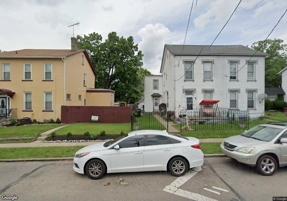
1326 Laidlaw Ave Cincinnati, OH 45237
Bond Hill NeighborhoodEstimated Value: $153,000 - $260,000
3
Beds
1
Bath
1,568
Sq Ft
$122/Sq Ft
Est. Value
About This Home
This home is located at 1326 Laidlaw Ave, Cincinnati, OH 45237 and is currently estimated at $190,916, approximately $121 per square foot. 1326 Laidlaw Ave is a home located in Hamilton County with nearby schools including Bond Hill Academy Elementary School, Shroder High School, and Clark Montessori High School.
Ownership History
Date
Name
Owned For
Owner Type
Purchase Details
Closed on
Sep 3, 2024
Sold by
Lyons Tonda
Bought by
Lyons Launa
Current Estimated Value
Home Financials for this Owner
Home Financials are based on the most recent Mortgage that was taken out on this home.
Original Mortgage
$92,000
Outstanding Balance
$90,966
Interest Rate
6.47%
Mortgage Type
New Conventional
Estimated Equity
$99,950
Purchase Details
Closed on
Apr 28, 2017
Sold by
Sg Investment Team Llc
Bought by
Powell Azariah
Home Financials for this Owner
Home Financials are based on the most recent Mortgage that was taken out on this home.
Original Mortgage
$58,310
Interest Rate
4.3%
Mortgage Type
New Conventional
Purchase Details
Closed on
Aug 29, 2000
Sold by
Eddie Fyall and Eddie Frances
Bought by
Lyons Tonda
Home Financials for this Owner
Home Financials are based on the most recent Mortgage that was taken out on this home.
Original Mortgage
$49,500
Interest Rate
8.15%
Purchase Details
Closed on
Jan 28, 2000
Sold by
Wells Heather
Bought by
Lyons Tonda
Home Financials for this Owner
Home Financials are based on the most recent Mortgage that was taken out on this home.
Original Mortgage
$74,100
Interest Rate
8.08%
Purchase Details
Closed on
Dec 28, 1999
Sold by
Equity Lending Inc
Bought by
Wells Heather
Home Financials for this Owner
Home Financials are based on the most recent Mortgage that was taken out on this home.
Original Mortgage
$74,100
Interest Rate
8.08%
Purchase Details
Closed on
May 28, 1999
Sold by
Mathis and Christine
Bought by
Equity Lending Inc
Purchase Details
Closed on
Sep 8, 1997
Sold by
Mathis Yvonne
Bought by
Mathis Yvonne and Mathis Christine
Home Financials for this Owner
Home Financials are based on the most recent Mortgage that was taken out on this home.
Original Mortgage
$56,800
Interest Rate
7.55%
Purchase Details
Closed on
Apr 7, 1994
Sold by
Homesteading & Urban Redevelopment Corp
Bought by
Mathis Yvonne
Create a Home Valuation Report for This Property
The Home Valuation Report is an in-depth analysis detailing your home's value as well as a comparison with similar homes in the area
Home Values in the Area
Average Home Value in this Area
Purchase History
| Date | Buyer | Sale Price | Title Company |
|---|---|---|---|
| Lyons Launa | -- | None Listed On Document | |
| Lyons Launa | -- | None Listed On Document | |
| Powell Azariah | $8,000 | -- | |
| Lyons Tonda | $55,000 | Global Title Agency Inc | |
| Lyons Tonda | $78,000 | -- | |
| Wells Heather | $35,500 | -- | |
| Equity Lending Inc | $40,000 | -- | |
| Mathis Yvonne | -- | -- | |
| Mathis Yvonne | -- | -- |
Source: Public Records
Mortgage History
| Date | Status | Borrower | Loan Amount |
|---|---|---|---|
| Open | Lyons Launa | $92,000 | |
| Closed | Lyons Launa | $92,000 | |
| Previous Owner | Powell Azariah | $58,310 | |
| Previous Owner | Lyons Tonda | $49,500 | |
| Previous Owner | Lyons Tonda | $74,100 | |
| Previous Owner | Mathis Yvonne | $56,800 |
Source: Public Records
Tax History Compared to Growth
Tax History
| Year | Tax Paid | Tax Assessment Tax Assessment Total Assessment is a certain percentage of the fair market value that is determined by local assessors to be the total taxable value of land and additions on the property. | Land | Improvement |
|---|---|---|---|---|
| 2024 | $2,276 | $35,683 | $3,840 | $31,843 |
| 2023 | $2,280 | $35,683 | $3,840 | $31,843 |
| 2022 | $1,424 | $19,933 | $3,287 | $16,646 |
| 2021 | $1,394 | $19,933 | $3,287 | $16,646 |
| 2020 | $1,398 | $19,933 | $3,287 | $16,646 |
| 2019 | $1,435 | $18,631 | $3,073 | $15,558 |
| 2018 | $1,436 | $18,631 | $3,073 | $15,558 |
| 2017 | $1,382 | $18,631 | $3,073 | $15,558 |
| 2016 | $1,710 | $22,523 | $3,227 | $19,296 |
| 2015 | $1,530 | $22,523 | $3,227 | $19,296 |
| 2014 | $1,538 | $22,523 | $3,227 | $19,296 |
| 2013 | $1,595 | $22,985 | $3,294 | $19,691 |
Source: Public Records
Map
Nearby Homes
- 1407 Regent Ave
- 1307 Regent Ave
- 1305 Regent Ave
- 1303 Regent Ave
- 1427 Regent Ave
- 1318 Franklin Ave
- 1227 Carolina Ave
- 1108 Ryland Ave
- 1409 Yarmouth Ave
- 1640 Anita Place
- 4822 Yarmouth Place
- 1730 Dale Rd
- 1129 Elm Park Dr
- 1139 Towanda Terrace
- 1801 Northcut Ave
- 1712 Carrahen Ave
- 1855 Dalewood Place
- 1744 Northampton Dr
- 0 Township Road 111
- 5120 Lillian Dr
- 1322 Laidlaw Ave
- 1328 Laidlaw Ave
- 1318 Laidlaw Ave
- 1334 Laidlaw Ave
- 1327 Ryland Ave
- 1325 Ryland Ave
- 1316 Laidlaw Ave
- 1331 Ryland Ave
- 1323 Ryland Ave
- 1321 Ryland Ave
- 1335 Ryland Ave
- 1325 Laidlaw Ave
- 1312 Laidlaw Ave
- 1329 Laidlaw Ave
- 1317 Ryland Ave
- 1323 Laidlaw Ave
- 1321 Laidlaw Ave
- 1333 Laidlaw Ave
- 1310 Laidlaw Ave
- 1315 Ryland Ave