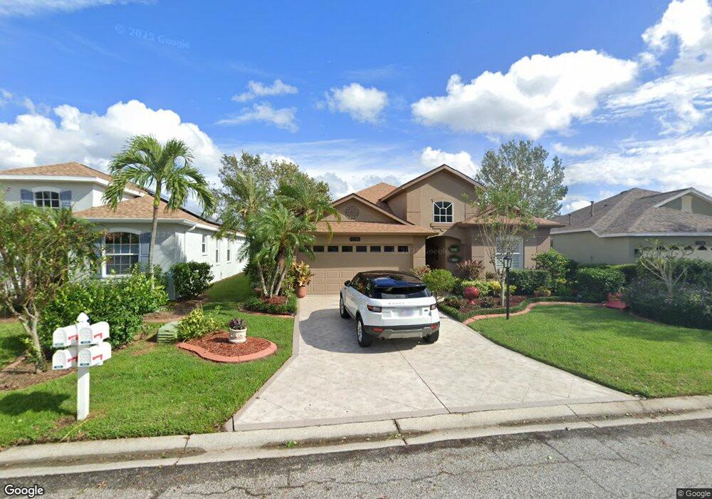
1326 Millbrook Cir Bradenton, FL 34212
Estimated Value: $386,000 - $440,000
2
Beds
2
Baths
1,782
Sq Ft
$230/Sq Ft
Est. Value
About This Home
This home is located at 1326 Millbrook Cir, Bradenton, FL 34212 and is currently estimated at $409,786, approximately $229 per square foot. 1326 Millbrook Cir is a home located in Manatee County with nearby schools including Freedom Elementary School, Carlos E. Haile Middle School, and Parrish Community High School.
Ownership History
Date
Name
Owned For
Owner Type
Purchase Details
Closed on
Mar 26, 2002
Sold by
B W Gen Contractors Inc
Bought by
Reynolds Gary Michael and Reynolds Barbara Ann
Current Estimated Value
Home Financials for this Owner
Home Financials are based on the most recent Mortgage that was taken out on this home.
Original Mortgage
$125,000
Outstanding Balance
$51,966
Interest Rate
6.85%
Mortgage Type
Purchase Money Mortgage
Estimated Equity
$357,820
Create a Home Valuation Report for This Property
The Home Valuation Report is an in-depth analysis detailing your home's value as well as a comparison with similar homes in the area
Home Values in the Area
Average Home Value in this Area
Purchase History
| Date | Buyer | Sale Price | Title Company |
|---|---|---|---|
| Reynolds Gary Michael | $207,000 | -- |
Source: Public Records
Mortgage History
| Date | Status | Borrower | Loan Amount |
|---|---|---|---|
| Open | Reynolds Gary Michael | $125,000 |
Source: Public Records
Tax History Compared to Growth
Tax History
| Year | Tax Paid | Tax Assessment Tax Assessment Total Assessment is a certain percentage of the fair market value that is determined by local assessors to be the total taxable value of land and additions on the property. | Land | Improvement |
|---|---|---|---|---|
| 2025 | $2,013 | $175,154 | -- | -- |
| 2024 | $2,013 | $170,218 | -- | -- |
| 2023 | $2,013 | $165,260 | $0 | $0 |
| 2022 | $1,950 | $160,447 | $0 | $0 |
| 2021 | $1,872 | $155,774 | $0 | $0 |
| 2020 | $1,932 | $153,623 | $0 | $0 |
| 2019 | $1,867 | $147,950 | $0 | $0 |
| 2018 | $1,849 | $145,191 | $0 | $0 |
| 2017 | $1,716 | $142,205 | $0 | $0 |
| 2016 | $1,711 | $139,280 | $0 | $0 |
| 2015 | $1,732 | $138,312 | $0 | $0 |
| 2014 | $1,732 | $137,214 | $0 | $0 |
| 2013 | $1,724 | $135,186 | $0 | $0 |
Source: Public Records
Map
Nearby Homes
- 1322 Millbrook Cir
- 1135 Millbrook Cir
- 1261 Millbrook Cir
- 1245 Millbrook Cir
- 774 Planters Manor Way
- 730 Old Quarry Rd
- 834 Springwood Cir
- 817 Tallgrass Ln
- 731 Planters Manor Way
- 522 Planters Manor Way
- 531 Hunter Ln
- 8827 Stone Harbour Loop
- 10523 Old Grove Cir
- 10550 Old Grove Cir
- 8772 Stone Harbour Loop
- 8746 Stone Harbour Loop
- 10571 Old Grove Cir
- 11407 Planetree Place
- 1606 Boxleaf Ln
- 1011 Fairwaycove Ln Unit 201
- 1330 Millbrook Cir
- 1318 Millbrook Cir
- 1334 Millbrook Cir
- 1323 Millbrook Cir
- 1314 Millbrook Cir
- 1327 Millbrook Cir
- 1319 Millbrook Cir
- 1338 Millbrook Cir
- 1315 Millbrook Cir
- 1310 Millbrook Cir
- 1342 Millbrook Cir
- 1311 Millbrook Cir
- 1169 Cane Mill Ln
- 1173 Cane Mill Ln
- 1306 Millbrook Cir
- 1346 Millbrook Cir
- 1165 Cane Mill Ln
- 1307 Millbrook Cir
- 1350 Millbrook Cir
- 1161 Cane Mill Ln