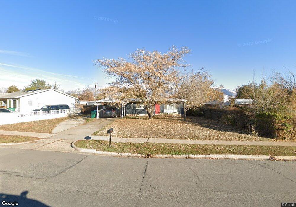
1326 Reid Dr Layton, UT 84041
Estimated Value: $335,000 - $396,000
3
Beds
1
Bath
1,037
Sq Ft
$350/Sq Ft
Est. Value
About This Home
This home is located at 1326 Reid Dr, Layton, UT 84041 and is currently estimated at $362,881, approximately $349 per square foot. 1326 Reid Dr is a home located in Davis County with nearby schools including Vae View Elementary School, Central Davis Junior High School, and Layton High School.
Ownership History
Date
Name
Owned For
Owner Type
Purchase Details
Closed on
Aug 2, 2024
Sold by
Paver Emily Ann and Paver Emily Anne
Bought by
Merrill Emily and Merrill Nicolas
Current Estimated Value
Purchase Details
Closed on
Feb 1, 2022
Sold by
Whicker Richard P
Bought by
Paver Don Pardee and Paver Emily Ann
Home Financials for this Owner
Home Financials are based on the most recent Mortgage that was taken out on this home.
Original Mortgage
$245,471
Interest Rate
3.45%
Mortgage Type
FHA
Purchase Details
Closed on
Jan 17, 2011
Sold by
Stephens Ophella M
Bought by
Whicker Richard P and Whicker Jessica E
Home Financials for this Owner
Home Financials are based on the most recent Mortgage that was taken out on this home.
Original Mortgage
$110,117
Interest Rate
3.96%
Mortgage Type
VA
Purchase Details
Closed on
Nov 19, 1997
Sold by
Horton J C
Bought by
Stephens Jerry H and Stephens Ophelia M
Create a Home Valuation Report for This Property
The Home Valuation Report is an in-depth analysis detailing your home's value as well as a comparison with similar homes in the area
Home Values in the Area
Average Home Value in this Area
Purchase History
| Date | Buyer | Sale Price | Title Company |
|---|---|---|---|
| Merrill Emily | -- | None Listed On Document | |
| Paver Don Pardee | -- | Integrated Title | |
| Whicker Richard P | -- | Mountain View Title | |
| Stephens Jerry H | -- | Avis & Archibald Title Insur |
Source: Public Records
Mortgage History
| Date | Status | Borrower | Loan Amount |
|---|---|---|---|
| Previous Owner | Paver Don Pardee | $245,471 | |
| Previous Owner | Whicker Richard P | $110,117 |
Source: Public Records
Tax History Compared to Growth
Tax History
| Year | Tax Paid | Tax Assessment Tax Assessment Total Assessment is a certain percentage of the fair market value that is determined by local assessors to be the total taxable value of land and additions on the property. | Land | Improvement |
|---|---|---|---|---|
| 2025 | $1,635 | $171,600 | $99,118 | $72,482 |
| 2024 | $1,581 | $167,200 | $118,446 | $48,754 |
| 2023 | $1,540 | $287,000 | $157,429 | $129,571 |
| 2022 | $1,647 | $303,000 | $132,856 | $170,144 |
| 2021 | $1,398 | $211,000 | $102,895 | $108,105 |
| 2020 | $1,243 | $180,000 | $75,207 | $104,793 |
| 2019 | $1,234 | $175,000 | $72,317 | $102,683 |
| 2018 | $1,067 | $152,000 | $66,960 | $85,040 |
| 2016 | $872 | $64,075 | $19,495 | $44,580 |
| 2015 | $825 | $57,530 | $19,495 | $38,035 |
| 2014 | $873 | $62,278 | $19,495 | $42,783 |
| 2013 | -- | $61,156 | $19,646 | $41,510 |
Source: Public Records
Map
Nearby Homes
- 1493 Marilyn Dr
- 1133 Laytona Dr
- 1523 Sherma Ave
- 1456 Scott Cir
- 1254 Marilyn Dr
- 1591 N Marilyn Dr
- Fremont Plan at Trailside
- Blakely Plan at Trailside
- Arlington Plan at Trailside
- Savannah Plan at Trailside
- Charlotte Plan at Trailside
- Birmingham Plan at Trailside
- Oakridge Plan at Trailside
- Middleton Plan at Trailside
- Wilmington Plan at Trailside
- 1211 N 1875 W Unit 211
- 1211 N 1875 W
- 1219 N 1875 W
- 1219 N 1875 W Unit 212
- 1259 W 1050 N