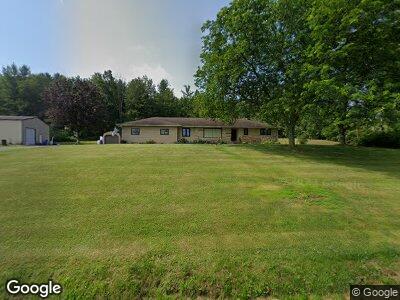
1326 Southside Rd Canton, PA 17724
Estimated Value: $241,011 - $311,000
3
Beds
5
Baths
--
Sq Ft
3.2
Acres
About This Home
This home is located at 1326 Southside Rd, Canton, PA 17724 and is currently estimated at $263,253. 1326 Southside Rd is a home located in Bradford County with nearby schools including Canton Area Elementary School and Canton Junior/Senior High School.
Ownership History
Date
Name
Owned For
Owner Type
Purchase Details
Closed on
Nov 30, 2018
Sold by
Bowman John D and Bowman Stephenie M
Bought by
Bowman John D
Current Estimated Value
Purchase Details
Closed on
Sep 8, 2007
Sold by
Reinhard Timothy E and Reinhard Ellen K
Bought by
Bowman John D and Bowman Stephenie M
Home Financials for this Owner
Home Financials are based on the most recent Mortgage that was taken out on this home.
Original Mortgage
$144,000
Interest Rate
6.63%
Mortgage Type
New Conventional
Create a Home Valuation Report for This Property
The Home Valuation Report is an in-depth analysis detailing your home's value as well as a comparison with similar homes in the area
Home Values in the Area
Average Home Value in this Area
Purchase History
| Date | Buyer | Sale Price | Title Company |
|---|---|---|---|
| Bowman John D | -- | None Available | |
| Bowman John D | $180,000 | None Available |
Source: Public Records
Mortgage History
| Date | Status | Borrower | Loan Amount |
|---|---|---|---|
| Open | Bowman John D | $120,025 | |
| Closed | Bowman John D | $144,000 |
Source: Public Records
Tax History Compared to Growth
Tax History
| Year | Tax Paid | Tax Assessment Tax Assessment Total Assessment is a certain percentage of the fair market value that is determined by local assessors to be the total taxable value of land and additions on the property. | Land | Improvement |
|---|---|---|---|---|
| 2025 | $2,660 | $47,950 | $0 | $0 |
| 2024 | $2,556 | $47,950 | $0 | $0 |
| 2023 | $2,556 | $47,950 | $0 | $0 |
| 2022 | $2,528 | $47,950 | $0 | $0 |
| 2021 | $2,529 | $47,950 | $0 | $0 |
| 2020 | $2,501 | $47,950 | $0 | $0 |
| 2019 | $2,498 | $47,950 | $0 | $0 |
| 2018 | $2,391 | $47,950 | $0 | $0 |
| 2017 | $2,358 | $47,950 | $0 | $0 |
| 2016 | -- | $46,500 | $0 | $0 |
| 2015 | -- | $46,500 | $0 | $0 |
| 2014 | $1,262 | $46,500 | $0 | $0 |
Source: Public Records
Map
Nearby Homes
- 312 E Union St
- 83 1st St
- 89 E Tioga St
- 94 N Center St
- 28-30 Tioga St
- 563 Sunset Rd
- 127 Troy St
- 50 Lycoming St
- 261 W South Ave
- 3639 Minnequa Main Rd
- 1166 Lower Mountain Rd
- 80 W Leroy Crossroads
- 76 Highlands Ln
- 181 Cold Spring Ln
- 12240 Pennsylvania 154
- 12240 Route 154
- 12066 Route 154
- 12052 Pennsylvania 154
- 94 Schrader Creek Rd
- 2004 Fall Brook Rd
- 1326 Southside Rd
- 1436 Southside Rd
- 0 Rr 3 Rt 154 Lot #2
- 1454 Southside Rd
- 1552 Southside Rd
- 74 Pratts Mill Rd
- 11 Pratts Mill Rd
- 118 Pratts Mill Rd
- 23 Mays Ln
- 107 Pratts Mill Rd
- 1136 Pratts Mill Rd
- 155 Pratts Mill Rd
- 187 Pratts Mill Rd
- 320 Pratts Mill Rd Unit 340
- 302 Pratts Mill Rd
- 3748 Route 414
- 221 Pratts Mill Rd
- 3737 Route 414
- 824 Southside Rd
- 807 Southside Rd