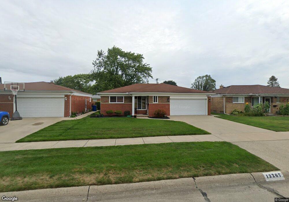
13267 Champaign Ave Warren, MI 48089
Southeast Warren NeighborhoodEstimated Value: $223,000 - $236,000
3
Beds
1
Bath
1,184
Sq Ft
$195/Sq Ft
Est. Value
About This Home
This home is located at 13267 Champaign Ave, Warren, MI 48089 and is currently estimated at $230,667, approximately $194 per square foot. 13267 Champaign Ave is a home located in Macomb County with nearby schools including Warren Woods Tower High School and Frontier International Academy Elementary.
Ownership History
Date
Name
Owned For
Owner Type
Purchase Details
Closed on
Feb 3, 2025
Sold by
Dinoto Vincent J and Dinoto Kathleen R
Bought by
Dinoto Vincent J and Dinoto Kathleen R
Current Estimated Value
Home Financials for this Owner
Home Financials are based on the most recent Mortgage that was taken out on this home.
Original Mortgage
$366,000
Outstanding Balance
$345,841
Interest Rate
6.87%
Estimated Equity
-$115,174
Create a Home Valuation Report for This Property
The Home Valuation Report is an in-depth analysis detailing your home's value as well as a comparison with similar homes in the area
Home Values in the Area
Average Home Value in this Area
Purchase History
| Date | Buyer | Sale Price | Title Company |
|---|---|---|---|
| Dinoto Vincent J | -- | None Listed On Document |
Source: Public Records
Mortgage History
| Date | Status | Borrower | Loan Amount |
|---|---|---|---|
| Open | Dinoto Vincent J | $366,000 | |
| Previous Owner | Dinoto Vincent J | $366,000 |
Source: Public Records
Tax History Compared to Growth
Tax History
| Year | Tax Paid | Tax Assessment Tax Assessment Total Assessment is a certain percentage of the fair market value that is determined by local assessors to be the total taxable value of land and additions on the property. | Land | Improvement |
|---|---|---|---|---|
| 2025 | $2,570 | $102,820 | $0 | $0 |
| 2024 | $2,497 | $90,970 | $0 | $0 |
| 2023 | $2,359 | $82,580 | $0 | $0 |
| 2022 | $2,313 | $74,170 | $0 | $0 |
| 2021 | $2,270 | $70,880 | $0 | $0 |
| 2020 | $2,175 | $66,510 | $0 | $0 |
| 2019 | $2,078 | $62,170 | $0 | $0 |
| 2018 | $62 | $47,620 | $0 | $0 |
| 2017 | $1,985 | $44,830 | $5,800 | $39,030 |
| 2016 | $1,970 | $44,830 | $0 | $0 |
| 2015 | -- | $41,260 | $0 | $0 |
| 2013 | $1,903 | $37,250 | $0 | $0 |
Source: Public Records
Map
Nearby Homes
- 13194 Burgundy Ave
- 13144 Stamford Ave
- 26640 Schoenherr Rd
- 13696 Harthill Ave
- 13734 Herbert Ave
- 13203 Frazho Rd
- 0000 Frazho Rd
- 26515 Newport Ave
- 13653 Brainbridge Ave
- 13429 Zagaiski Ave
- 27052 Sutherland Dr
- 27226 Bradner Dr
- 12922 Heritage S Unit 54
- 13342 De Mott Dr
- 12291 E 11 Mile Rd
- 26443 Marilyn Ave
- 25653 Palomino Ave
- 13510 Angela Dr
- 26552 Wagner Ave
- 13858 Arnold Dr
- 13257 Champaign Ave
- 13305 Champaign Ave
- 13245 Champaign Ave
- 13317 Champaign Ave
- 13260 Stamford Ave
- 13389 Bloomfield Ave
- 13235 Champaign Ave
- 13327 Champaign Ave
- 13248 Stamford Ave
- 13264 Champaign Ave
- 13236 Stamford Ave
- 13250 Champaign Ave
- 13314 Champaign Ave
- 13223 Champaign Ave
- 13339 Champaign Ave
- 13238 Champaign Ave
- 13377 Bloomfield Ave
- 13326 Champaign Ave
- 13224 Stamford Ave
- 26491 Schoenherr Rd