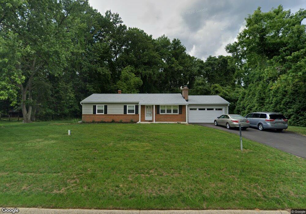
1327 Ashburton Dr Millersville, MD 21108
Estimated Value: $416,752 - $524,000
--
Bed
2
Baths
1,196
Sq Ft
$398/Sq Ft
Est. Value
About This Home
This home is located at 1327 Ashburton Dr, Millersville, MD 21108 and is currently estimated at $475,438, approximately $397 per square foot. 1327 Ashburton Dr is a home located in Anne Arundel County with nearby schools including Millersville Elementary School, Old Mill High School, and Odenton Christian Academy.
Ownership History
Date
Name
Owned For
Owner Type
Purchase Details
Closed on
Jan 25, 2022
Sold by
Goss Franklin W
Bought by
Goss Franklin W and Franklin Elva Elaine
Current Estimated Value
Purchase Details
Closed on
May 24, 1983
Bought by
Goss Franklin W
Home Financials for this Owner
Home Financials are based on the most recent Mortgage that was taken out on this home.
Original Mortgage
$56,000
Interest Rate
12.55%
Create a Home Valuation Report for This Property
The Home Valuation Report is an in-depth analysis detailing your home's value as well as a comparison with similar homes in the area
Home Values in the Area
Average Home Value in this Area
Purchase History
| Date | Buyer | Sale Price | Title Company |
|---|---|---|---|
| Goss Franklin W | -- | None Listed On Document | |
| Goss Franklin W | $30,000 | -- |
Source: Public Records
Mortgage History
| Date | Status | Borrower | Loan Amount |
|---|---|---|---|
| Previous Owner | Goss Franklin W | $56,000 |
Source: Public Records
Tax History Compared to Growth
Tax History
| Year | Tax Paid | Tax Assessment Tax Assessment Total Assessment is a certain percentage of the fair market value that is determined by local assessors to be the total taxable value of land and additions on the property. | Land | Improvement |
|---|---|---|---|---|
| 2025 | $3,123 | $406,700 | $267,500 | $139,200 |
| 2024 | $3,123 | $387,100 | $0 | $0 |
| 2023 | $3,024 | $367,500 | $0 | $0 |
| 2022 | $2,820 | $347,900 | $225,500 | $122,400 |
| 2021 | $2,675 | $334,900 | $0 | $0 |
| 2020 | $2,675 | $321,900 | $0 | $0 |
| 2019 | $2,625 | $308,900 | $172,500 | $136,400 |
| 2018 | $3,033 | $299,133 | $0 | $0 |
| 2017 | $2,475 | $289,367 | $0 | $0 |
| 2016 | -- | $279,600 | $0 | $0 |
| 2015 | -- | $279,600 | $0 | $0 |
| 2014 | -- | $279,600 | $0 | $0 |
Source: Public Records
Map
Nearby Homes
- 396 Aurora Dr
- 927 Heatherfield Ln
- 1610 Hog Farm Rd
- 1513 Chase Hill Dr
- 762 Cougar Dr
- 357 Council Oak Dr
- 1525 Winfields Ln
- 771 Generals Hwy
- 1536 Winfields Ln
- 328 Council Oak Dr
- 884 Oakdale Cir
- 397 Charles Hall Dr
- 820 Annapolis Rd
- 213 Burns Crossing Rd
- 630 Cross Chase Dr
- 931 Oakdale Cir
- 503 S Farm Crossing Rd
- 508 Greencrest Ln
- 544 Wet Sand Dr
- 0 Annapolis Rd Unit MDAA2088728
- 1325 Ashburton Dr
- 1329 Ashburton Dr
- 386 Accotink Ct
- 1331 Ashburton Dr
- 1316 Ashburton Dr
- 388 Accotink Ct
- 1308 Antrim Dr
- 1333 Ashburton Dr
- 1322 Ashburton Dr
- 390 Accotink Ct
- 1323 Ashburton Dr
- 1302 Alta Vista Dr
- 1304 Alta Vista Dr
- 387 Accotink Ct
- 1300 Alta Vista Dr
- 1335 Ashburton Dr
- 1298 Alta Vista Dr
- 1321 Ashburton Dr
- 1382 Antrim Dr
- 1296 Alta Vista Dr