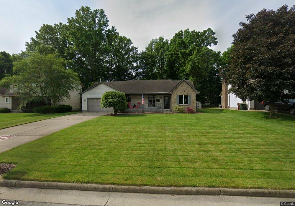
1327 Quail Ct Youngstown, OH 44512
Estimated Value: $265,063 - $320,000
3
Beds
2
Baths
1,564
Sq Ft
$181/Sq Ft
Est. Value
About This Home
This home is located at 1327 Quail Ct, Youngstown, OH 44512 and is currently estimated at $283,516, approximately $181 per square foot. 1327 Quail Ct is a home located in Mahoning County with nearby schools including West Boulevard Elementary School, Boardman Center Middle School, and Boardman High School.
Ownership History
Date
Name
Owned For
Owner Type
Purchase Details
Closed on
May 5, 2003
Sold by
Hayes William T and Hayes Charles A
Bought by
Carbone Janel M
Current Estimated Value
Home Financials for this Owner
Home Financials are based on the most recent Mortgage that was taken out on this home.
Original Mortgage
$153,985
Outstanding Balance
$67,266
Interest Rate
5.86%
Mortgage Type
VA
Estimated Equity
$216,250
Purchase Details
Closed on
May 7, 2001
Sold by
Rose Jeanne B
Bought by
Hayes William T and Hayes Charles A
Purchase Details
Closed on
Apr 23, 1991
Bought by
Rose Gilbert E
Create a Home Valuation Report for This Property
The Home Valuation Report is an in-depth analysis detailing your home's value as well as a comparison with similar homes in the area
Home Values in the Area
Average Home Value in this Area
Purchase History
| Date | Buyer | Sale Price | Title Company |
|---|---|---|---|
| Carbone Janel M | $154,000 | -- | |
| Hayes William T | -- | -- | |
| Rose Gilbert E | $115,500 | -- |
Source: Public Records
Mortgage History
| Date | Status | Borrower | Loan Amount |
|---|---|---|---|
| Open | Carbone Janel M | $153,985 |
Source: Public Records
Tax History Compared to Growth
Tax History
| Year | Tax Paid | Tax Assessment Tax Assessment Total Assessment is a certain percentage of the fair market value that is determined by local assessors to be the total taxable value of land and additions on the property. | Land | Improvement |
|---|---|---|---|---|
| 2024 | $3,930 | $76,930 | $10,850 | $66,080 |
| 2023 | $3,878 | $76,930 | $10,850 | $66,080 |
| 2022 | $4,038 | $61,360 | $10,760 | $50,600 |
| 2021 | $4,040 | $61,360 | $10,760 | $50,600 |
| 2020 | $4,061 | $61,360 | $10,760 | $50,600 |
| 2019 | $3,736 | $49,890 | $8,750 | $41,140 |
| 2018 | $3,236 | $49,630 | $8,750 | $40,880 |
| 2017 | $3,187 | $49,630 | $8,750 | $40,880 |
| 2016 | $3,147 | $48,530 | $9,630 | $38,900 |
| 2015 | $3,085 | $48,530 | $9,630 | $38,900 |
| 2014 | $3,094 | $48,530 | $9,630 | $38,900 |
| 2013 | $3,055 | $48,530 | $9,630 | $38,900 |
Source: Public Records
Map
Nearby Homes
- 6911 Tippecanoe Rd
- 6957 Tippecanoe Rd
- 6808 Twin Oaks Ct Unit 6808
- 6836 Twin Oaks Ct
- 6729 Tippecanoe Rd Unit 6
- 1133 Red Tail Hawk Ct Unit 6
- 1243 Red Tail Hawk Ct Unit 3
- 3710 Mercedes Place
- 1193 Red Tail Hawk Ct Unit 1
- 6879 Kyle Ridge Pointe
- 6857 Kyle Ridge Pointe
- 3649 Indian Run Dr Unit 2
- 7245 Hanbury Close
- 6240 Farmington Cir
- 6925 Colleen Dr
- 6743 Lockwood Blvd
- 6747 Lockwood Blvd
- 0 Pinewood Dr Unit 5140025
- 6723 Lockwood Blvd Unit 4
- 7511 E Parkside Dr
- 1323 Quail Ct
- 1331 Quail Ct
- 7391 E Huntington Dr
- 1322 Quail Ct
- 1314 Fox Run Dr Unit 4B
- 1326 Quail Ct
- 1318 Quail Ct
- 1316 Fox Run Dr Unit 4C
- 1339 Quail Ct
- 1312 Fox Run Dr
- 1312 Fox Run Dr Unit A
- 1318 Fox Run Dr
- 7387 E Huntington Dr
- 7398 E Huntington Dr
- 7398 E Huntington Dr Unit 7398B
- 7398 E Huntington Dr
- 7398 E Huntington Dr
- 7398 E Huntington Dr Unit C
- 7398 E Huntington Dr Unit A
- 7398 E Huntington Dr Unit B