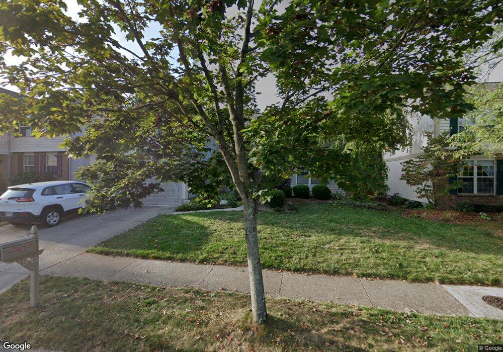
1327 Sandstone Loop S Westerville, OH 43081
Estimated Value: $398,484 - $443,000
3
Beds
3
Baths
1,815
Sq Ft
$231/Sq Ft
Est. Value
About This Home
This home is located at 1327 Sandstone Loop S, Westerville, OH 43081 and is currently estimated at $419,871, approximately $231 per square foot. 1327 Sandstone Loop S is a home located in Franklin County with nearby schools including Mcvay Elementary School, Walnut Springs Middle School, and Westerville-North High School.
Ownership History
Date
Name
Owned For
Owner Type
Purchase Details
Closed on
Jun 30, 2008
Sold by
Brainerd Arthur E and Brainerd Delynn
Bought by
Mislan Todd and Mislan Ellen M
Current Estimated Value
Home Financials for this Owner
Home Financials are based on the most recent Mortgage that was taken out on this home.
Original Mortgage
$176,900
Outstanding Balance
$111,501
Interest Rate
5.96%
Mortgage Type
Purchase Money Mortgage
Estimated Equity
$308,370
Purchase Details
Closed on
Aug 25, 2005
Sold by
Loehr Timothy R and Loehr Karen K
Bought by
Brainerd Arthur E
Home Financials for this Owner
Home Financials are based on the most recent Mortgage that was taken out on this home.
Original Mortgage
$170,000
Interest Rate
5.89%
Mortgage Type
Purchase Money Mortgage
Purchase Details
Closed on
Mar 17, 1994
Bought by
Loehr Timothy R and Loehr Karen K
Purchase Details
Closed on
Jun 16, 1993
Purchase Details
Closed on
Mar 4, 1993
Create a Home Valuation Report for This Property
The Home Valuation Report is an in-depth analysis detailing your home's value as well as a comparison with similar homes in the area
Home Values in the Area
Average Home Value in this Area
Purchase History
| Date | Buyer | Sale Price | Title Company |
|---|---|---|---|
| Mislan Todd | $206,900 | Talon | |
| Brainerd Arthur E | $218,000 | -- | |
| Loehr Timothy R | $157,000 | -- | |
| -- | $192,500 | -- | |
| -- | -- | -- |
Source: Public Records
Mortgage History
| Date | Status | Borrower | Loan Amount |
|---|---|---|---|
| Open | Mislan Todd | $176,900 | |
| Closed | Brainerd Arthur E | $170,000 |
Source: Public Records
Tax History
| Year | Tax Paid | Tax Assessment Tax Assessment Total Assessment is a certain percentage of the fair market value that is determined by local assessors to be the total taxable value of land and additions on the property. | Land | Improvement |
|---|---|---|---|---|
| 2025 | $6,719 | $118,230 | $28,000 | $90,230 |
| 2024 | $6,719 | $118,230 | $28,000 | $90,230 |
| 2023 | $6,577 | $118,230 | $28,000 | $90,230 |
| 2022 | $6,075 | $83,380 | $15,580 | $67,800 |
| 2021 | $6,126 | $83,380 | $15,580 | $67,800 |
| 2020 | $6,108 | $83,380 | $15,580 | $67,800 |
| 2019 | $5,305 | $68,360 | $12,990 | $55,370 |
| 2018 | $5,282 | $68,360 | $12,990 | $55,370 |
| 2017 | $5,377 | $68,360 | $12,990 | $55,370 |
| 2016 | $5,538 | $66,050 | $17,610 | $48,440 |
| 2015 | $5,363 | $66,050 | $17,610 | $48,440 |
| 2014 | $5,367 | $66,050 | $17,610 | $48,440 |
| 2013 | $2,680 | $66,045 | $17,605 | $48,440 |
Source: Public Records
Map
Nearby Homes
- 1151 Scarlet Ct
- 1114 Forest View Ct
- 613 Deer Run Rd
- 961 E College Ave
- 180 Oakwood Ct
- 655 Mohican Way
- 45 Kanpur Place
- 636 E Schrock Rd
- 612 E Schrock Rd
- 960 Lakeland Dr
- 138 Wood St
- 487 Beachside Dr
- 629 Andrew Ave
- 6553 Bowery Peak Ln
- 456 Saint Thomas Dr
- 4650 Cautela Dr
- 291 Mohawk Ave
- 703 Pointview Dr
- 974 Timberbank Dr
- 322 Huber Village Blvd
- 1331 Sandstone Loop S
- 1323 Sandstone Loop S
- 1335 Sandstone Loop S
- 1321 Sandstone Loop S
- 1324 Sandstone Loop S
- 1328 Sandstone Loop S
- 1320 Sandstone Loop S
- 1332 Sandstone Loop S
- 1339 Sandstone Loop S
- 1368 Sugarberry Ct
- 1372 Sugarberry Ct
- 161 Sandstone Loop W
- 1336 Sandstone Loop S
- 1362 Sugarberry Ct
- 157 Sandstone Loop W
- 1343 Sandstone Loop S
- 1329 Cobblestone Ave
- 1380 Sugarberry Ct
- 1331 Cobblestone Ave
- 1327 Cobblestone Ave
Your Personal Tour Guide
Ask me questions while you tour the home.