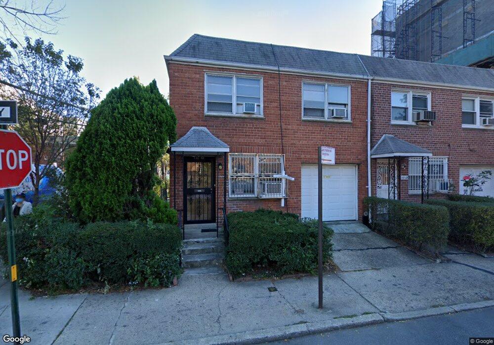
13270 Pople Ave Flushing, NY 11355
Flushing-Willets Point NeighborhoodEstimated Value: $1,292,000 - $1,557,000
Studio
--
Bath
1,456
Sq Ft
$958/Sq Ft
Est. Value
About This Home
This home is located at 13270 Pople Ave, Flushing, NY 11355 and is currently estimated at $1,395,543, approximately $958 per square foot. 13270 Pople Ave is a home located in Queens County with nearby schools including P.S. 120 - Queens, Rachel Carson I.S. 237Q, and John Bowne High School.
Ownership History
Date
Name
Owned For
Owner Type
Purchase Details
Closed on
Aug 4, 2022
Sold by
Louie Kam H
Bought by
Yu Sha Sha
Current Estimated Value
Purchase Details
Closed on
May 2, 2003
Sold by
Louie Lawrence W and Louie Tuey G
Bought by
Louie Kam H and Louie Lawrence W
Purchase Details
Closed on
Feb 2, 2000
Sold by
Louie Tuey Gim
Bought by
Louie Tuey Gim and Louie Lawrence
Create a Home Valuation Report for This Property
The Home Valuation Report is an in-depth analysis detailing your home's value as well as a comparison with similar homes in the area
Home Values in the Area
Average Home Value in this Area
Purchase History
| Date | Buyer | Sale Price | Title Company |
|---|---|---|---|
| Yu Sha Sha | $1,500,000 | -- | |
| Yu Sha Sha | $1,500,000 | -- | |
| Yu Sha Sha | $1,500,000 | -- | |
| Louie Kam H | -- | -- | |
| Louie Kam H | -- | -- | |
| Louie Tuey Gim | $100,000 | First American Title Ins Co | |
| Louie Tuey Gim | -- | First American Title Ins Co |
Source: Public Records
Tax History
| Year | Tax Paid | Tax Assessment Tax Assessment Total Assessment is a certain percentage of the fair market value that is determined by local assessors to be the total taxable value of land and additions on the property. | Land | Improvement |
|---|---|---|---|---|
| 2025 | $7,946 | $41,934 | $10,593 | $31,341 |
| 2024 | $7,946 | $39,564 | $10,566 | $28,998 |
| 2023 | $7,497 | $37,325 | $9,958 | $27,367 |
| 2022 | $2,917 | $65,700 | $16,680 | $49,020 |
| 2021 | $6,882 | $60,660 | $16,680 | $43,980 |
| 2020 | $6,738 | $54,300 | $16,680 | $37,620 |
| 2019 | $2,790 | $59,820 | $16,680 | $43,140 |
| 2018 | $2,511 | $31,104 | $8,570 | $22,534 |
| 2017 | $5,441 | $29,859 | $8,202 | $21,657 |
| 2016 | $5,348 | $29,859 | $8,202 | $21,657 |
| 2015 | $3,397 | $29,121 | $7,757 | $21,364 |
| 2014 | $3,397 | $27,475 | $8,780 | $18,695 |
Source: Public Records
Map
Nearby Homes
- 134-11 Franklin Ave Unit 3F
- 134-11 Franklin Ave Unit 6E
- 134-11 Franklin Ave Unit 7C
- 134-11 Franklin Ave Unit 6F
- 134-11 Franklin Ave Unit 6B
- 134-11 Franklin Ave Unit 7A
- 134-11 Franklin Ave Unit 4A
- 134-11 Franklin Ave Unit 4F
- 134-11 Franklin Ave Unit 7D
- 134-11 Franklin Ave Unit 3A
- 134-11 Franklin Ave Unit 9A
- 134-11 Franklin Ave Unit 6A
- 134-11 Franklin Ave Unit 4D
- 134-11 Franklin Ave Unit 9B
- 134-11 Franklin Ave Unit 3E
- 134-11 Franklin Ave Unit 9D
- 134-11 Franklin Ave Unit 5C
- 134-11 Franklin Ave Unit 5F
- 134-11 Franklin Ave Unit 5E
- 134-11 Franklin Ave Unit 9C
- 132-70 Pople Ave
- 13268 Pople Ave
- 13266 Pople Ave
- 132-64 Pople Ave
- 13264 Pople Ave
- 13262 Pople Ave
- 13262 Pople Ave
- 42-17 Saull St
- 42-29 Saull St Unit 1Fl
- 42-29 Saull St
- 4229 Saull St
- 4227 Saull St
- 4231 Saull St
- 4225 Saull St
- 4233 Saull St
- 13271 Pople Ave
- 13269 Pople Ave
- 4234 Saull St
- 13267 Pople Ave
- 13271 Avery Ave
Your Personal Tour Guide
Ask me questions while you tour the home.