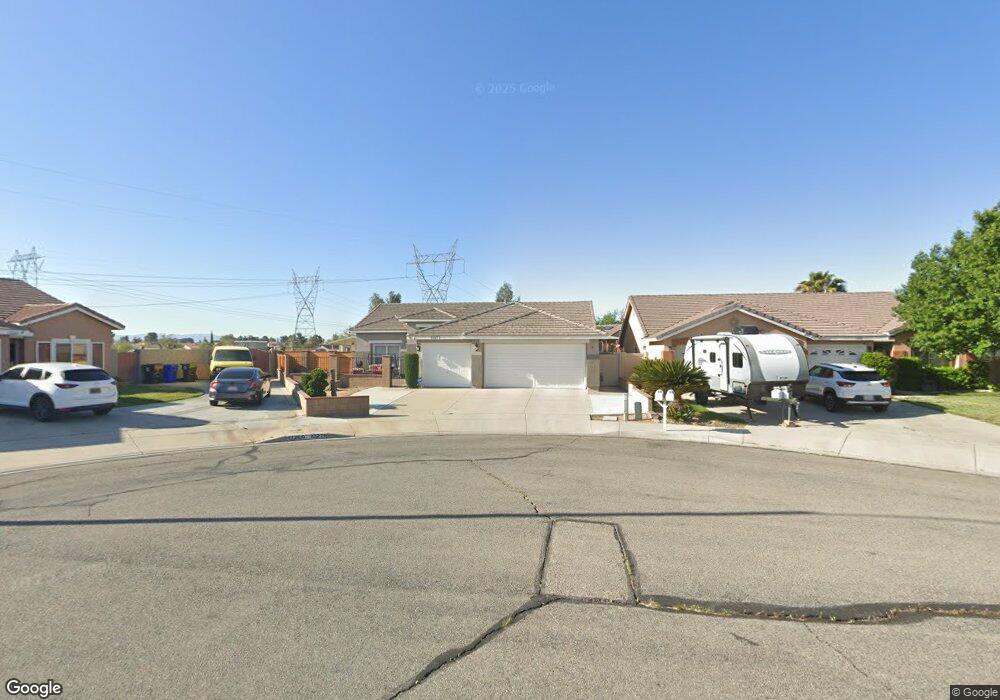
13271 Davidson Cir Victorville, CA 92392
Mesa Linda NeighborhoodEstimated Value: $450,409 - $472,000
4
Beds
2
Baths
2,028
Sq Ft
$225/Sq Ft
Est. Value
About This Home
This home is located at 13271 Davidson Cir, Victorville, CA 92392 and is currently estimated at $457,102, approximately $225 per square foot. 13271 Davidson Cir is a home located in San Bernardino County with nearby schools including Morgan Kincaid Preparatory School and Silverado High School.
Ownership History
Date
Name
Owned For
Owner Type
Purchase Details
Closed on
Oct 13, 2023
Sold by
Huete Bridgette and Huete Jacqueline H
Bought by
Huete Family 2023 Trust and Huete
Current Estimated Value
Purchase Details
Closed on
Aug 2, 1995
Sold by
Kaufman & Broad Of Southern Ca Inc
Bought by
Huete Bridgette and Hernandez Jacqueline H
Home Financials for this Owner
Home Financials are based on the most recent Mortgage that was taken out on this home.
Original Mortgage
$126,381
Interest Rate
7.97%
Mortgage Type
FHA
Create a Home Valuation Report for This Property
The Home Valuation Report is an in-depth analysis detailing your home's value as well as a comparison with similar homes in the area
Home Values in the Area
Average Home Value in this Area
Purchase History
| Date | Buyer | Sale Price | Title Company |
|---|---|---|---|
| Huete Family 2023 Trust | -- | None Listed On Document | |
| Huete Bridgette | $128,000 | First American Title Ins Co |
Source: Public Records
Mortgage History
| Date | Status | Borrower | Loan Amount |
|---|---|---|---|
| Previous Owner | Huete Bridgette | $126,381 |
Source: Public Records
Tax History Compared to Growth
Tax History
| Year | Tax Paid | Tax Assessment Tax Assessment Total Assessment is a certain percentage of the fair market value that is determined by local assessors to be the total taxable value of land and additions on the property. | Land | Improvement |
|---|---|---|---|---|
| 2025 | $2,126 | $193,207 | $31,934 | $161,273 |
| 2024 | $2,126 | $189,419 | $31,308 | $158,111 |
| 2023 | $2,102 | $185,705 | $30,694 | $155,011 |
| 2022 | $2,060 | $182,064 | $30,092 | $151,972 |
| 2021 | $2,175 | $178,494 | $29,502 | $148,992 |
| 2020 | $2,134 | $176,663 | $29,199 | $147,464 |
| 2019 | $2,118 | $173,199 | $28,626 | $144,573 |
| 2018 | $2,139 | $169,803 | $28,065 | $141,738 |
| 2017 | $2,076 | $166,474 | $27,515 | $138,959 |
| 2016 | $2,036 | $163,209 | $26,975 | $136,234 |
| 2015 | $1,963 | $160,758 | $26,570 | $134,188 |
| 2014 | $1,942 | $157,609 | $26,050 | $131,559 |
Source: Public Records
Map
Nearby Homes
- 13169 La Salle Cir
- 12873 Cobalt Rd
- 12841 Cobalt Rd
- 13290 Via Robles Cir
- 13320 Anza Ct
- 12910 Oasis Rd
- 13446 Dover Ln
- 1001 Del Cerro St
- 0 Luna Rd Unit 530105
- 13366 Viejo Cir
- 13570 Carrera Place
- 0 Cobalt Rd Unit HD25073625
- 13198 Blue Mesa Ct
- 13073 Snowview Rd
- 13489 Buggy Whip Ct
- 13186 Blue Mesa Ct
- 13546 Vox Ln
- 0 Topaz Rd Unit CV24008905
- 13497 Del Cerro St
- 13525 Evanston St
- 13261 Davidson Cir
- 13269 Davidson Cir
- 13241 Fordham Cir
- 13255 Davidson Cir
- 13245 Fordham Cir
- 13233 Fordham Cir
- 13241 Davidson Cir
- 13270 Davidson Cir
- 13272 Davidson Cir
- 13225 Fordham Cir
- 13249 Fordham Cir
- 13231 Davidson Cir
- 13266 Davidson Cir
- 13258 Davidson Cir
- 13215 Fordham Cir
- 13246 Davidson Cir
- 13225 Davidson Cir
- 13238 Davidson Cir
- 13246 Fordham Cir
- 13207 Fordham Cir