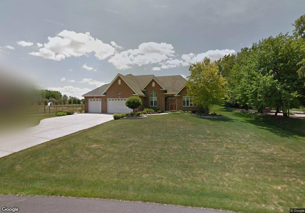
13272 Briar Patch Ln Lemont, IL 60439
Southeast Lemont NeighborhoodEstimated Value: $703,446 - $805,000
3
Beds
3
Baths
2,908
Sq Ft
$261/Sq Ft
Est. Value
About This Home
This home is located at 13272 Briar Patch Ln, Lemont, IL 60439 and is currently estimated at $758,612, approximately $260 per square foot. 13272 Briar Patch Ln is a home located in Cook County with nearby schools including Oakwood School, River Valley School, and Old Quarry Middle School.
Ownership History
Date
Name
Owned For
Owner Type
Purchase Details
Closed on
Sep 21, 2011
Sold by
Markiewicz Gregg A and Markiewicz Sharon M
Bought by
Markiewicz Gregg A and Markiewicz Sharon M
Current Estimated Value
Purchase Details
Closed on
Sep 16, 2004
Sold by
Suburbank Bank & Trust Co
Bought by
Markiewicz Gregg A and Markiewicz Sharon M
Home Financials for this Owner
Home Financials are based on the most recent Mortgage that was taken out on this home.
Original Mortgage
$330,000
Outstanding Balance
$160,559
Interest Rate
5.93%
Mortgage Type
Unknown
Estimated Equity
$598,053
Create a Home Valuation Report for This Property
The Home Valuation Report is an in-depth analysis detailing your home's value as well as a comparison with similar homes in the area
Home Values in the Area
Average Home Value in this Area
Purchase History
| Date | Buyer | Sale Price | Title Company |
|---|---|---|---|
| Markiewicz Gregg A | -- | None Available | |
| Markiewicz Gregg A | $605,000 | Atgf Inc |
Source: Public Records
Mortgage History
| Date | Status | Borrower | Loan Amount |
|---|---|---|---|
| Open | Markiewicz Gregg A | $330,000 |
Source: Public Records
Tax History
| Year | Tax Paid | Tax Assessment Tax Assessment Total Assessment is a certain percentage of the fair market value that is determined by local assessors to be the total taxable value of land and additions on the property. | Land | Improvement |
|---|---|---|---|---|
| 2025 | $10,281 | $59,000 | $20,584 | $38,416 |
| 2024 | $10,281 | $59,000 | $20,584 | $38,416 |
| 2023 | $10,142 | $59,000 | $20,584 | $38,416 |
| 2022 | $10,142 | $51,179 | $7,917 | $43,262 |
| 2021 | $9,888 | $51,179 | $7,917 | $43,262 |
| 2020 | $10,120 | $51,179 | $7,917 | $43,262 |
| 2019 | $10,468 | $54,716 | $7,917 | $46,799 |
| 2018 | $10,886 | $54,716 | $7,917 | $46,799 |
| 2017 | $10,754 | $54,716 | $7,917 | $46,799 |
| 2016 | $9,961 | $47,793 | $6,333 | $41,460 |
| 2015 | $10,108 | $47,793 | $6,333 | $41,460 |
| 2014 | $10,238 | $47,793 | $6,333 | $41,460 |
| 2013 | $9,311 | $46,389 | $5,541 | $40,848 |
Source: Public Records
Map
Nearby Homes
- 13335 Silver Fox Dr
- 13335 W Choctaw Trail
- 13617 S Kickapoo Trail
- 13725 Kit Ln
- 13124 W Beaver Lake Dr
- 14845 131st St
- 13735 W Meath Dr
- 12585 Eileen St
- 12750 Corbett Ct
- 12674 Waterford Dr
- 12758 Corbett Ct
- 12766 Corbett Ct
- 12554 Eileen St
- 12538 Eileen St
- 13255 W Long Run Ct
- 12620 Derry Dr Unit 33901
- 13952 S Oak Ridge Dr
- 12624 Derry Dr
- 13940 S Teakwood Dr
- 12619 Derry Dr Unit 30401
- 13262 Briar Patch Ln
- 13252 Briar Patch Ln
- 13325 Silver Fox Dr
- 13305 Silver Fox Dr
- 13225 Silver Fox Dr
- 13277 Briar Patch Ln
- 13242 Briar Patch Ln
- 13267 Briar Patch Ln
- 13257 Briar Patch Ln
- 13205 Silver Fox Dr
- 13308 E Red Coat Dr
- 13232 Briar Patch Ln
- 13247 Briar Patch Ln
- 13345 Silver Fox Dr
- 13316 N Red Coat Dr
- 13318 E Red Coat Dr
- 13315 N Red Coat Dr
- 13120 Moorefield Ct
- 13145 Silver Fox Dr
- 13330 Silver Fox Dr
Your Personal Tour Guide
Ask me questions while you tour the home.