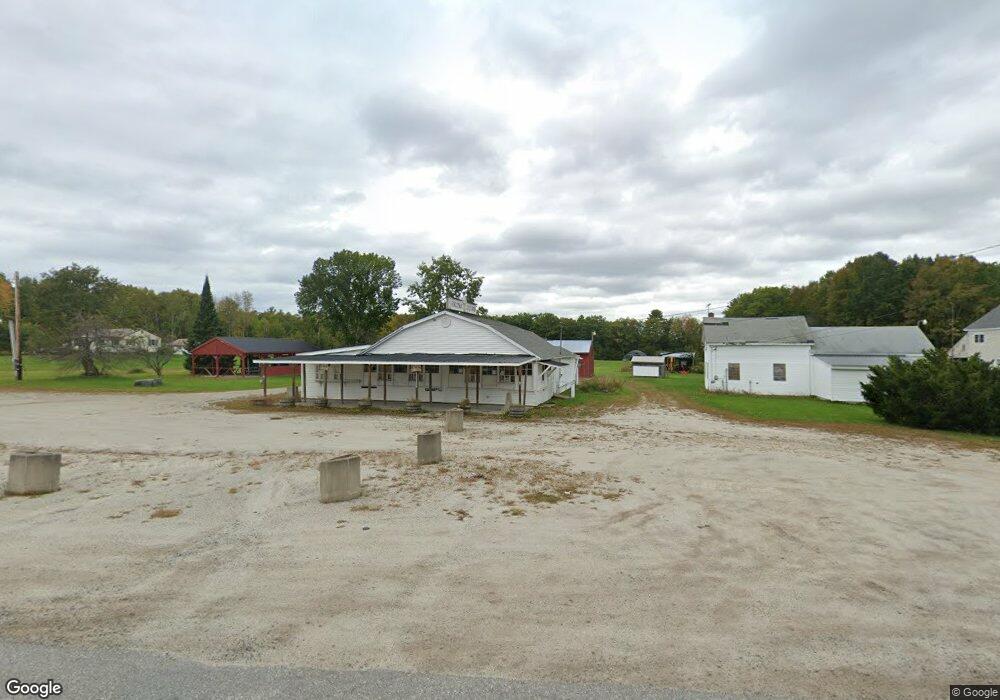
1328 Lewiston Rd New Gloucester, ME 04260
Estimated Value: $354,000 - $437,000
2
Beds
3
Baths
--
Sq Ft
1.88
Acres
About This Home
This home is located at 1328 Lewiston Rd, New Gloucester, ME 04260 and is currently estimated at $386,343. 1328 Lewiston Rd is a home located in Cumberland County with nearby schools including Gray-New Gloucester High School and Spurwink School - Auburn.
Ownership History
Date
Name
Owned For
Owner Type
Purchase Details
Closed on
Apr 2, 2010
Sold by
Hanson William E
Bought by
Deutsche Bk Natl T Co Tr
Current Estimated Value
Create a Home Valuation Report for This Property
The Home Valuation Report is an in-depth analysis detailing your home's value as well as a comparison with similar homes in the area
Home Values in the Area
Average Home Value in this Area
Purchase History
| Date | Buyer | Sale Price | Title Company |
|---|---|---|---|
| Deutsche Bk Natl T Co Tr | -- | -- |
Source: Public Records
Mortgage History
| Date | Status | Borrower | Loan Amount |
|---|---|---|---|
| Previous Owner | Deutsche Bk Natl T Co Tr | $50,000 | |
| Previous Owner | Deutsche Bk Natl T Co Tr | $46,741 |
Source: Public Records
Tax History Compared to Growth
Tax History
| Year | Tax Paid | Tax Assessment Tax Assessment Total Assessment is a certain percentage of the fair market value that is determined by local assessors to be the total taxable value of land and additions on the property. | Land | Improvement |
|---|---|---|---|---|
| 2025 | $3,227 | $208,620 | $66,484 | $142,136 |
| 2024 | $3,106 | $208,620 | $66,484 | $142,136 |
| 2023 | $2,981 | $208,620 | $66,484 | $142,136 |
| 2022 | $2,879 | $208,620 | $66,484 | $142,136 |
| 2021 | $2,879 | $208,620 | $66,484 | $142,136 |
| 2020 | $9,410 | $208,620 | $66,484 | $142,136 |
| 2019 | $1,338 | $169,900 | $60,800 | $109,100 |
| 2018 | $2,368 | $169,900 | $60,800 | $109,100 |
| 2017 | $2,650 | $169,900 | $60,800 | $109,100 |
| 2016 | $2,498 | $169,900 | $60,800 | $109,100 |
| 2015 | $2,489 | $169,900 | $60,800 | $109,100 |
| 2014 | $2,464 | $169,900 | $60,800 | $109,100 |
| 2013 | $2,285 | $169,900 | $60,800 | $109,100 |
Source: Public Records
Map
Nearby Homes
- 10-56 C&E Bowdoin Way
- 12 Country Charm Ln
- 10 Spring Valley Ln
- 832 Old Danville Rd
- 114 Garden Cir
- 16 Harvest Hill Ln Unit 2
- 22 Lantern Way Unit 23
- 14 Harvest Hill Ln Unit 1
- 164 Intervale Rd
- 161 Beaver Dam Dr
- 15 Country Club Dr
- 120 Brentwood Dr
- 730 Beech Hill Rd
- 281 Old Danville Rd
- 17 Harmons Corner Rd
- 10 Cobbs Bridge Rd
- 46 Club House Ln Unit 9
- 24 Swamp Rd
- 200 Woodman Rd
- 46-47D Hines Rd & Main St
- 1327 Lewiston Rd
- 1318 Lewiston Rd
- 1335 Lewiston Rd
- 1308 Lewiston Rd
- 1341 Lewiston Rd
- 1350 Lewiston Rd
- 1330B Lewiston Rd
- 1330 Lewiston Rd
- 1307 Lewiston Rd
- 1347 Lewiston Rd
- 0 Bryant
- 1292 Lewiston Rd
- 1351 Lewiston Rd
- 1359 Lewiston Rd
- 1362 Lewiston Rd
- 1293 Lewiston Rd
- 28 Bryant Rd
- 27 Bryant Rd
- 1283 Lewiston Rd
- 38 Bryant Rd