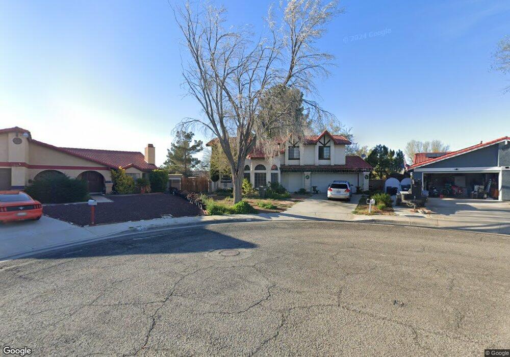
1329 Pascal Ct Lancaster, CA 93535
East Lancaster NeighborhoodEstimated Value: $452,652 - $482,000
3
Beds
2
Baths
1,779
Sq Ft
$262/Sq Ft
Est. Value
About This Home
This home is located at 1329 Pascal Ct, Lancaster, CA 93535 and is currently estimated at $466,663, approximately $262 per square foot. 1329 Pascal Ct is a home located in Los Angeles County with nearby schools including Lincoln Elementary School, New Vista Middle School, and Eastside High School.
Ownership History
Date
Name
Owned For
Owner Type
Purchase Details
Closed on
Apr 14, 2005
Sold by
Hessler Dana P
Bought by
Perera Sunil
Current Estimated Value
Home Financials for this Owner
Home Financials are based on the most recent Mortgage that was taken out on this home.
Original Mortgage
$239,900
Outstanding Balance
$128,506
Interest Rate
6.37%
Mortgage Type
Purchase Money Mortgage
Estimated Equity
$338,157
Purchase Details
Closed on
Feb 28, 2002
Sold by
Hessler Dana P and Hessler Dana P
Bought by
Hessler Dana P
Home Financials for this Owner
Home Financials are based on the most recent Mortgage that was taken out on this home.
Original Mortgage
$101,250
Interest Rate
6.94%
Purchase Details
Closed on
Apr 4, 1995
Sold by
Hessler Cindylou
Bought by
Hessler Dana P
Create a Home Valuation Report for This Property
The Home Valuation Report is an in-depth analysis detailing your home's value as well as a comparison with similar homes in the area
Home Values in the Area
Average Home Value in this Area
Purchase History
| Date | Buyer | Sale Price | Title Company |
|---|---|---|---|
| Perera Sunil | $300,000 | Fidelity | |
| Hessler Dana P | -- | American Title Co | |
| Hessler Dana P | -- | -- |
Source: Public Records
Mortgage History
| Date | Status | Borrower | Loan Amount |
|---|---|---|---|
| Open | Perera Sunil | $239,900 | |
| Previous Owner | Hessler Dana P | $101,250 | |
| Closed | Perera Sunil | $44,950 |
Source: Public Records
Tax History
| Year | Tax Paid | Tax Assessment Tax Assessment Total Assessment is a certain percentage of the fair market value that is determined by local assessors to be the total taxable value of land and additions on the property. | Land | Improvement |
|---|---|---|---|---|
| 2025 | $6,331 | $418,013 | $169,488 | $248,525 |
| 2024 | $6,331 | $409,817 | $166,165 | $243,652 |
| 2023 | $6,195 | $401,782 | $162,907 | $238,875 |
| 2022 | $5,947 | $393,905 | $159,713 | $234,192 |
| 2021 | $5,227 | $361,700 | $146,200 | $215,500 |
| 2019 | $4,302 | $287,000 | $116,000 | $171,000 |
| 2018 | $3,969 | $260,000 | $105,000 | $155,000 |
| 2016 | $2,804 | $169,000 | $68,500 | $100,500 |
| 2015 | $2,799 | $169,000 | $68,500 | $100,500 |
| 2014 | $2,580 | $148,000 | $60,000 | $88,000 |
Source: Public Records
Map
Nearby Homes
- 1519 Michelle Ave
- 43629 Rembrandt St
- 43601 Rembrandt St
- 87 E Avenue J 12
- 117 E Avenue J 12
- 1518 E Avenue J-12
- 1518 E Avenue j12
- 43815 Silver Bow Rd
- 43743 Alain Ct
- 1311 Herzel Ave
- 1251 Herzel Ave
- 1118 E Avenue K
- 1144 E Avenue J 10
- 1144 E Avenue j10
- 43415 Emilia Ln
- 1565 Astoria Ave
- 43927 Fallon Dr
- 43922 Fallon Dr
- 1642 Bisbee Place
- 1554 Granville Way
- 1326 Pascal Ct
- 1337 Pascal Ct
- 1320 Franklin Ave
- 1314 Franklin Ave
- 1338 Franklin Ave
- 1308 Franklin Ave
- 43620 Picaso St
- 1344 Franklin Ave
- 43614 Picaso St
- 1330 Pascal Ct
- 43626 Picaso St
- 43641 Emile Zola St
- 1336 Pascal Ct
- 43634 Picaso St
- 43608 Picaso St
- 43649 Emile Zola St
- 43619 Emile Zola St
- 1335 Franklin Ave
- 1329 Franklin Ave
- 1323 Franklin Ave
Your Personal Tour Guide
Ask me questions while you tour the home.