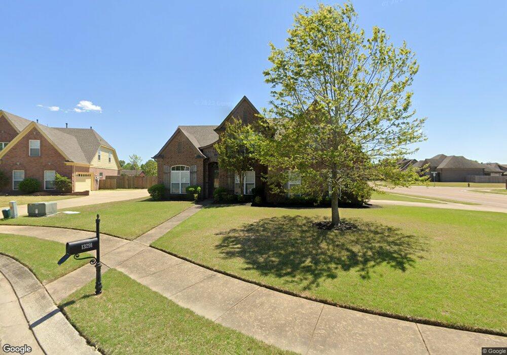
13291 Baskins Cove Olive Branch, MS 38654
Center Hill NeighborhoodEstimated Value: $298,000 - $413,000
4
Beds
3
Baths
2,800
Sq Ft
$126/Sq Ft
Est. Value
About This Home
This home is located at 13291 Baskins Cove, Olive Branch, MS 38654 and is currently estimated at $353,950, approximately $126 per square foot. 13291 Baskins Cove is a home located in DeSoto County with nearby schools including Overpark Elementary School, Center Hill High School, and Desoto Christian Academy.
Ownership History
Date
Name
Owned For
Owner Type
Purchase Details
Closed on
Feb 3, 2010
Sold by
Oakhurst Development Inc
Bought by
Thomas Cynthia
Current Estimated Value
Home Financials for this Owner
Home Financials are based on the most recent Mortgage that was taken out on this home.
Original Mortgage
$204,232
Outstanding Balance
$134,442
Interest Rate
5.16%
Mortgage Type
FHA
Estimated Equity
$219,508
Purchase Details
Closed on
Jul 30, 2009
Sold by
J Sweeney Homes Llc
Bought by
Bankplus
Create a Home Valuation Report for This Property
The Home Valuation Report is an in-depth analysis detailing your home's value as well as a comparison with similar homes in the area
Home Values in the Area
Average Home Value in this Area
Purchase History
| Date | Buyer | Sale Price | Title Company |
|---|---|---|---|
| Thomas Cynthia | -- | None Available | |
| Bankplus | $200,903 | None Available |
Source: Public Records
Mortgage History
| Date | Status | Borrower | Loan Amount |
|---|---|---|---|
| Open | Thomas Cynthia | $204,232 |
Source: Public Records
Tax History Compared to Growth
Tax History
| Year | Tax Paid | Tax Assessment Tax Assessment Total Assessment is a certain percentage of the fair market value that is determined by local assessors to be the total taxable value of land and additions on the property. | Land | Improvement |
|---|---|---|---|---|
| 2025 | $2,685 | $25,778 | $3,500 | $22,278 |
| 2024 | $2,278 | $18,888 | $3,500 | $15,388 |
| 2023 | $2,278 | $18,888 | $0 | $0 |
| 2022 | $2,278 | $18,888 | $3,500 | $15,388 |
| 2021 | $2,278 | $18,888 | $3,500 | $15,388 |
| 2020 | $1,462 | $17,628 | $3,500 | $14,128 |
| 2019 | $1,462 | $17,628 | $3,500 | $14,128 |
| 2017 | $1,442 | $31,106 | $17,303 | $13,803 |
| 2016 | $1,442 | $17,303 | $3,500 | $13,803 |
| 2015 | $1,742 | $31,106 | $17,303 | $13,803 |
| 2014 | $1,566 | $18,529 | $0 | $0 |
| 2013 | $1,566 | $18,529 | $0 | $0 |
Source: Public Records
Map
Nearby Homes
- 7127 Carriebrook Dr
- 7049 Windswept Ln
- 13185 Cades Ln
- 7375 Fox Creek Dr
- 7338 Hunters Horn Dr
- 6813 Braybourne Main
- 7462 Hunters Horn Dr
- 13881 Goodman Rd
- 13917 Wesley Banks Blvd
- 6610 John Hamilton Way E
- 13877 Wesley Banks Blvd
- 13939 Wesley Banks Blvd
- 13845 Wesley Banks Blvd
- 13947 Wesley Banks Blvd
- 13837 Wesley Banks Blvd
- 13829 Wesley Banks Blvd
- 13824 Molly Madeline Ln
- 13825 Molly Madeline Ln
- 13981 Wesley Banks Blvd
- 6347 Braybourne Place
- 13290 Baskins Cove
- 13303 Baskins Cove
- 13303 Baskin CV Dr
- 13259 Baskins Cove W
- 13307 Baskins Cove
- 13302 Baskins Cove
- 13258 Baskins Cove W
- 13247 Baskins Cove W
- 13306 Baskins Cove
- 7195 Reliance Ln
- 13246 Baskins Cove W
- 13233 Baskins Cove W
- 7183 Reliance Ln
- 13232 Baskins Cove W
- 13219 Baskins Cove W
- 7196 Windswept Ln
- 7167 Reliance Ln
- 13218 Baskins Cove W
- 7180 Windswept Ln
- 7255 Rollins Cove