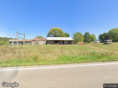
13295 State Route 550 Fleming, OH 45729
Estimated Value: $181,510 - $257,000
3
Beds
2
Baths
1,352
Sq Ft
$155/Sq Ft
Est. Value
About This Home
This home is located at 13295 State Route 550, Fleming, OH 45729 and is currently estimated at $209,878, approximately $155 per square foot. 13295 State Route 550 is a home located in Washington County with nearby schools including Warren High School.
Ownership History
Date
Name
Owned For
Owner Type
Purchase Details
Closed on
May 24, 2011
Sold by
Moore Danny L and Moore Pamela K
Bought by
Harlow James
Current Estimated Value
Home Financials for this Owner
Home Financials are based on the most recent Mortgage that was taken out on this home.
Original Mortgage
$131,577
Outstanding Balance
$95,043
Interest Rate
5.37%
Mortgage Type
FHA
Estimated Equity
$121,375
Create a Home Valuation Report for This Property
The Home Valuation Report is an in-depth analysis detailing your home's value as well as a comparison with similar homes in the area
Home Values in the Area
Average Home Value in this Area
Purchase History
| Date | Buyer | Sale Price | Title Company |
|---|---|---|---|
| Harlow James | $135,000 | Title First Marietta |
Source: Public Records
Mortgage History
| Date | Status | Borrower | Loan Amount |
|---|---|---|---|
| Open | Harlow James R | $20,890 | |
| Open | Harlow James | $131,577 | |
| Previous Owner | Moore Danny L | $105,000 |
Source: Public Records
Tax History Compared to Growth
Tax History
| Year | Tax Paid | Tax Assessment Tax Assessment Total Assessment is a certain percentage of the fair market value that is determined by local assessors to be the total taxable value of land and additions on the property. | Land | Improvement |
|---|---|---|---|---|
| 2024 | $1,885 | $47,530 | $12,150 | $35,380 |
| 2023 | $1,885 | $47,530 | $12,150 | $35,380 |
| 2022 | $1,862 | $47,530 | $12,150 | $35,380 |
| 2021 | $1,660 | $40,490 | $9,400 | $31,090 |
| 2020 | $1,659 | $40,490 | $9,400 | $31,090 |
| 2019 | $1,636 | $40,490 | $9,400 | $31,090 |
| 2018 | $1,529 | $36,720 | $7,520 | $29,200 |
| 2017 | $1,884 | $45,810 | $7,520 | $38,290 |
| 2016 | $2,332 | $45,810 | $7,520 | $38,290 |
| 2015 | $1,675 | $45,090 | $6,970 | $38,120 |
| 2014 | $2,321 | $45,090 | $6,970 | $38,120 |
| 2013 | $840 | $45,090 | $6,970 | $38,120 |
Source: Public Records
Map
Nearby Homes
- 240 Anderson Rd
- 2851 Barnett Ridge Rd
- 0 Fisher Ridge Rd
- 0 Fisher Ridge Rd Tract 1
- 0 Fisher Ridge Rd Tract 2
- 0 Fisher Ridge Rd Tract 5
- 0 Fisher Ridge Rd Tract 4
- 0 Fisher Ridge Rd Tract 6
- 0 Fisher Ridge Rd Tract 7
- 10270 Ohio 550
- 0 Layman Rd Unit 5120989
- 6570 State Route 339
- 0 Fisher Ridge Rd Tract 8
- 16 Main St
- 2746 Vickers Rd
- 38 Radabaugh Rd
- 9550 Ohio 550
- 1112 Pine Ridge Rd
- 0 Brackenridge Rd Unit 11519818
- 0 Brackenridge Rd Unit 23885979
- 13295 State Route 550
- 13295 Ohio 550
- 13313 State Route 550
- 13333 State Route 550
- 13189 State Route 550
- 13310 State Route 550
- 13326 State Route 550
- 13356 Ohio 550
- 13356 State Route 550
- 89 Anderson Rd
- 19 Anderson Rd
- 13364 State Route 550
- 67 Anderson Rd
- 13153 State Route 550
- 13404 State Route 550
- 105 Anderson Rd
- 13134 State Route 550
- 201 Anderson Rd
- 13408 State Route 550
- 48 & 100 Anderson Rd
