L
Seller's Agent in 2025
Lori Perron
Mott & Chace Sotheby's Intl.
(401) 640-8906
4 in this area
10 Total Sales
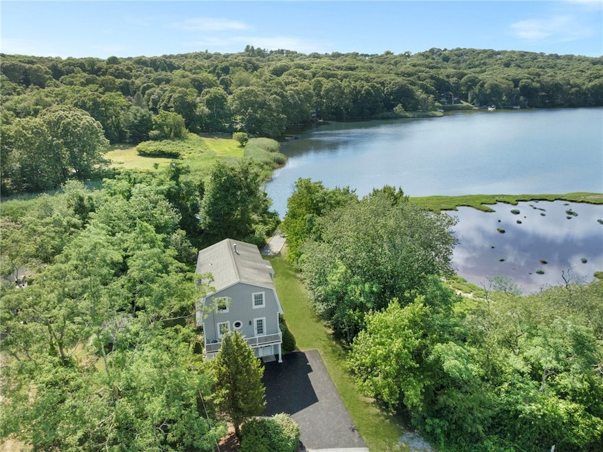
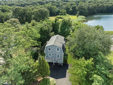
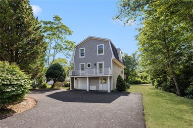
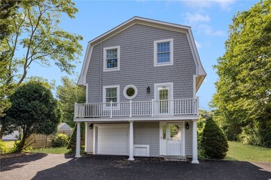
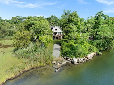
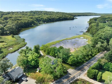
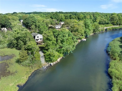
Nestled on the tranquil shores of the Narrow River/Pettasquamscutt Lake, this waterfront retreat offers the ultimate in coastal living. Whether you're into kayaking, canoeing, boating, fishing, paddleboarding, or water skiing, this property is your gateway to endless water adventures. Start your day with a cup of coffee on one of the multiple expansive decks, where you can take in panoramic views of the water and watch the boating activity unfold. Inside, the open-concept living and dining areas are bathed in natural light, thanks to oversized windows that frame the serene vistas. A two-sided gas fireplace adds warmth and charm, perfect for cozy evenings with loved ones. This one-owner home is ideal for a summer escape, weekend getaway, or even as a full-time residence, all while being located in the sought-after town of Narragansett. Just minutes from Narragansett Town Beach, Bonnet Shores, The Pier, and the vibrant shopping and dining options in Wakefield, this property offers the best of both worlds peaceful retreat and convenient access to everything the area has to offer. With the added convenience of being connected to town water, sewer, and natural gas, all that's left to do is move in and enjoy life on the River.
Last Agent to Sell the Property
Mott & Chace Sotheby's Intl. License #RES.0043097 Listed on: 07/24/2025

| Date | Type | Sale Price | Title Company |
|---|---|---|---|
| Deed | -- | -- | |
| Deed | -- | -- | |
| Deed | $290,000 | -- |
| Date | Status | Loan Amount | Loan Type |
|---|---|---|---|
| Previous Owner | $140,000 | No Value Available | |
| Previous Owner | $120,741 | No Value Available |
| Date | Event | Price | List to Sale | Price per Sq Ft |
|---|---|---|---|---|
| 09/29/2025 09/29/25 | Sold | $922,500 | -7.7% | $547 / Sq Ft |
| 09/22/2025 09/22/25 | Pending | -- | -- | -- |
| 09/02/2025 09/02/25 | Price Changed | $999,000 | -2.5% | $592 / Sq Ft |
| 08/13/2025 08/13/25 | Price Changed | $1,025,000 | -6.8% | $608 / Sq Ft |
| 07/24/2025 07/24/25 | For Sale | $1,100,000 | -- | $652 / Sq Ft |
| Year | Tax Paid | Tax Assessment Tax Assessment Total Assessment is a certain percentage of the fair market value that is determined by local assessors to be the total taxable value of land and additions on the property. | Land | Improvement |
|---|---|---|---|---|
| 2025 | $6,997 | $1,030,500 | $572,000 | $458,500 |
| 2024 | $6,750 | $1,030,500 | $572,000 | $458,500 |
| 2023 | $6,745 | $724,500 | $408,600 | $315,900 |
| 2022 | $6,521 | $724,500 | $408,600 | $315,900 |
| 2021 | $6,419 | $724,500 | $408,600 | $315,900 |
| 2020 | $5,926 | $565,500 | $278,300 | $287,200 |
| 2019 | $5,785 | $565,500 | $278,300 | $287,200 |
| 2018 | $5,627 | $565,500 | $278,300 | $287,200 |
| 2017 | $5,344 | $506,100 | $288,100 | $218,000 |
| 2016 | $5,101 | $506,100 | $288,100 | $218,000 |
| 2015 | $5,031 | $506,100 | $288,100 | $218,000 |
| 2014 | $5,018 | $499,800 | $272,900 | $226,900 |
L
Seller's Agent in 2025
Lori Perron
Mott & Chace Sotheby's Intl.
(401) 640-8906
4 in this area
10 Total Sales
Buyer's Agent in 2025
Rob Paliotta
ROPAL REALTY
(401) 368-2255
2 in this area
55 Total Sales
Source: State-Wide MLS
MLS Number: 1388387
APN: NARR-000009-000000-000000NA
Disclaimer: Certain information contained herein is derived from information provided by parties other than Homes.com. All information provided is deemed reliable, but is not guaranteed to be accurate and should be independently verified.
![]() IDX information is provided exclusively for personal, non-commercial use, and may not be used for any purpose other than to identify prospective properties consumers may be interested in purchasing. Information is deemed reliable but not guaranteed.
IDX information is provided exclusively for personal, non-commercial use, and may not be used for any purpose other than to identify prospective properties consumers may be interested in purchasing. Information is deemed reliable but not guaranteed.
Copyright © 2025 State-Wide MLS, Inc. All rights reserved.