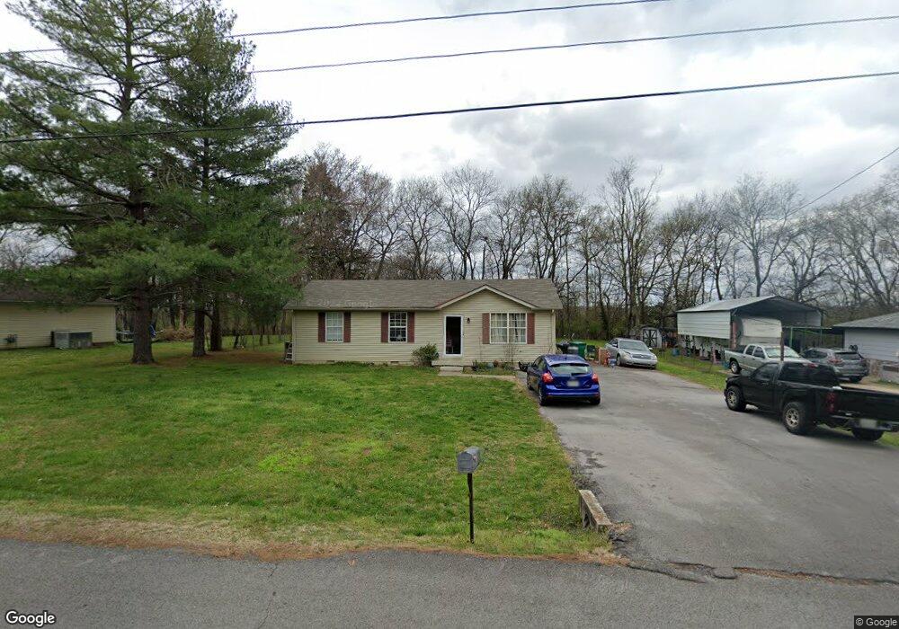
133 Long Rifle Rd Smyrna, TN 37167
Estimated Value: $247,203 - $321,000
--
Bed
1
Bath
1,100
Sq Ft
$268/Sq Ft
Est. Value
About This Home
This home is located at 133 Long Rifle Rd, Smyrna, TN 37167 and is currently estimated at $295,301, approximately $268 per square foot. 133 Long Rifle Rd is a home located in Rutherford County with nearby schools including Stewartsboro Elementary School, Rocky Fork Middle School, and Smyrna High School.
Ownership History
Date
Name
Owned For
Owner Type
Purchase Details
Closed on
Oct 29, 2001
Sold by
Malgorzata Gawron
Bought by
Corrigan Alan B
Current Estimated Value
Purchase Details
Closed on
Nov 19, 1998
Sold by
Aba Enterprises
Bought by
Malgorzata Gawron
Home Financials for this Owner
Home Financials are based on the most recent Mortgage that was taken out on this home.
Original Mortgage
$74,900
Interest Rate
6.77%
Create a Home Valuation Report for This Property
The Home Valuation Report is an in-depth analysis detailing your home's value as well as a comparison with similar homes in the area
Home Values in the Area
Average Home Value in this Area
Purchase History
| Date | Buyer | Sale Price | Title Company |
|---|---|---|---|
| Corrigan Alan B | $87,000 | -- | |
| Malgorzata Gawron | $74,900 | -- |
Source: Public Records
Mortgage History
| Date | Status | Borrower | Loan Amount |
|---|---|---|---|
| Previous Owner | Malgorzata Gawron | $74,900 |
Source: Public Records
Tax History Compared to Growth
Tax History
| Year | Tax Paid | Tax Assessment Tax Assessment Total Assessment is a certain percentage of the fair market value that is determined by local assessors to be the total taxable value of land and additions on the property. | Land | Improvement |
|---|---|---|---|---|
| 2025 | $1,141 | $47,475 | $13,750 | $33,725 |
| 2024 | $1,141 | $47,475 | $13,750 | $33,725 |
| 2023 | $1,141 | $47,475 | $13,750 | $33,725 |
| 2022 | $1,017 | $47,475 | $13,750 | $33,725 |
| 2021 | $917 | $31,400 | $7,750 | $23,650 |
| 2020 | $917 | $31,400 | $7,750 | $23,650 |
| 2019 | $917 | $31,400 | $7,750 | $23,650 |
| 2018 | $879 | $31,400 | $0 | $0 |
| 2017 | $769 | $21,575 | $0 | $0 |
| 2016 | $769 | $21,575 | $0 | $0 |
| 2015 | $769 | $21,575 | $0 | $0 |
| 2014 | $537 | $21,575 | $0 | $0 |
| 2013 | -- | $21,325 | $0 | $0 |
Source: Public Records
Map
Nearby Homes
- 340 Stewarts Landing Cir
- 308 Custer Ct
- 211 Stewarts Landing Cir
- 213 Stewarts Landing Cir
- 104 Evanmeade Dr
- 203 Longfellow Ln
- 109 Longfellow Ln
- 101 Longfellow Ln
- 303 Davis Park Dr
- 1026 Rosemont Terrace
- 0 Old Nashville Hwy Unit RTC2943706
- 1014 Rosemont Terrace
- 121 Crockett Ct
- 202 Latimer Dr
- 647 Legacy Dr
- 2110 Alteras Dr
- 205 Bane Dr
- 633 Glenties Dr
- 201 Bane Dr
- 1023 Avery Park Dr
- 135 Long Rifle Rd
- 131 Long Rifle Rd
- 126 Long Rifle Rd
- 429 Stockade Dr
- 124 Long Rifle Rd
- 129 Long Rifle Rd
- 122 Long Rifle Rd
- 139 Long Rifle Rd
- 130 Long Rifle Rd
- 413 Pony Dr
- 120 Long Rifle Rd
- 415 Pony Dr
- 411 Pony Dr
- 127 Long Rifle Rd
- 434 Stockade Dr
- 409 Pony Dr
- 118 Long Rifle Rd
- 407 Pony Dr
- 125 Long Rifle Rd
- 432 Stockade Dr