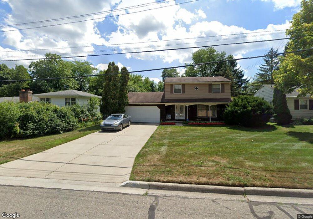
133 Loree Dr East Lansing, MI 48823
Estimated Value: $303,000 - $323,247
4
Beds
2
Baths
1,662
Sq Ft
$188/Sq Ft
Est. Value
About This Home
This home is located at 133 Loree Dr, East Lansing, MI 48823 and is currently estimated at $312,562, approximately $188 per square foot. 133 Loree Dr is a home located in Ingham County with nearby schools including Green Elementary School, MacDonald Middle School, and East Lansing High School.
Ownership History
Date
Name
Owned For
Owner Type
Purchase Details
Closed on
Jan 26, 2016
Sold by
Jackson Maxie C and Jackson Carrie B
Bought by
Jackson Maxie C and The Maxie & Carrie Jackson Revocable Fam
Current Estimated Value
Create a Home Valuation Report for This Property
The Home Valuation Report is an in-depth analysis detailing your home's value as well as a comparison with similar homes in the area
Home Values in the Area
Average Home Value in this Area
Purchase History
| Date | Buyer | Sale Price | Title Company |
|---|---|---|---|
| Jackson Maxie C | -- | None Available |
Source: Public Records
Tax History Compared to Growth
Tax History
| Year | Tax Paid | Tax Assessment Tax Assessment Total Assessment is a certain percentage of the fair market value that is determined by local assessors to be the total taxable value of land and additions on the property. | Land | Improvement |
|---|---|---|---|---|
| 2025 | $4,831 | $148,200 | $31,300 | $116,900 |
| 2024 | $4,512 | $138,300 | $29,000 | $109,300 |
| 2023 | $4,512 | $125,200 | $25,100 | $100,100 |
| 2022 | $4,323 | $114,100 | $21,400 | $92,700 |
| 2021 | $4,249 | $107,700 | $20,500 | $87,200 |
| 2020 | $4,202 | $99,800 | $20,500 | $79,300 |
| 2019 | $4,030 | $94,000 | $22,200 | $71,800 |
| 2018 | $4,407 | $88,300 | $19,400 | $68,900 |
| 2017 | $4,231 | $88,000 | $19,500 | $68,500 |
| 2016 | -- | $83,200 | $19,500 | $63,700 |
| 2015 | -- | $78,800 | $36,487 | $42,313 |
| 2014 | -- | $71,800 | $33,880 | $37,920 |
Source: Public Records
Map
Nearby Homes
- 404 Gainsborough Dr
- 338 W Saginaw St Unit 48
- 523 Bainbridge Dr Unit 37
- 407 Walbridge Dr
- 1412 N Harrison Rd
- 408 Whitehills Dr
- 904 Sunset Ln
- 1522 Hitching Post Rd
- 953 Rosewood Ave
- 815 Westlawn Ave
- 1968 Rutgers Cir
- 753 E Saginaw St
- 421 W Lake Lansing Rd
- 1609 Gilcrest Ave
- 6031 Rutherford Ave
- 732 Tarleton Ave
- 524 W Lake Lansing Rd
- 620 Ardson Rd
- 2341 N Harrison Rd
- 805 Southlawn Ave
- 205 Loree Dr
- 125 Loree Dr
- 207 Loree Dr
- 117 Loree Dr
- 126 Loree Dr
- 140 Loree Dr
- 211 Loree Dr
- 109 Loree Dr
- 204 Loree Dr
- 110 Loree Dr
- 101 Loree Dr
- 217 Loree Dr
- 169 Abbott Woods Dr Unit 6
- 177 Abbott Woods Dr
- 161 Abbott Woods Dr Unit 5
- 212 Loree Dr
- 153 Abbott Woods Dr
- 153 Abbott Woods Dr Unit 4
- 209 Abbott Woods Dr
- 217 Abbott Woods Dr Unit 10