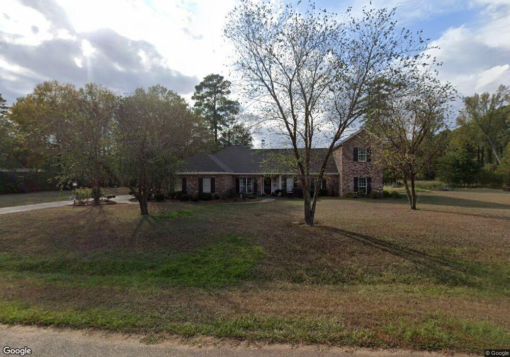
133 Nottaway Rd Ruston, LA 71270
Estimated Value: $392,000 - $449,000
Studio
--
Bath
2,977
Sq Ft
$143/Sq Ft
Est. Value
About This Home
This home is located at 133 Nottaway Rd, Ruston, LA 71270 and is currently estimated at $425,034, approximately $142 per square foot. 133 Nottaway Rd is a home located in Lincoln Parish with nearby schools including Glen View Elementary School, Cypress Springs Elementary School, and Ruston Junior High School.
Ownership History
Date
Name
Owned For
Owner Type
Purchase Details
Closed on
Aug 27, 2010
Sold by
Baldridge Sutton Joseph William and Baldridge Sutton Kathryn
Bought by
Simmons Jacob Cullen and Simmons Leah Colvin
Current Estimated Value
Home Financials for this Owner
Home Financials are based on the most recent Mortgage that was taken out on this home.
Original Mortgage
$194,275
Outstanding Balance
$126,476
Interest Rate
4.55%
Mortgage Type
FHA
Estimated Equity
$298,558
Create a Home Valuation Report for This Property
The Home Valuation Report is an in-depth analysis detailing your home's value as well as a comparison with similar homes in the area
Purchase History
| Date | Buyer | Sale Price | Title Company |
|---|---|---|---|
| Simmons Jacob Cullen | $215,000 | None Available |
Source: Public Records
Mortgage History
| Date | Status | Borrower | Loan Amount |
|---|---|---|---|
| Open | Simmons Jacob Cullen | $194,275 |
Source: Public Records
Tax History
| Year | Tax Paid | Tax Assessment Tax Assessment Total Assessment is a certain percentage of the fair market value that is determined by local assessors to be the total taxable value of land and additions on the property. | Land | Improvement |
|---|---|---|---|---|
| 2025 | $2,834 | $34,590 | $2,395 | $32,195 |
| 2024 | $2,834 | $34,591 | $2,395 | $32,196 |
| 2023 | $2,891 | $34,175 | $3,563 | $30,612 |
| 2022 | $2,906 | $34,175 | $3,563 | $30,612 |
| 2021 | $2,679 | $34,175 | $3,563 | $30,612 |
| 2020 | $2,430 | $30,744 | $3,563 | $27,181 |
| 2019 | $2,346 | $30,425 | $3,563 | $26,862 |
| 2018 | $1,787 | $23,648 | $3,563 | $20,085 |
| 2017 | $1,792 | $23,648 | $3,563 | $20,085 |
| 2016 | $1,785 | $0 | $0 | $0 |
| 2015 | $1,724 | $20,928 | $3,160 | $17,768 |
| 2013 | $1,752 | $20,928 | $3,160 | $17,768 |
Source: Public Records
Map
Nearby Homes
- 209 Mount Harmony Church Rd
- 193 Mount Harmony Church Rd
- 185 Mount Harmony Church Rd
- 136 Shade Tree Trace
- Lot 1B Unit 1 Harmony Church Rd
- 144 Creeks Crossing
- 641 Goodgoin Rd
- 3252 Highway 821
- 173 Oak Alley Dr
- 128 Marlou Cir
- 305 Oak Alley Dr
- 145 Woodshire Ln
- 180 Vz Top Farm Rd
- 197 Baxter Rd
- 294 Moody Rd
- 1709 Rampart Dr
- 2420 Highway 33
- 0 English Turn
- 2900 Post Oak Dr
- 201 Vintage Ln
- 134 Nottaway Rd
- 111 Nottaway Rd
- 155 Nottaway Rd
- 165 Goodgoin Rd
- 112 Nottaway Rd
- 156 Nottaway Rd
- 217 Goodgoin Rd
- 3586 Highway 33
- 177 Nottaway Rd
- 3598 Highway 33
- 178 Nottaway Rd
- 221 Goodgoin Rd
- 158 Goodgoin Rd
- 3608 Highway 33
- 150 Goodgoin Rd
- 3599 Louisiana 33
- 3599 Highway 33
- 3573 Louisiana 33
- 263 Goodgoin Rd
- 3658 Highway 33
Your Personal Tour Guide
Ask me questions while you tour the home.