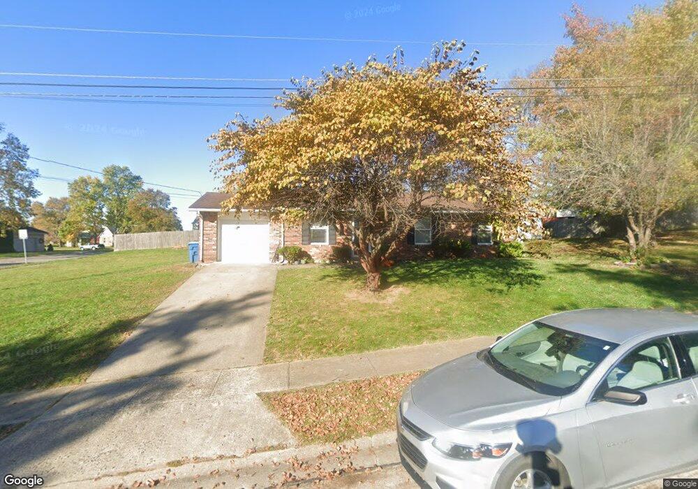
133 Springside Ave Georgetown, KY 40324
South Scott County NeighborhoodEstimated Value: $190,000 - $255,000
3
Beds
2
Baths
1,050
Sq Ft
$206/Sq Ft
Est. Value
About This Home
This home is located at 133 Springside Ave, Georgetown, KY 40324 and is currently estimated at $216,233, approximately $205 per square foot. 133 Springside Ave is a home located in Scott County with nearby schools including Garth Elementary School, Creekside Elementary School, and Georgetown Middle School.
Ownership History
Date
Name
Owned For
Owner Type
Purchase Details
Closed on
Jun 28, 2019
Sold by
Gaines Candi
Bought by
Tackett John
Current Estimated Value
Purchase Details
Closed on
Aug 28, 2008
Sold by
Secretary Of Housing & Urban Development
Bought by
Gaines Candi
Home Financials for this Owner
Home Financials are based on the most recent Mortgage that was taken out on this home.
Original Mortgage
$1,800
Interest Rate
6.48%
Mortgage Type
Unknown
Purchase Details
Closed on
Dec 6, 2007
Sold by
Lancaster James R and Anderson Venus M
Bought by
Secretary Of Housing And Urban Developme
Create a Home Valuation Report for This Property
The Home Valuation Report is an in-depth analysis detailing your home's value as well as a comparison with similar homes in the area
Home Values in the Area
Average Home Value in this Area
Purchase History
| Date | Buyer | Sale Price | Title Company |
|---|---|---|---|
| Tackett John | $127,000 | None Available | |
| Gaines Candi | $94,500 | Regional First Title Group | |
| Secretary Of Housing And Urban Developme | $90,000 | None Available |
Source: Public Records
Mortgage History
| Date | Status | Borrower | Loan Amount |
|---|---|---|---|
| Previous Owner | Gaines Candi | $1,800 | |
| Previous Owner | Gaines Candi | $96,039 |
Source: Public Records
Tax History Compared to Growth
Tax History
| Year | Tax Paid | Tax Assessment Tax Assessment Total Assessment is a certain percentage of the fair market value that is determined by local assessors to be the total taxable value of land and additions on the property. | Land | Improvement |
|---|---|---|---|---|
| 2024 | $1,309 | $145,600 | $0 | $0 |
| 2023 | $1,257 | $138,600 | $33,000 | $105,600 |
| 2022 | $1,080 | $127,000 | $27,500 | $99,500 |
| 2021 | $1,196 | $127,000 | $27,500 | $99,500 |
| 2020 | $1,091 | $127,000 | $27,500 | $99,500 |
| 2019 | $872 | $127,000 | $0 | $0 |
| 2018 | $830 | $95,620 | $0 | $0 |
| 2017 | $834 | $95,620 | $0 | $0 |
| 2016 | $770 | $95,620 | $0 | $0 |
| 2015 | $734 | $91,700 | $0 | $0 |
| 2014 | $760 | $91,700 | $0 | $0 |
| 2011 | $63 | $100,900 | $0 | $0 |
Source: Public Records
Map
Nearby Homes
- 180 Hillside Dr
- 1108 Beth Ct
- 500 Hiawatha Trail
- 115 Hutchins Dr
- 900 Shoshoni Trail
- 109 Acorn Path
- 127 Anne Jennings
- 119 Acorn Path
- 167 Delissa Dr
- 126 Autumn Leaf Path
- 1115 Apache Trail
- 301 Aztec Trail
- 104 Copper Kettle Path
- 405 W Main St
- 1215 Seminole Trail
- 126 Copper Kettle Path
- 235 Ransom Trace
- 198 Hiawatha Trail
- 132 Rucker Ave
- 412 Cheyenne Trail
- 113 Josie Trail
- 127 Springside Ave
- 115 Josie Trail
- 120 Springside Ave
- 118 Springside Ave
- 188 Brookside Dr
- 111 Josie Trail
- 116 Springside Ave
- 117 Josie Trail
- 192 Brookside Dr
- 123 Hillside Dr
- 121 Hillside Dr
- 114 Springside Ave
- 119 Hillside Dr
- 604 Mason Ct
- 110 Josie Trail
- 112 Josie Trail
- 121 Springside Ave
- 119 Josie Trail
- 109 Josie Trail