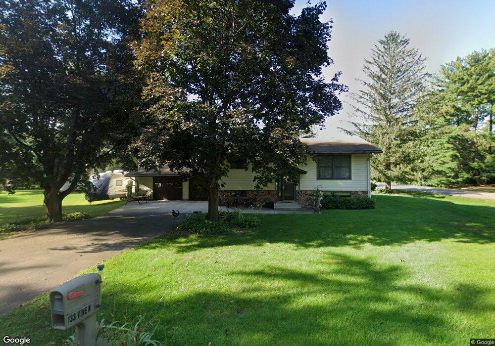
133 Vine St N Prescott, WI 54021
Estimated Value: $275,000 - $311,357
3
Beds
2
Baths
--
Sq Ft
0.35
Acres
About This Home
This home is located at 133 Vine St N, Prescott, WI 54021 and is currently estimated at $299,339. 133 Vine St N is a home located in Pierce County with nearby schools including Malone Elementary School, Prescott Middle School, and Prescott High School.
Ownership History
Date
Name
Owned For
Owner Type
Purchase Details
Closed on
Jul 16, 2020
Sold by
Brunkhorst Trust
Bought by
Franco Josias V and Franco Maria J
Current Estimated Value
Home Financials for this Owner
Home Financials are based on the most recent Mortgage that was taken out on this home.
Original Mortgage
$148,000
Outstanding Balance
$131,237
Interest Rate
3.1%
Mortgage Type
New Conventional
Estimated Equity
$168,102
Create a Home Valuation Report for This Property
The Home Valuation Report is an in-depth analysis detailing your home's value as well as a comparison with similar homes in the area
Home Values in the Area
Average Home Value in this Area
Purchase History
| Date | Buyer | Sale Price | Title Company |
|---|---|---|---|
| Franco Josias V | $185,000 | None Available |
Source: Public Records
Mortgage History
| Date | Status | Borrower | Loan Amount |
|---|---|---|---|
| Open | Franco Josias V | $148,000 |
Source: Public Records
Tax History Compared to Growth
Tax History
| Year | Tax Paid | Tax Assessment Tax Assessment Total Assessment is a certain percentage of the fair market value that is determined by local assessors to be the total taxable value of land and additions on the property. | Land | Improvement |
|---|---|---|---|---|
| 2024 | $4,994 | $282,500 | $74,200 | $208,300 |
| 2023 | $4,837 | $282,500 | $74,200 | $208,300 |
| 2022 | $3,834 | $169,200 | $42,400 | $126,800 |
| 2021 | $3,746 | $169,200 | $42,400 | $126,800 |
| 2020 | $3,852 | $169,200 | $42,400 | $126,800 |
| 2019 | $3,838 | $169,200 | $42,400 | $126,800 |
| 2018 | $3,673 | $169,200 | $42,400 | $126,800 |
| 2017 | $4,239 | $169,200 | $42,400 | $126,800 |
| 2016 | $3,720 | $150,700 | $42,400 | $108,300 |
| 2015 | $3,859 | $150,700 | $42,400 | $108,300 |
| 2014 | $3,725 | $150,700 | $42,400 | $108,300 |
| 2013 | $3,507 | $150,700 | $42,400 | $108,300 |
Source: Public Records
Map
Nearby Homes
- 316 Young St N
- 728 Linn St
- 284 Elm St S
- 170 Tower Rd
- 455 Flora St S
- 155 Linden Rd
- 1433 Glenridge Dr
- 150 Front St N Unit 421
- 150 Front St N Unit 323
- XXX Locust St
- 833 River Terrace
- 170 Mississippi St
- 565 Pleasant Dr
- 1813 Canton Rd
- 580 Northern Lights Dr
- 482 Delta Queen Ave
- Virginia Plan at Great Rivers
- Tennessee Plan at Great Rivers
- Vermont Plan at Great Rivers
- Sycamore Plan at Great Rivers