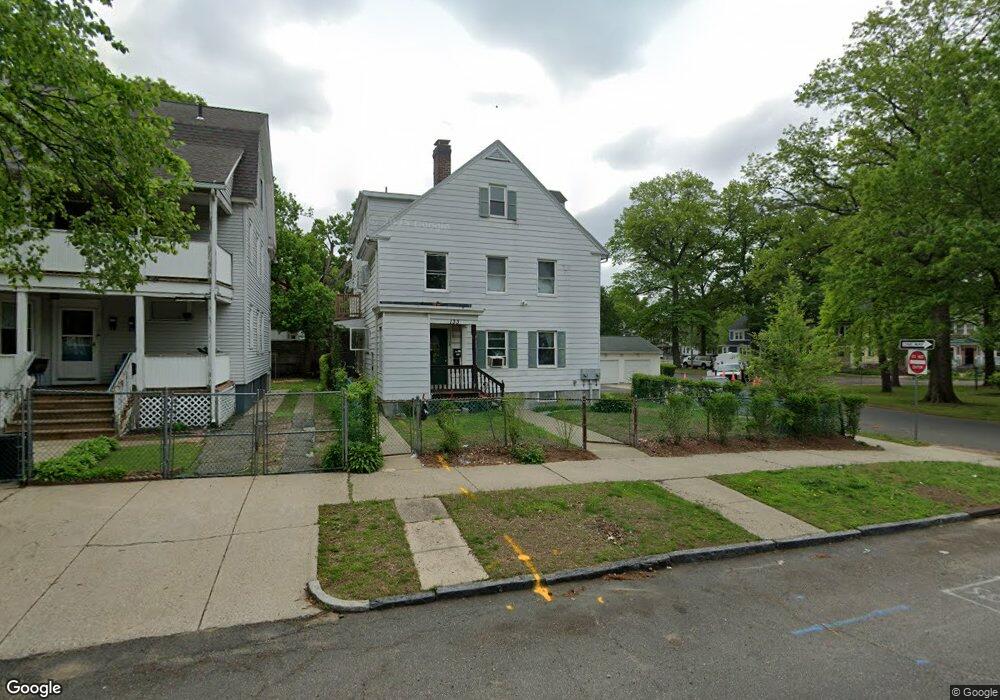
133 Westford Ave Unit 135 Springfield, MA 01109
Upper Hill NeighborhoodEstimated Value: $385,342 - $444,000
8
Beds
3
Baths
3,862
Sq Ft
$109/Sq Ft
Est. Value
About This Home
This home is located at 133 Westford Ave Unit 135, Springfield, MA 01109 and is currently estimated at $422,836, approximately $109 per square foot. 133 Westford Ave Unit 135 is a home located in Hampden County with nearby schools including Mary M. Walsh Elementary School, M Marcus Kiley Middle, and Springfield High School of Science and Technology.
Ownership History
Date
Name
Owned For
Owner Type
Purchase Details
Closed on
Mar 11, 2022
Sold by
Collins Melvin J
Bought by
Saklaa Rt
Current Estimated Value
Purchase Details
Closed on
Jun 28, 2021
Sold by
Gearing Alison D
Bought by
Collins Melvin J
Purchase Details
Closed on
Jul 7, 2016
Sold by
Gearing Alison D
Bought by
Collins Melvin J
Purchase Details
Closed on
Jan 6, 2016
Sold by
Nelson Willie
Bought by
Gearing Joan
Purchase Details
Closed on
Sep 2, 2003
Sold by
Nelson Willie
Bought by
Gearing Joan Y
Purchase Details
Closed on
Jan 18, 1979
Bought by
Nelson Willie
Create a Home Valuation Report for This Property
The Home Valuation Report is an in-depth analysis detailing your home's value as well as a comparison with similar homes in the area
Home Values in the Area
Average Home Value in this Area
Purchase History
| Date | Buyer | Sale Price | Title Company |
|---|---|---|---|
| Saklaa Rt | $194,755 | None Available | |
| Collins Melvin J | -- | None Available | |
| Collins Melvin J | -- | -- | |
| Gearing Joan | -- | -- | |
| Gearing Joan Y | -- | -- | |
| Nelson Willie | -- | -- |
Source: Public Records
Tax History Compared to Growth
Tax History
| Year | Tax Paid | Tax Assessment Tax Assessment Total Assessment is a certain percentage of the fair market value that is determined by local assessors to be the total taxable value of land and additions on the property. | Land | Improvement |
|---|---|---|---|---|
| 2025 | $5,414 | $345,300 | $31,700 | $313,600 |
| 2024 | $5,012 | $312,100 | $31,700 | $280,400 |
| 2023 | $4,612 | $270,500 | $28,800 | $241,700 |
| 2022 | $3,655 | $194,200 | $26,900 | $167,300 |
| 2021 | $3,387 | $179,200 | $19,100 | $160,100 |
| 2020 | $3,459 | $177,100 | $19,100 | $158,000 |
| 2019 | $3,143 | $159,700 | $16,300 | $143,400 |
| 2018 | $3,361 | $170,800 | $16,300 | $154,500 |
| 2017 | $3,269 | $166,300 | $15,300 | $151,000 |
| 2016 | $2,953 | $150,200 | $15,300 | $134,900 |
| 2015 | $2,783 | $141,500 | $15,300 | $126,200 |
Source: Public Records
Map
Nearby Homes
- 21 Westford Cir
- 140 Northampton Ave
- 162 Northampton Ave
- 88 Dunmoreland St
- 179 Albemarle St
- 19 Westford Ave
- 124-126 Westford Cir
- 290 Quincy St
- 129 Eastern Ave
- 135-137 Suffolk St
- 0 NS (24) Alden St
- 62-64 Bristol St
- 158 Norfolk St
- 52-56 Andrew St
- 65 Montrose St
- 111 Marlborough St
- 50-52 Maynard St
- 81 Hayden Ave
- 108 Alden St
- 43 Colonial Ave
- 133-135 Westford Ave
- 129 Westford Ave
- 140 Massachusetts Ave
- 144 Massachusetts Ave Unit 146
- 134 Massachusetts Ave
- 144-146 Massachusetts Ave
- 123 Westford Ave Unit 125
- 123 Westford Ave Unit 1
- 123-125 Westford Ave
- 128 Massachusetts Ave Unit 130
- 128-130 Massachusetts Ave
- 119 Westford Ave
- 20 Gunn Square
- 124 Massachusetts Ave Unit 126
- 113 Westford Ave Unit 115
- 14 Gunn Square
- 19 Westford Cir
- 118 Massachusetts Ave
- 124 Westford Ave Unit 126
- 11 Westford Cir Unit 15