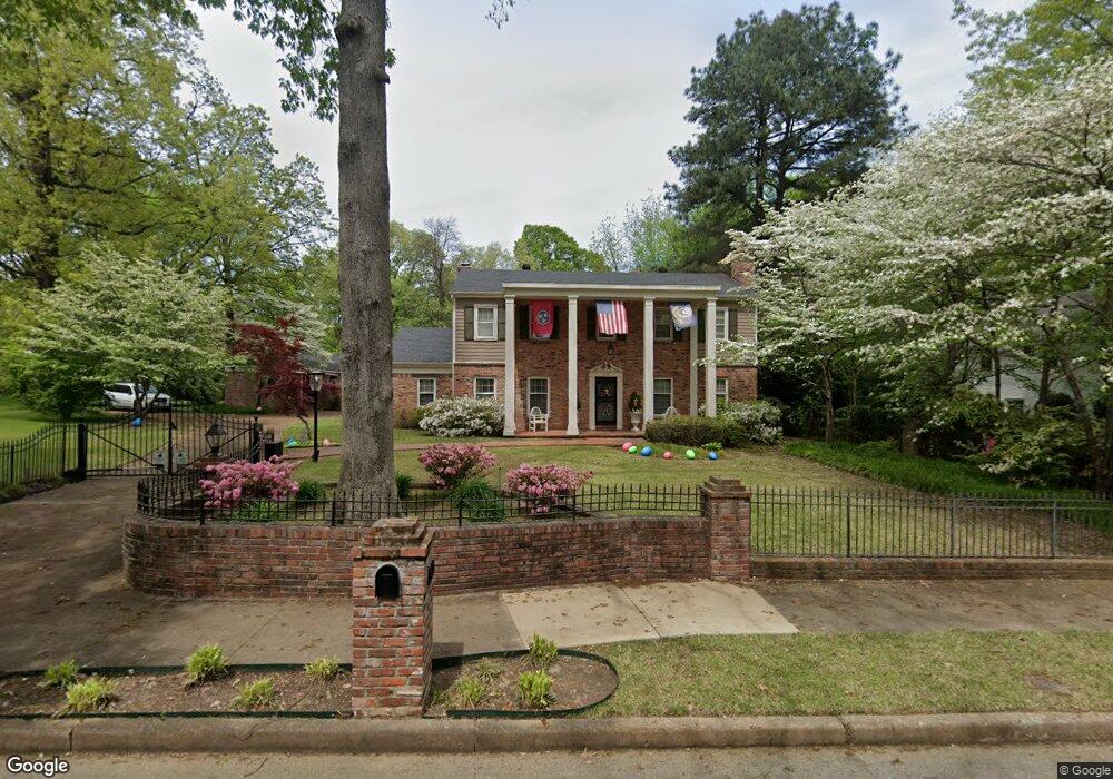
1330 Brookfield Rd Memphis, TN 38119
Sea Isle Park NeighborhoodEstimated Value: $534,000 - $639,000
3
Beds
4
Baths
3,482
Sq Ft
$164/Sq Ft
Est. Value
About This Home
This home is located at 1330 Brookfield Rd, Memphis, TN 38119 and is currently estimated at $571,969, approximately $164 per square foot. 1330 Brookfield Rd is a home located in Shelby County with nearby schools including Sea Isle Elementary School, Colonial Middle, and Overton High.
Ownership History
Date
Name
Owned For
Owner Type
Purchase Details
Closed on
May 21, 2007
Sold by
Jordan Paul Vernon
Bought by
Johnson Daniel F and Johnson Susan G
Current Estimated Value
Home Financials for this Owner
Home Financials are based on the most recent Mortgage that was taken out on this home.
Original Mortgage
$292,400
Outstanding Balance
$177,858
Interest Rate
6.17%
Mortgage Type
Purchase Money Mortgage
Estimated Equity
$394,111
Purchase Details
Closed on
Jan 8, 2004
Sold by
Jordan Elizabeth Chisholm
Bought by
Jordan Paul Vernon
Purchase Details
Closed on
Mar 17, 2000
Sold by
Biggs Jack C and Biggs Nancy C
Bought by
Jordan Paul and Jordan Elizabeth C
Home Financials for this Owner
Home Financials are based on the most recent Mortgage that was taken out on this home.
Original Mortgage
$285,300
Interest Rate
8%
Create a Home Valuation Report for This Property
The Home Valuation Report is an in-depth analysis detailing your home's value as well as a comparison with similar homes in the area
Home Values in the Area
Average Home Value in this Area
Purchase History
| Date | Buyer | Sale Price | Title Company |
|---|---|---|---|
| Johnson Daniel F | $365,500 | None Available | |
| Jordan Paul Vernon | -- | None Available | |
| Jordan Paul | $317,000 | -- |
Source: Public Records
Mortgage History
| Date | Status | Borrower | Loan Amount |
|---|---|---|---|
| Open | Johnson Daniel F | $292,400 | |
| Previous Owner | Jordan Paul | $285,300 |
Source: Public Records
Tax History
| Year | Tax Paid | Tax Assessment Tax Assessment Total Assessment is a certain percentage of the fair market value that is determined by local assessors to be the total taxable value of land and additions on the property. | Land | Improvement |
|---|---|---|---|---|
| 2025 | $3,658 | $138,900 | $17,625 | $121,275 |
| 2024 | $3,658 | $107,900 | $17,525 | $90,375 |
| 2023 | $6,573 | $107,900 | $17,525 | $90,375 |
| 2022 | $6,573 | $107,900 | $17,525 | $90,375 |
| 2021 | $6,650 | $107,900 | $17,525 | $90,375 |
| 2020 | $6,061 | $83,650 | $17,525 | $66,125 |
| 2019 | $6,061 | $83,650 | $17,525 | $66,125 |
| 2018 | $6,061 | $83,650 | $17,525 | $66,125 |
| 2017 | $3,438 | $83,650 | $17,525 | $66,125 |
| 2016 | $3,208 | $73,400 | $0 | $0 |
| 2014 | $3,208 | $73,400 | $0 | $0 |
Source: Public Records
Map
Nearby Homes
- 1360 E Crestwood Dr
- 1204 E Crestwood Dr
- 1279 W Crestwood Dr
- 5866 Roxbury Dr Unit 5866
- 5718 Quince Rd Unit 10
- 5718 Quince Rd Unit 4
- 1212 Bristol Dr
- 1205 Bristol Dr Unit 14
- 1206 Bristol Dr Unit 202
- 5696 Quince Rd Unit 1
- 5696 Quince Rd Unit 3
- 5726 Quince Rd Unit 9
- 5845 Park Ave Unit 5845
- 1220 Chamberlain Dr Unit 4
- 5906 Noyes Ct Unit 4
- 1204 Chamberlain Dr Unit 20
- 5918 Julian Ct Unit 1
- 5457 Quince Rd
- 5367 Shady Breeze Cove
- 5476 E End Village Dr
- 1334 Brookfield Rd
- 1306 Brookfield Rd
- 1307 Yorkshire Dr
- 1298 Brookfield Rd
- 1297 Yorkshire Dr
- 1315 Brookfield Rd
- 1325 Brookfield Rd
- 1307 Brookfield Rd
- 1287 Yorkshire Dr
- 1288 Brookfield Rd
- 1324 Yorkshire Dr
- 1314 Yorkshire Dr
- 1334 Yorkshire Dr
- 1299 Brookfield Rd
- 1304 Yorkshire Dr
- 1365 Yorkshire Dr
- 1344 Yorkshire Dr
- 1277 Yorkshire Dr
- 1294 Yorkshire Dr
- 1289 Brookfield Rd
Your Personal Tour Guide
Ask me questions while you tour the home.