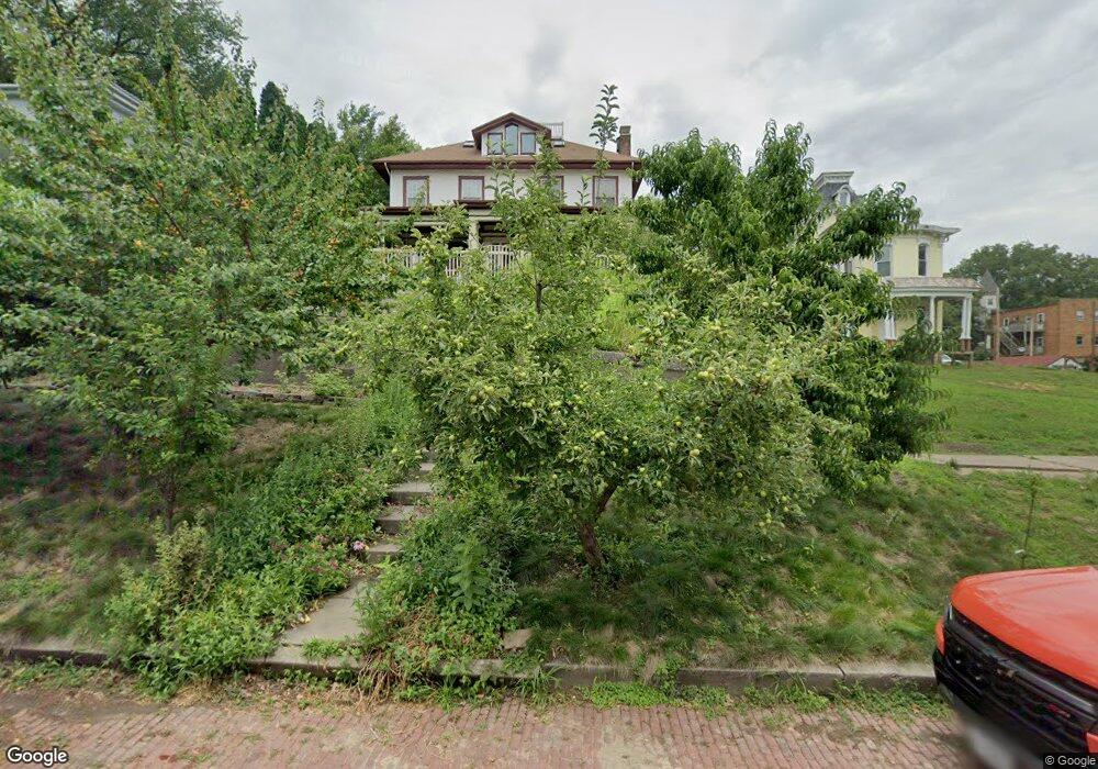
1330 E 10th St Davenport, IA 52803
East End NeighborhoodEstimated Value: $248,000 - $358,000
3
Beds
3
Baths
3,588
Sq Ft
$90/Sq Ft
Est. Value
About This Home
This home is located at 1330 E 10th St, Davenport, IA 52803 and is currently estimated at $321,848, approximately $89 per square foot. 1330 E 10th St is a home located in Scott County with nearby schools including Walnut Hill Elementary School, McKinley Elementary School, and Casey County Middle School.
Ownership History
Date
Name
Owned For
Owner Type
Purchase Details
Closed on
May 31, 2006
Sold by
Cannon Matthew C and Cannon Tiphanie B
Bought by
Augspurger Michael J and Simonsen Jane E
Current Estimated Value
Home Financials for this Owner
Home Financials are based on the most recent Mortgage that was taken out on this home.
Original Mortgage
$168,800
Outstanding Balance
$99,208
Interest Rate
6.66%
Mortgage Type
Stand Alone Second
Estimated Equity
$222,640
Create a Home Valuation Report for This Property
The Home Valuation Report is an in-depth analysis detailing your home's value as well as a comparison with similar homes in the area
Home Values in the Area
Average Home Value in this Area
Purchase History
| Date | Buyer | Sale Price | Title Company |
|---|---|---|---|
| Augspurger Michael J | $211,000 | None Available |
Source: Public Records
Mortgage History
| Date | Status | Borrower | Loan Amount |
|---|---|---|---|
| Open | Augspurger Michael J | $168,800 |
Source: Public Records
Tax History Compared to Growth
Tax History
| Year | Tax Paid | Tax Assessment Tax Assessment Total Assessment is a certain percentage of the fair market value that is determined by local assessors to be the total taxable value of land and additions on the property. | Land | Improvement |
|---|---|---|---|---|
| 2025 | $5,094 | $316,290 | $21,000 | $295,290 |
| 2024 | $4,816 | $295,200 | $21,000 | $274,200 |
| 2023 | $5,350 | $286,630 | $21,000 | $265,630 |
| 2022 | $5,142 | $259,390 | $13,200 | $246,190 |
| 2021 | $5,142 | $248,610 | $13,200 | $235,410 |
| 2020 | $4,572 | $219,240 | $13,200 | $206,040 |
| 2019 | $4,728 | $219,240 | $13,200 | $206,040 |
| 2018 | $4,624 | $219,240 | $13,200 | $206,040 |
| 2017 | $1,219 | $219,240 | $13,200 | $206,040 |
| 2016 | $4,610 | $219,242 | $0 | $0 |
| 2015 | $4,610 | $210,112 | $0 | $0 |
| 2014 | $4,472 | $211,230 | $0 | $0 |
| 2013 | $4,416 | $0 | $0 | $0 |
| 2012 | -- | $210,070 | $16,270 | $193,800 |
Source: Public Records
Map
Nearby Homes
- 1004 College Ave
- 1102 College Ave
- 1224 E 11th St
- 1012 Bridge Ave
- 1220 College Ave
- 1202 Adams St
- 1325 Mississippi Ave
- 1233 Eastern Ave
- 1134 Tremont Ave
- 1501 Bridge Ave
- 1310 Kirkwood Blvd
- 1108 Arlington Ave
- 1020 E 15th St
- 1616 Esplanade Ave
- 1626 Esplanade Ave
- 916 Kirkwood Blvd
- 1603 Arlington Ave
- 1605 Arlington Ave
- 1215 Farnam St
- 616 E 6th St
- 1328 E 10th St
- 1404 E 10th St
- 1324 E 10th St
- 1329 E 11th St
- 1327 E 11th St
- 1339 E 11th St
- 1316 E 10th St
- 1316 E 10th St Unit 2
- 1329 E 10th St
- 1008 Mississippi Ave
- 1315 E 11th St
- 1331 E 10th St
- 1022 Mississippi Ave
- 1317 E 10th St
- 1411 E 11th St
- 1306 E 10th St
- 1009 College Ave
- 1028 Mississippi Ave
- 1021 College Ave
- 930 Mississippi Ave