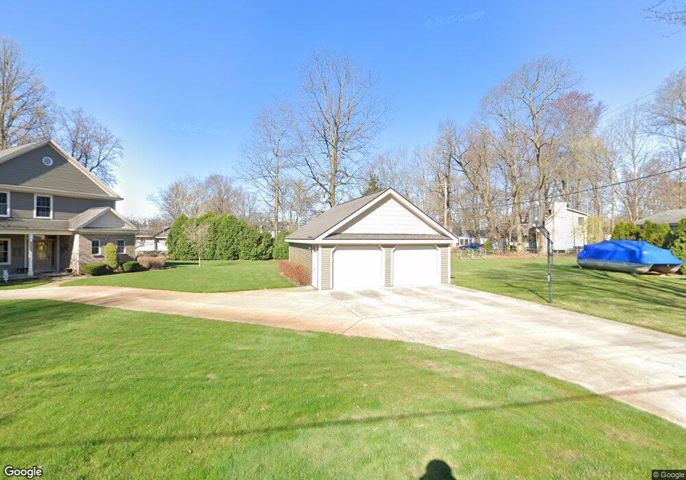
1330 Elmhurst Dr Howell, MI 48843
Estimated Value: $411,000 - $1,213,000
3
Beds
3
Baths
2,300
Sq Ft
$349/Sq Ft
Est. Value
About This Home
This home is located at 1330 Elmhurst Dr, Howell, MI 48843 and is currently estimated at $802,487, approximately $348 per square foot. 1330 Elmhurst Dr is a home located in Livingston County with nearby schools including Three Fires Elementary, Parker Middle School, and Howell High School.
Ownership History
Date
Name
Owned For
Owner Type
Purchase Details
Closed on
Aug 7, 2012
Sold by
Richeson David A and Mason Kathleen B
Bought by
Richeson David A and Mason Kathleen B
Current Estimated Value
Purchase Details
Closed on
Jun 3, 2011
Sold by
Bostock William and Bostock Sharon
Bought by
Richeson David A and Mason Kathleen B
Purchase Details
Closed on
Apr 25, 2011
Sold by
Bostock William and Bostock Sharon
Bought by
Haigh Henry and Haigh Diane
Purchase Details
Closed on
Jun 23, 2005
Sold by
Langford Charles Edward and Langford Charles E
Bought by
Bostock William and Bostock Sharon
Create a Home Valuation Report for This Property
The Home Valuation Report is an in-depth analysis detailing your home's value as well as a comparison with similar homes in the area
Home Values in the Area
Average Home Value in this Area
Purchase History
| Date | Buyer | Sale Price | Title Company |
|---|---|---|---|
| Richeson David A | -- | -- | |
| Richeson David A | $431,500 | -- | |
| Haigh Henry | -- | -- | |
| Bostock William | $250,000 | -- |
Source: Public Records
Tax History Compared to Growth
Tax History
| Year | Tax Paid | Tax Assessment Tax Assessment Total Assessment is a certain percentage of the fair market value that is determined by local assessors to be the total taxable value of land and additions on the property. | Land | Improvement |
|---|---|---|---|---|
| 2025 | $4,987 | $367,400 | $0 | $0 |
| 2024 | $4,869 | $334,500 | $0 | $0 |
| 2023 | $4,683 | $317,800 | $0 | $0 |
| 2022 | $6,383 | $270,700 | $0 | $0 |
| 2021 | $6,268 | $271,300 | $0 | $0 |
| 2020 | $6,368 | $273,700 | $0 | $0 |
| 2019 | $5,742 | $270,700 | $0 | $0 |
| 2018 | $5,455 | $267,800 | $0 | $0 |
| 2017 | $5,476 | $267,800 | $0 | $0 |
| 2016 | $5,314 | $261,200 | $0 | $0 |
| 2014 | $3,943 | $235,200 | $0 | $0 |
| 2012 | $3,943 | $206,000 | $0 | $0 |
Source: Public Records
Map
Nearby Homes
- 1339 Elmhurst Dr
- 5564 Water Willow Dr
- 1716 S Hughes Rd
- 1605 S Hughes Rd
- 959 Menominee Dr
- 1673 Edwin Dr
- 1938 Genoa Cir Unit 13
- 5790 Comanche Ln
- 560 Black Oaks Trail
- 1146 Sunrise Park St
- 1008 Sunrise Park St
- 6421 Breezeway
- 4738 Summer Ridge Dr
- 5570 Golf Club Rd
- VL E Grand River N
- 2861 Spring Hill Dr
- 2895 Spring Hill Dr
- 920 Del Sher Dr
- 3186 Aspen Ridge Ct
- 1339 Pond Bluff Way Unit 31
- 1314 Elmhurst Dr
- Lots 36 and 37 Elmhurst Dr
- 1205 Chemung Dr
- 1315 Elmhurst Dr
- 1206 Chemung Dr
- 1300 S Hughes Rd
- 1197 Chemung Dr
- 1200 Chemung Dr
- 1338 Elmhurst Dr
- 1188 James R St
- 1290 S Hughes Rd
- 1193 Chemung Dr
- PAR 1 Elmhurst
- 1198 Chemung Dr
- 1342 Elmhurst Dr Unit Bldg-Unit
- 1342 Elmhurst Dr
- 1353 Elmhurst Dr
- 1184 James R St
- 1189 Chemung Dr
- 1278 S Hughes Rd