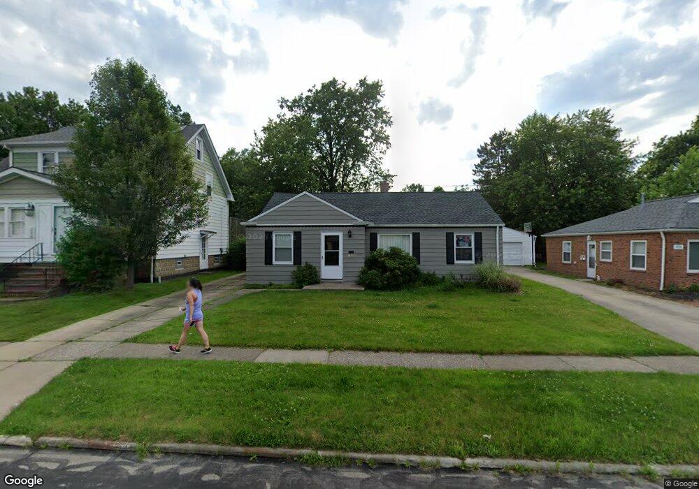
1330 Iroquois Ave Cleveland, OH 44124
Estimated Value: $172,461 - $214,000
3
Beds
1
Bath
980
Sq Ft
$206/Sq Ft
Est. Value
About This Home
This home is located at 1330 Iroquois Ave, Cleveland, OH 44124 and is currently estimated at $202,115, approximately $206 per square foot. 1330 Iroquois Ave is a home located in Cuyahoga County with nearby schools including Mayfield High School, Flex High School Cleveland, and Corpus Christi Academy.
Ownership History
Date
Name
Owned For
Owner Type
Purchase Details
Closed on
Aug 19, 2013
Sold by
Masseria Marie
Bought by
Mgm Northern Ohio Properties Llc
Current Estimated Value
Purchase Details
Closed on
Nov 8, 1999
Sold by
Marie Masseria
Bought by
Masseria Marie
Purchase Details
Closed on
Aug 1, 1997
Sold by
Sheriff Of Cuyahoga Coun
Bought by
Masseria Marie
Purchase Details
Closed on
Feb 26, 1990
Sold by
Fisco Anthony
Bought by
Pietropinto Anthony C
Purchase Details
Closed on
Aug 29, 1985
Sold by
Fisco Anthony
Bought by
Fisco Anthony
Purchase Details
Closed on
Oct 18, 1978
Sold by
Longo Carrie L
Bought by
Fisco Anthony
Purchase Details
Closed on
May 26, 1978
Sold by
Longo Joseph J and Longo Carrie L
Bought by
Longo Carrie L
Purchase Details
Closed on
Jan 1, 1975
Bought by
Longo Joseph J and Longo Carrie L
Create a Home Valuation Report for This Property
The Home Valuation Report is an in-depth analysis detailing your home's value as well as a comparison with similar homes in the area
Home Values in the Area
Average Home Value in this Area
Purchase History
| Date | Buyer | Sale Price | Title Company |
|---|---|---|---|
| Mgm Northern Ohio Properties Llc | -- | Attorney | |
| Masseria Marie | -- | -- | |
| Masseria Marie | $67,500 | -- | |
| Pietropinto Anthony C | $64,900 | -- | |
| Fisco Anthony | -- | -- | |
| Fisco Anthony | $41,000 | -- | |
| Longo Carrie L | -- | -- | |
| Longo Joseph J | -- | -- |
Source: Public Records
Tax History Compared to Growth
Tax History
| Year | Tax Paid | Tax Assessment Tax Assessment Total Assessment is a certain percentage of the fair market value that is determined by local assessors to be the total taxable value of land and additions on the property. | Land | Improvement |
|---|---|---|---|---|
| 2024 | $3,266 | $48,440 | $12,040 | $36,400 |
| 2023 | $3,010 | $41,410 | $10,990 | $30,420 |
| 2022 | $3,117 | $41,410 | $10,990 | $30,420 |
| 2021 | $3,087 | $41,410 | $10,990 | $30,420 |
| 2020 | $2,881 | $35,390 | $9,380 | $26,010 |
| 2019 | $2,794 | $101,100 | $26,800 | $74,300 |
| 2018 | $2,779 | $35,390 | $9,380 | $26,010 |
| 2017 | $2,473 | $29,300 | $8,260 | $21,040 |
| 2016 | $2,455 | $29,300 | $8,260 | $21,040 |
| 2015 | $2,276 | $29,300 | $8,260 | $21,040 |
| 2014 | $2,276 | $29,300 | $8,260 | $21,040 |
Source: Public Records
Map
Nearby Homes
- 1391 Iroquois Ave
- 1307 Ford Rd
- 1213 Eastwood Ave
- 1218 Summit Dr
- 1233 Summit Dr
- 1194 Croyden Rd
- 1363 Ranchland Dr
- 1201 Summit Dr
- 1291 Haverston Rd
- 1151 Croyden Rd
- 1430 Belrose Rd
- 1146 Iroquois Ave
- 1151 Brainard Rd
- 1284 Haverston Rd
- 1120 Croyden Rd
- 1328 Elmwood Rd
- 1574 Hawthorne Dr
- 1337 Elmwood Rd
- 1193 Mayfield Ridge Rd
- 1590 Longwood Dr
- 1336 Iroquois Ave
- 1326 Iroquois Ave
- 1340 Iroquois Ave
- 1320 Iroquois Ave
- 1297 Rae Rd
- 1346 Iroquois Ave
- 1316 Iroquois Ave
- 1303 Rae Rd
- 1291 Rae Rd
- 1331 Iroquois Ave
- 1327 Iroquois Ave
- 1350 Iroquois Ave
- 1310 Iroquois Ave
- 1341 Iroquois Ave
- 1321 Iroquois Ave
- 1285 Rae Rd
- 1347 Iroquois Ave
- 1317 Iroquois Ave
- 1356 Iroquois Ave
- 1306 Iroquois Ave