Estimated Value: $384,396 - $419,000
3
Beds
3
Baths
2,134
Sq Ft
$188/Sq Ft
Est. Value
About This Home
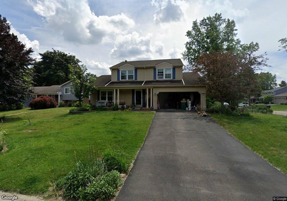
This home is located at 1330 Merriweather Ct, Wixom, MI 48393 and is currently estimated at $401,099, approximately $187 per square foot. 1330 Merriweather Ct is a home located in Oakland County with nearby schools including Loon Lake Elementary School, Sarah G. Banks Middle School, and Walled Lake Central High School.
Ownership History
Date
Name
Owned For
Owner Type
Purchase Details
Closed on
Apr 27, 2001
Sold by
Carolyn E Pantazides Tr
Bought by
Pavelko John H
Current Estimated Value
Home Financials for this Owner
Home Financials are based on the most recent Mortgage that was taken out on this home.
Original Mortgage
$172,500
Interest Rate
6.99%
Purchase Details
Closed on
Jan 4, 2000
Sold by
Pantazides Carolyn E
Bought by
Carolyn E Pantazides Tr
Create a Home Valuation Report for This Property
The Home Valuation Report is an in-depth analysis detailing your home's value as well as a comparison with similar homes in the area
Home Values in the Area
Average Home Value in this Area
Purchase History
| Date | Buyer | Sale Price | Title Company |
|---|---|---|---|
| Pavelko John H | $230,000 | -- | |
| Carolyn E Pantazides Tr | -- | -- |
Source: Public Records
Mortgage History
| Date | Status | Borrower | Loan Amount |
|---|---|---|---|
| Previous Owner | Pavelko John H | $172,500 |
Source: Public Records
Tax History Compared to Growth
Tax History
| Year | Tax Paid | Tax Assessment Tax Assessment Total Assessment is a certain percentage of the fair market value that is determined by local assessors to be the total taxable value of land and additions on the property. | Land | Improvement |
|---|---|---|---|---|
| 2024 | $3,535 | $169,390 | $0 | $0 |
| 2023 | $3,350 | $158,810 | $0 | $0 |
| 2022 | $3,364 | $139,820 | $0 | $0 |
| 2021 | $3,341 | $138,660 | $0 | $0 |
| 2020 | $3,226 | $136,570 | $0 | $0 |
| 2019 | $3,353 | $130,400 | $0 | $0 |
| 2018 | $3,401 | $125,660 | $0 | $0 |
| 2017 | $3,370 | $124,410 | $0 | $0 |
| 2016 | $3,345 | $111,310 | $0 | $0 |
| 2015 | -- | $100,930 | $0 | $0 |
| 2014 | -- | $94,350 | $0 | $0 |
| 2011 | -- | $86,100 | $0 | $0 |
Source: Public Records
Map
Nearby Homes
- 1599 Chanticlair Cir
- 882 Natures Cove Ct
- 1535 Kings Crown Ct
- 30210 Chesapeake Cir Unit 360
- 24202 Chesapeake Cir Unit 287
- 8208 Chesapeake Cir Unit 95
- 1040 Drakeshire Dr
- 1338 Andover Cir
- 1179 Andover Cir Unit 48
- 1104 Andover Cir Unit 92
- 2225 Silvermaple Ct
- 1255 Andover Dr
- 1500 Rustic Ln
- 913 Rikki Ann Ct
- 2160 Darnell St
- 1445 Mariposa Dr
- 1148 Lakeview Dr
- 2588 Maple Forest Ct
- 746 Red Maple Ln
- 1588 Ladd Rd
- 1336 Merriweather Ct
- 1322 Kenneport Cir
- 44858 Kenneport Cir
- 1342 Merriweather Ct
- 1316 Kenneport Cir
- 1327 Kenneport Cir Unit Bldg-Unit
- 1327 Kenneport Cir
- 1321 Kenneport Cir
- 1333 Kenneport Cir
- 1329 Merriweather Ct
- 1335 Merriweather Ct
- 1350 Merriweather Ct
- 1310 Kenneport Cir
- 1315 Kenneport Cir
- 1341 Merriweather Ct
- 1308 Chanticlair Cir
- 1351 Merriweather Ct
- 1516 Stonegate Ct
- 1307 Kenneport Cir Unit Bldg-Unit
- 1307 Kenneport Cir