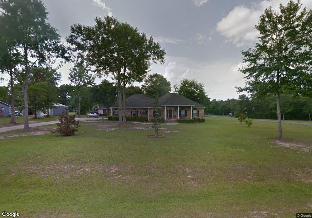
13301 Little Bluff Dr Vancleave, MS 39565
Estimated Value: $285,000 - $403,000
--
Bed
3
Baths
2,460
Sq Ft
$143/Sq Ft
Est. Value
About This Home
This home is located at 13301 Little Bluff Dr, Vancleave, MS 39565 and is currently estimated at $352,713, approximately $143 per square foot. 13301 Little Bluff Dr is a home located in Jackson County with nearby schools including Vancleave Lower Elementary School, Vancleave Upper Elementary School, and Vancleave Middle School.
Ownership History
Date
Name
Owned For
Owner Type
Purchase Details
Closed on
Apr 25, 2017
Sold by
The Teresa J Carter Revocable Trust
Bought by
Anderson Amanda
Current Estimated Value
Purchase Details
Closed on
Feb 28, 2014
Sold by
Teresa L Teresa L and Carter Teresa J
Bought by
Teresa J Carter Revocable Trust
Purchase Details
Closed on
Apr 12, 2010
Sold by
Lofton Thomas E and Carter Teresa L
Bought by
Carter Teresa L and Anderson Amanda
Create a Home Valuation Report for This Property
The Home Valuation Report is an in-depth analysis detailing your home's value as well as a comparison with similar homes in the area
Home Values in the Area
Average Home Value in this Area
Purchase History
| Date | Buyer | Sale Price | Title Company |
|---|---|---|---|
| Anderson Amanda | -- | None Available | |
| Teresa J Carter Revocable Trust | -- | -- | |
| Carter Teresa J | -- | -- | |
| Carter Teresa L | -- | -- |
Source: Public Records
Tax History Compared to Growth
Tax History
| Year | Tax Paid | Tax Assessment Tax Assessment Total Assessment is a certain percentage of the fair market value that is determined by local assessors to be the total taxable value of land and additions on the property. | Land | Improvement |
|---|---|---|---|---|
| 2024 | $1,999 | $19,151 | $1,571 | $17,580 |
| 2023 | $1,999 | $19,151 | $1,571 | $17,580 |
| 2022 | $1,934 | $19,151 | $1,571 | $17,580 |
| 2021 | $1,941 | $19,223 | $1,571 | $17,652 |
| 2020 | $1,875 | $18,008 | $1,258 | $16,750 |
| 2019 | $3,228 | $27,012 | $1,887 | $25,125 |
| 2018 | $3,290 | $27,012 | $1,887 | $25,125 |
| 2017 | $3,282 | $26,496 | $1,887 | $24,609 |
| 2016 | $3,152 | $26,496 | $1,887 | $24,609 |
| 2015 | $2,793 | $155,680 | $11,970 | $143,710 |
| 2014 | $2,834 | $24,124 | $1,796 | $22,328 |
| 2013 | $975 | $16,082 | $1,197 | $14,885 |
Source: Public Records
Map
Nearby Homes
- 13109 Little Bluff Dr
- Tbd Seaman Rd
- 6305 Morningside Dr
- 0 Fairley Rd
- 0 Morningside Dr Unit 4120736
- 6404 Humphrey Rd
- 14832 Hillside Dr
- 00 Humphrey Rd
- 6001 Wooded Acres Rd
- 0 Ms 57 Unit 4122608
- 0 Ms 57 Unit 4117591
- 0 Ms-57 Unit 4107638
- 0 Ms-57 Unit 4097649
- 0 Hillsboro Rd
- 8236 Stonehaven Dr
- 5701 Juniper Dr
- 3685 Poticaw Bayou Rd
- 3665 Poticaw Bayou Rd
- 10115 Silverwood Dr
- 13700 Southern Pine Drive Central
- 13209 Little Bluff Dr
- 13308 Little Bluff Dr
- 13300 Little Bluff Dr
- 13300 Little Bluff Dr
- 13308 Little Bluff Cove
- 13208 Little Bluff Dr
- 13312 Little Bluff Dr
- 13204 Little Bluff Dr
- 6705 Little Bluff Cove
- 6705 Little Bluff Cove
- 6704 Little Bluff Cove
- 3704 Little Bluff Cove
- 13201 Little Bluff Dr
- 13316 Little Bluff
- 13200 Little Bluff Dr
- 0 Little Bluff Dr
- 13196 Little Bluff Dr
- 13101 Little Bluff Dr
- 13405 Little Bluff Dr
- 13008 Little Bluff Place