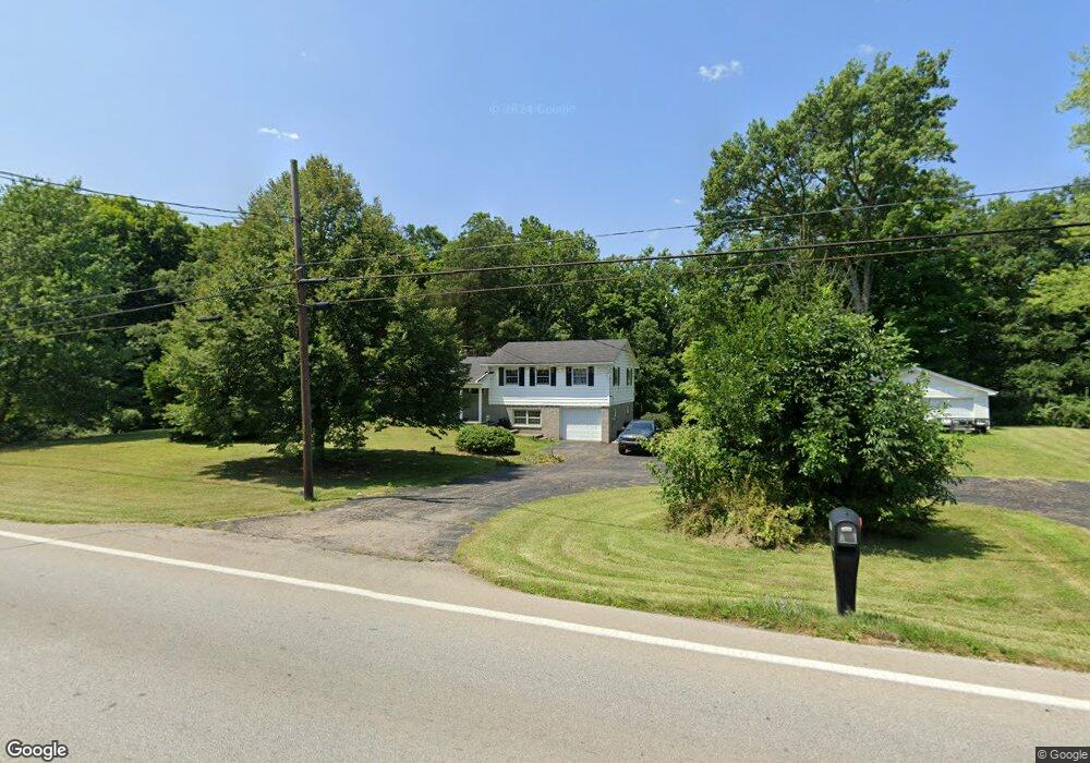
13307 Us Highway 68 Mount Orab, OH 45154
Estimated Value: $267,000 - $475,000
3
Beds
2
Baths
2,060
Sq Ft
$165/Sq Ft
Est. Value
About This Home
This home is located at 13307 Us Highway 68, Mount Orab, OH 45154 and is currently estimated at $339,782, approximately $164 per square foot. 13307 Us Highway 68 is a home located in Brown County with nearby schools including Western Brown High School.
Ownership History
Date
Name
Owned For
Owner Type
Purchase Details
Closed on
Aug 20, 2019
Sold by
Snider Stephen L
Bought by
Debord Rebecca M and Piatt Caden Andrew
Current Estimated Value
Home Financials for this Owner
Home Financials are based on the most recent Mortgage that was taken out on this home.
Original Mortgage
$171,717
Outstanding Balance
$151,043
Interest Rate
3.7%
Mortgage Type
New Conventional
Estimated Equity
$188,739
Create a Home Valuation Report for This Property
The Home Valuation Report is an in-depth analysis detailing your home's value as well as a comparison with similar homes in the area
Home Values in the Area
Average Home Value in this Area
Purchase History
| Date | Buyer | Sale Price | Title Company |
|---|---|---|---|
| Debord Rebecca M | $170,000 | Lawyers Ttl Of Cincinnati In |
Source: Public Records
Mortgage History
| Date | Status | Borrower | Loan Amount |
|---|---|---|---|
| Open | Debord Rebecca M | $171,717 |
Source: Public Records
Tax History Compared to Growth
Tax History
| Year | Tax Paid | Tax Assessment Tax Assessment Total Assessment is a certain percentage of the fair market value that is determined by local assessors to be the total taxable value of land and additions on the property. | Land | Improvement |
|---|---|---|---|---|
| 2024 | $2,046 | $70,660 | $9,980 | $60,680 |
| 2023 | $2,046 | $44,350 | $7,230 | $37,120 |
| 2022 | $1,323 | $44,350 | $7,230 | $37,120 |
| 2021 | $1,308 | $44,350 | $7,230 | $37,120 |
| 2020 | $1,129 | $36,960 | $6,030 | $30,930 |
| 2019 | $903 | $36,960 | $6,030 | $30,930 |
| 2018 | $448 | $36,960 | $6,030 | $30,930 |
| 2017 | $703 | $30,680 | $6,030 | $24,650 |
| 2016 | $703 | $30,680 | $6,030 | $24,650 |
| 2015 | $690 | $30,680 | $6,030 | $24,650 |
| 2014 | $690 | $30,130 | $5,480 | $24,650 |
| 2013 | $688 | $30,130 | $5,480 | $24,650 |
Source: Public Records
Map
Nearby Homes
- 114 Tammera Ln
- 781 S High St
- 422 Liming Farm Rd
- 419 Liming Farm Rd
- 13523 Lake Grant Rd
- 3305 Pleasant Hill Rd
- 216 Red Bud Ln
- 411 Smith Ave
- 200 Gregory St
- 210 Gregory St
- 206 Gregory St
- 208 Gregory St
- 214 Gregory St
- 4656 Oakland Rd
- 14084 Holiday Dr
- 127 Lonny St
- 150 Lonny St
- 329 E Main St
- Fairton Plan at Glover Meadows
- Chatham Plan at Glover Meadows
- 13307 U S 68
- 13285 Us Rt 68
- 13285 Us Highway 68
- 802 S High St
- 800 S High St
- 13241 St Rt 68
- 13225 Us Highway 68
- 3748 Lake Grant Access Rd
- 13223 Us Highway 68
- 13221 Us Highway 68
- 13421 Us Highway 68
- 13169 Us Rt 68
- 3708 Lake Grant Access Rd
- 13465 Us Rt 68
- 13465 Us Highway 68
- 2 Oakland
- 13112 U S 68
- 130 Oakland Rd
- 13104 State Route 774
- 13051 St Rt 774